
|
|
Mountain/Rock |
|---|---|
|
|
27.10475°S / 68.71368°W |
|
|
Hiking, Mountaineering, Scrambling |
|
|
Summer |
|
|
20358 ft / 6205 m |
|
|
Overview
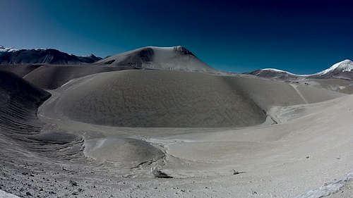
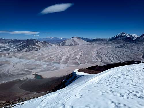
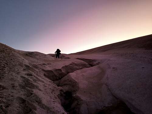
An obscure and infrequently climbed peak in the Puna de Atacama, Cerro El Solo (not to be confused with Cerro Solo in Patagonia) is overshadowed both literally and figuratively by its many taller neighbours. This inconspicuity is further exascerbated by the long approach required for even the most direct routes, as well as the lack of any notable features to make for a technically engaging climb. That said, this mountain has its own unique character: less rocky than Nevado Tres Cruces, less snowy than Ojos del Salado, and less sandy than El Fraile. As well, approaching El Solo from Chile involves crossing the fascinating (and frustrating) permafrost gullies north of the mountain - a labyrinth of perfectly V-shaped channels carved into the frozen pumice sand.
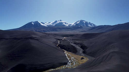
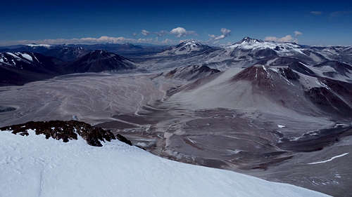
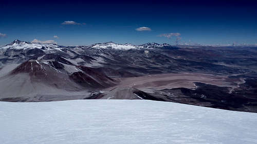
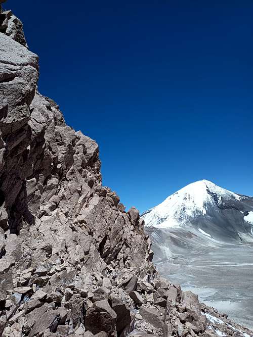
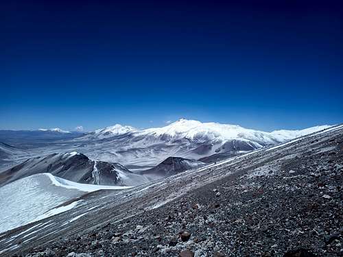
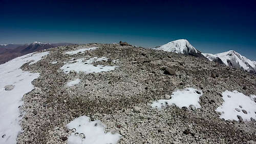
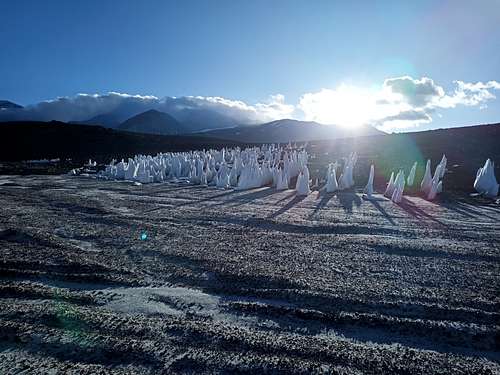
Geographically, Cerro El Solo sits on the Chile-Argentina border about 700 km north of Santiago. As with most of the surrounding peaks, it is an extinct volcano. The northern aspects of El Solo are largely surfaced by pumice nodules and sand, with relatively little exposed solid rock. This gives it notably smooth contours compared to its neighbours. The southwest aspect has several rock ridges.
Getting There
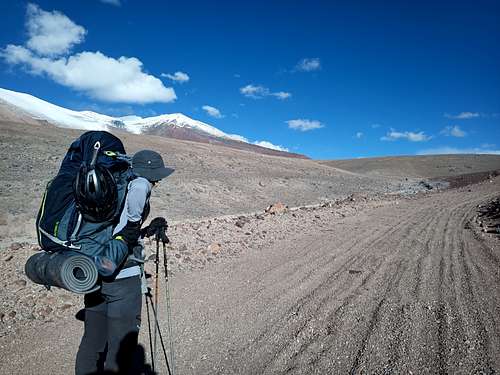
The simpler approach is from Chile. From Copiapo, travel along C-31 for about 220 km (roughly 25 km past Rio Lamas). Aside from any acclimatization, this should take about 3.5 days by bicycle or 4 hours by car. From here, a prominent jeep trail leads south of the highway between Tres Cruces and Barrancas Blancas. Continue along this trail for 10 km to reach a large pond at the foot of Barrancas Blancas. From here, there are several options - all feasible, none excellent. Several medium-sized gullies open directly south of the pond, and any of these can be followed up towards Tres Cruces Central and many reasonable camp options. However, this will necessitate crossing at least one quite large gully later, so if El Solo is your only objective it will be preferable to modify this approach. A more direct route is to proceed 2.5 km southeast from the pond to the largest of the gullies, and hike up this gulley for anywhere from 4-8 km before exiting to the south.
An approach from Argentina is certainly feasible, and sattelite imagery shows at least one set of jeep tracks leading to the south side of the mountain from the vicinity of Salar Tres Quebradas. That said, it will be a long off-road drive with little or no trail to follow for the last 30 km - adequate supplies and preparation for an emergency would be critical.
Route
Route?! What route? You think there are routes out here? Just point yourself towards the summit and get going!
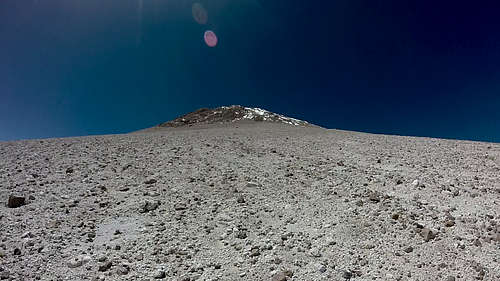
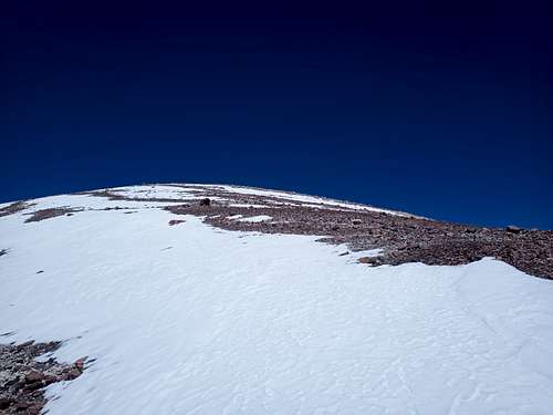
More seriously, climbers can pick whatever line they want and have a good chance of reaching the summit. Even the steepest, loosest lines up the northwest slope are entirely manageable if you take care when placing your feet, and most other areas have shallower angles and firmer ground. One notable exception is the north-northwest face, which (if not snow-covered) will involve up to 500 vertical meters of marble-sized pumice that roll over a firmer substrate - difficult terrain whether going up or down. As a general heuristic, the lighter the colour of the ground on El Solo (except for snow), the less stable it will be.
The shallowest slopes are on the east side of the mountain, and this may be doubly helpful on windy days as the prevailing winds from the northwest will be blocked by El Solo. Walking around to the southwest is also feasible, and this will lead to route options involving more solid rock and scrambling.
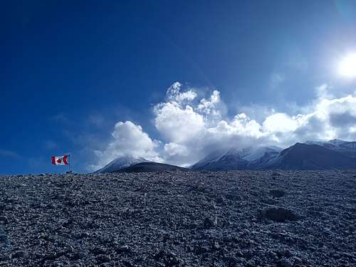
Gentle terrain (i.e. walking casually) extends as high as 5500 MASL to the west of the summit. Depending on the route chosen, climbers may encounter the main slope as low as 5250 m. If convenient, the ridge running east from the summit offers an easy ascent/descent option for the uppermost 200 m of the climb.
Depending on your base camp location, fitness, and acclimatization, a summit bid might be anywhere from 5-12 hours round-trip. Slower parties should consider an early start to avoid encountering strong afternoon winds on the more precarious sections of the climb.
The author's route up the northwest slope is shown in the images below as an example.
Red Tape
From Chile, one should obtain an expedition permit from DIFROL (https://difrol.gob.cl/en/procedures/expeditions/). This is quick, easy to do, and free of cost, and it appears that the process may now be fully automated - more of a registration than a permit. This permit can be shown at the border station beside Salar Maricunga to minimize any hassle in getting through.
To the author's knowledge, no permit is required or expected if approaching from Argentina.
When to Climb
The normal climbing season in the Puna de Atacama is austral summer, with most climbs occurring from November through early March.
Camping
It is permissible to camp anywhere in the area, but climbers should keep the wind in mind when choosing a location. While overnight and early morning conditions might sometimes be calm, the afternoons are almost always windy. A sheltered site is therefore vital if climbers want their camp to still be where they left it when returning from the summit.
Beyond Rio Lamas, potable water can be obtained by melting ice or snow. In the afternoon and early evening, many of the gullies north of El Solo have small meltwater streams running through them - this can be an excellent way to save time and fuel instead of melting ice yourself.
External Links
Add External Links text here.