

Nikman - Feb 9, 2008 12:58 pm - Voted 10/10
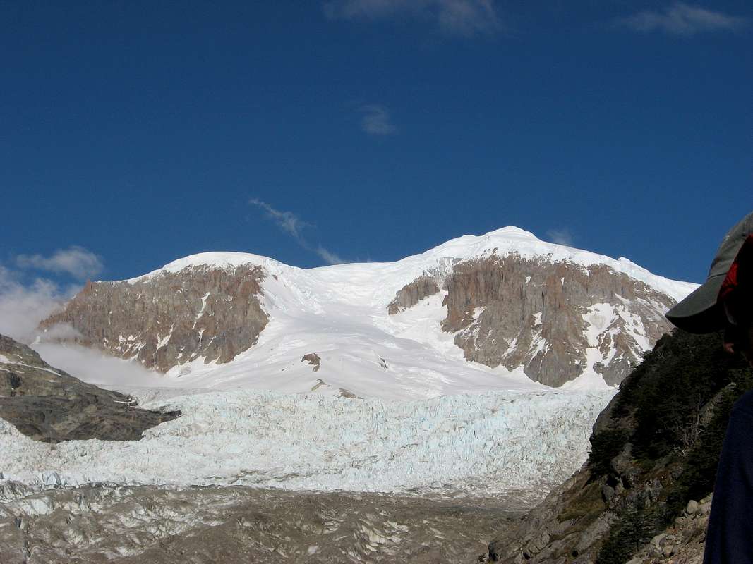
Very inforamtive image!Thanks for attaching this one. The normal route goes right through the middle of the upper Gl. Calluqueo and can be seen directly in the middle of your picture.
Camp 2 is usually done in the center of the ice flank in the middle of the picture at a certain point where the flank becomes flat for some meters.
Nikman - Feb 12, 2008 9:33 am - Voted 10/10
Re: Very inforamtive image!There is an alternative to the normal route that can be done with one camp in 2 days up and one day down = 3 days from Toni Rohrer hut (Agostini BC).
The camp can be reached in bad weather also, so only one "good day" is needed to summit.
I planned to go on that new route this new year but unfortunately my wife got very ill before X-mas so I had to cancel the whole expedition and stay in Germany.
Hopefully next year I might go for it:
Cerro San Lorenzo new direct line attempt
Nikman - Feb 12, 2008 9:48 am - Voted 10/10
Re: Very inforamtive image!I am looking forward to your uploads.


Comments
Post a Comment