
|
|
Mountain/Rock |
|---|---|
|
|
46.47176°N / 121.71676°W |
|
|
Lewis |
|
|
Hiking |
|
|
Spring, Summer, Fall |
|
|
5656 ft / 1724 m |
|
|
Overview
Cispus Mountain is a former fire lookout in Lewis County. The lookout structure was built in 1926 and burned in 1956 when no longer needed. Today it provides for a short easy hike to the lookout site with fantastic views of Mount Adams, Mount Rainier, Mount Saint Helens, Mount Hood, and many surrounding area peaks. The hike follows the Klickitat Trail which is an ancient trail previously used by Native Americans for travel and commerce between tribes on the east side of the Cascades and those on the west. It goes by several names. In my research I saw it referred to as Cispus Mountain, Cispus Peak, Cispus Lookout, Cispus Point, and Cispus Butte. I couldn't determine the official name, but Cispus Mountain lookout came up the most and is how it is listed on all the former fire lookout pages I found so I'm going with it.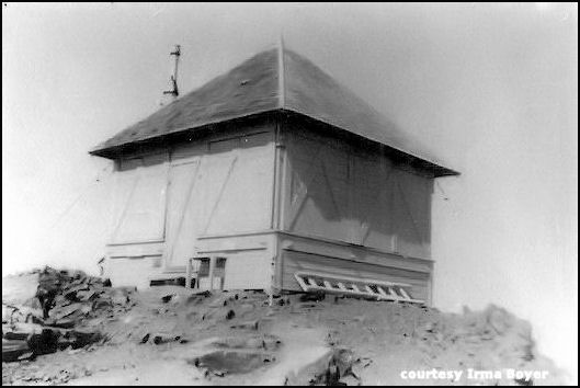 Cispus Mountain Lookout, constructed in 1926 | 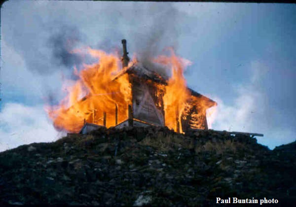 burned in 1956 |
Getting There
Forest Road 20 off of Highway 12 will take you to the trail head. From Randle, WA drive about 12.5 miles east, or from Packwood, WA drive 3 miles south / west until you reach the sign for Forest Road 20. Turn south here and simply follow the road approximately 12.3 miles to the trailhead. As of 2016 the road is in rough shape in parts, heavily potholed and several sections of the road have been washed out. It is still passable in higher clearance vehicles (Subaru Outback did fine) but standard vehicles may not be able to pass the washout sections unless they are repaired. There are no official signs designating the trailhead, but there is a large clearing on the right ~12.3 miles from Highway 12 for you to park. Across the road there is a sign for the Klickitat trail #7 which is the start of the hike.Route
Follow the Klickitat Trail #7 a short distance until you reach a small pond followed by Jackpot Lake. Continue on the trail gaining a bit of elevation in the process. After about a mile, mile and a half you come to a junction with the Cispus Mountain Trail. Turn left here and continue another half mile up the trail to the summit. The hike is short. My GPS measured 2 miles, but I've seen it listed as 2.5 miles one way with 1136' elevation gain. It's a short hike with great views and can be combined with near by mountains (like Castle Butte) for some peak bagging.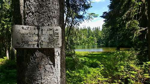 Jackpot Lake | 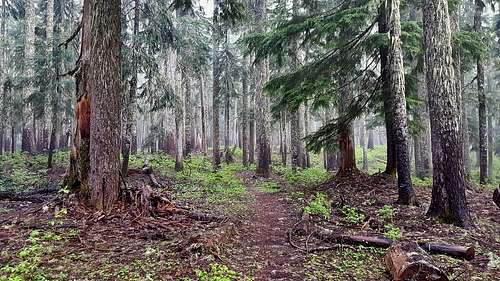 Klickitat Trail #7 |
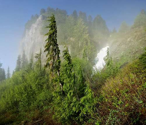 Cliffs in the Mist | 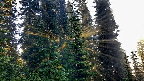 Sunburst Through the Trees |
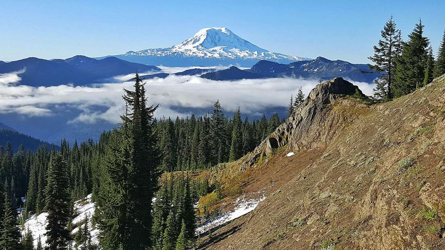 Mount Adams from Cispus Mountain | 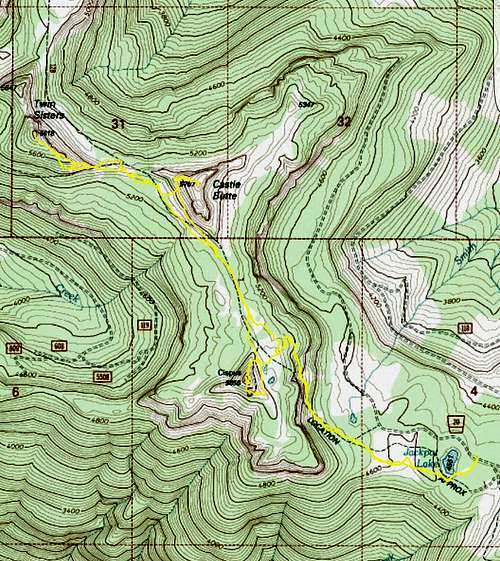 Cispus, Castle Butte, Twin Sisters Route |
When to Climb
This hike is usually done in the Spring to Fall season and snow can linger well into July. Trailhead access is the main issue as the trailhead is at 4500 feet and likely holds snow until June.Views

Cispus Mountain Summit View North
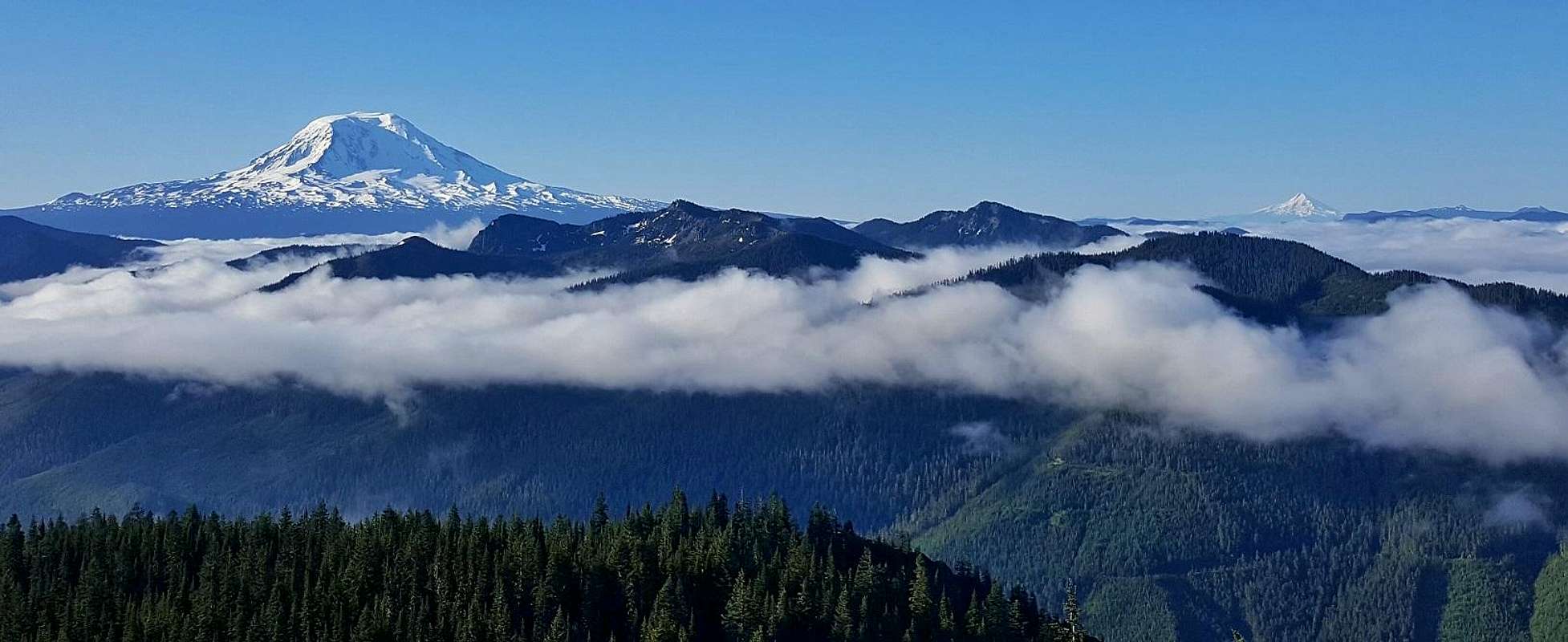
Adams and Hood from Cispus Mountain
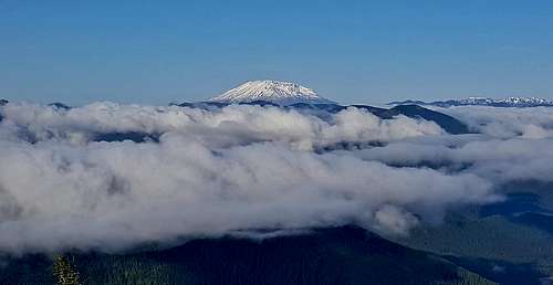
Mount Saint Helens from Cispus Mountain
External Links
NWHiker info here (for route described here) and here (for a longer approach from the north)WillhiteWeb page trip report here
My trip report here