climber's diagram for standard SW Ridge route
Climber's diagram for Cloud peak, location marked for cloud peak at N44.38216 W107.17389 at 13,202'.
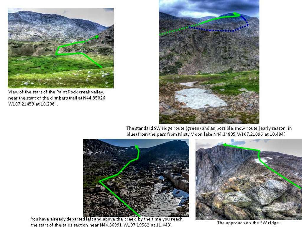
From N44.34835 W107.21096 at 10484 (the pass to the Paint Rock creek valley), follow the trail to N44.35026 W107.21459 at 10,206' (the climber's trail that leads down and across the valley to Paint Rock creek falls at N44.35342 W107.21575 at 10,257'.
At several points the trail or the rock kerns become sparse. Past a certain point, it was clear that multiple paths were indicated by the rock kerns. For the standard SW Ridge route, you start by following the creek, but you do need to go left and above the creek, at a certain point, rather than following it as it bends in the valley to the climber's right. We followed this series of waypoints (for the standard SW Ridge route):
1. N44.35361 W107.21534 at 10,208'.
2. N44.35599 W107.21406 at 10,326'.
3. N44.35960 W107.20901 at 10,587'.
4. N44.36245 W107.20509 at 10,895'.
5. N44.36991 W107.19562 at 11,443'.
6. N44.37337 W107.18758 at 12,107'.
7. N44.37766 W107.17738 at 12,689'.
8. N44.38216 W107.17389 at 13,202' (cloud peak).
see also (for photos from trip): https://www.flickr.com/photos/19047247@N04/sets/72157655914698642


