

PAROFES - Apr 15, 2011 6:56 pm - Voted 10/10
GREAT LABELSBoris!

Boriss Andean - Apr 16, 2011 2:08 pm - Hasn't voted
Re: GREAT LABELSThank you Paulo :D!
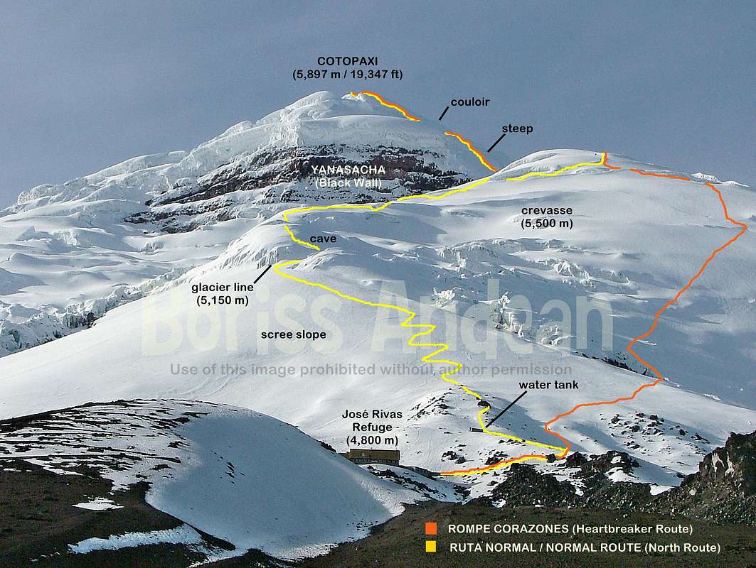
It tried to describe the route the best I could with these landmarks.
I know this info will last very little since the glacier is moving constantly.

ChristianRodriguez - Jul 15, 2011 3:48 am - Voted 10/10
Great...Great work, thanks for share it!
Boriss Andean - Jul 15, 2011 3:18 pm - Hasn't voted
Re: Great...You're welcome Christian. The route has changed a bit in the last couple months. I'll try to update it every now and then.

piem - Jul 1, 2013 11:48 am - Hasn't voted
Re: Great...Thanks Boriss!
I climbed twice this month, using two different routes:
The old route takes left soon after the ladder, and climbs in zigzags through the icefall, before reaching the 'steep' ridge.
The newest route is slightly longer, takes a right after the ladder and traverses west before it starts climbing, first in between two large walls with stalactites, then straight up a steep snow slope.
Both routes rejoin when reaching the ridge, from where a beautiful view on Yanasacha can be observed.
Both routes are still being used. There are some hidden crevasses on the new one, but it is sometimes preferred since a serac fell in the icefall about three weeks ago.
I have both GPS tracks if you are interested.
EthanMoscoso - Oct 13, 2012 3:54 pm - Hasn't voted
Nice photo!Thanks for the photo!
This reminds me of when I first climbed the mountain in 2010, but I just got back from my second trip, and summitted, sadly the Ice Cave is gone!


Comments
Post a Comment