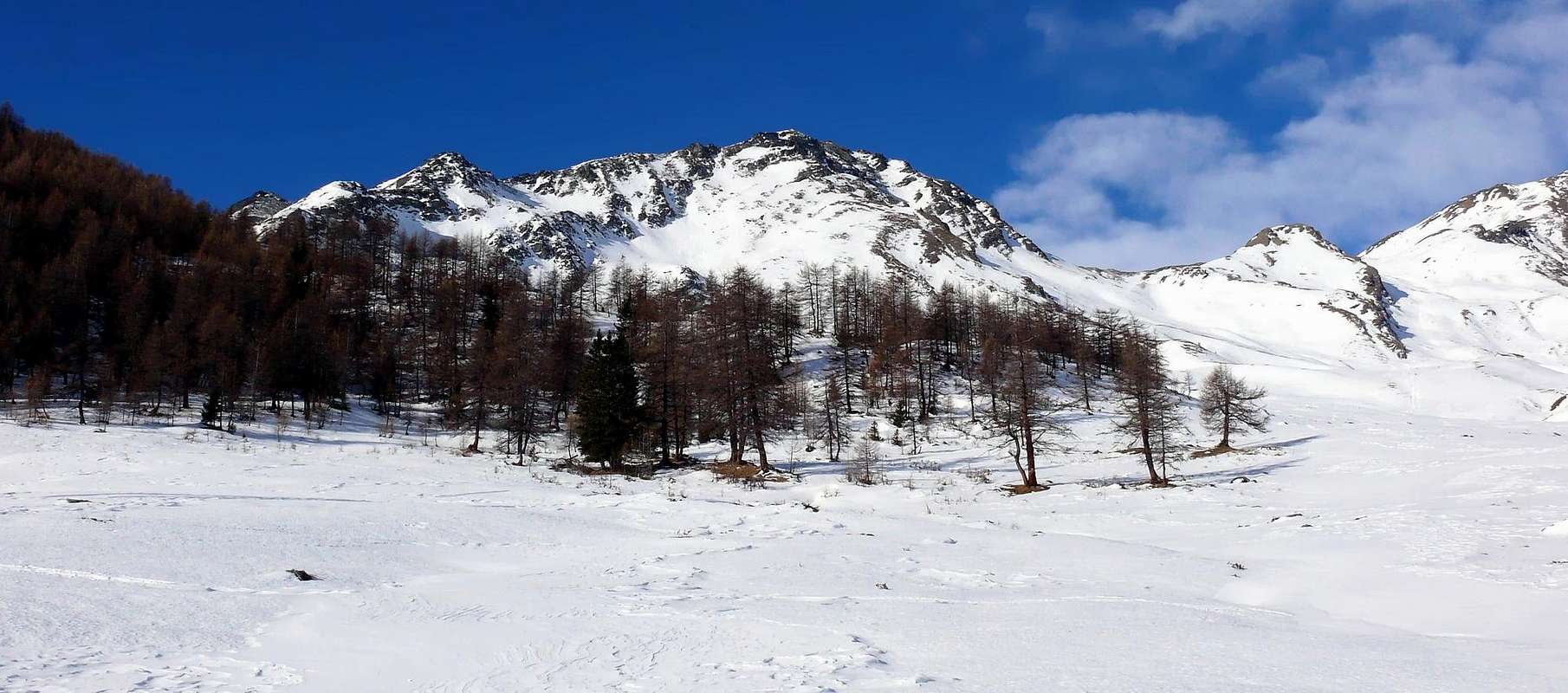
Mountain placed almost at the end of the long S-SW Buttress, which from Mont Velan (3.734m) ends at Mont Saron (2.681m) above the Village of Allein. Requires attention to the fragile rock mixed with grass. From its summit a wide view on the Monte Bianco, La Salliaousa, Mont Velan, on the Gelè - Morion ridge and on Gran Combin Massif.
Montagna posta quasi al termine del lungo Contrafforte S-SW, che dal Mont Velan (3.734 m) termina al Mont Saron (2.681 m) sopra il Villaggio di Allein. Richiede attenzione per la roccia fragile frammista a erba. Dalla sua cima si gode un ottima veduta sulla Catena del Monte Bianco, La Salliaousa, Mont Velan, sulla costiera Mont Gelé - Mont Morion e sul Massiccio del Grand Combin.
First Ascents
Firs on the summit: Unknown.
First ascent in winter: Unknown.
Great Crossing to Salliaousa: (from Haut Praz Bass - Crou de Bleintse (E-SE Arête, in ascent; N-NW Ridge in descent) Champillon Pass - Mont Chenaille Points S and N - Tête des Cretes - La Salliaousa Pass to La Salliaousa): Osvaldo Cardellina, Nadina Capitanio (until Mont Chenaille N), Giulio Fiou and Piero Zoja (until Tête de Cretes), (Jun 17th, 1976, round trip).
Crossing South/North: (from Pied du Plan - Mont Saron - Tête du Praz - Crou de Bleintse (S-SE Arête, in ascent; N-NW Ridge in descent) to Champillon Pass): Osvaldo Cardellina and Giuseppe Lamazzi, (Mar 31th, 1997).
Getting There
BY CAR:
From Torino, Milano, etc: Motorway A5. Exit Aosta Est.
From Switzerland: through the Grand St. Bernard Tunnel or the homonym pass.
From France: through Mont Blanc Tunnel or Petit St. Bernard Pass. It isn't necessary to enter in Motorway A5, you can drive through SS.26 Aosta direction.
BY PLANE:
Aeroporto "Corrado Gex" Saint Christophe (Aosta).
Itinerary
From Aosta (583m) along the SS.27 of Gran San Bernardo for about 10km, at a fork turn to the left toward Allein and, after passing Doues, on until the Plan Debat Champillon (2.076m) foreground where the route starts.
Dalla Città di Aosta (583 m) si percorre la SS.27 del Gran San Bernardo, dopo una decina di km imboccare sulla sinistra il bivio per il Paese di Allein e, dopo aver superato anche il Paese di Doues, proseguire sino al piazzale di Plan Debat (2.076 m) dove inizia l'itinerario.
Route
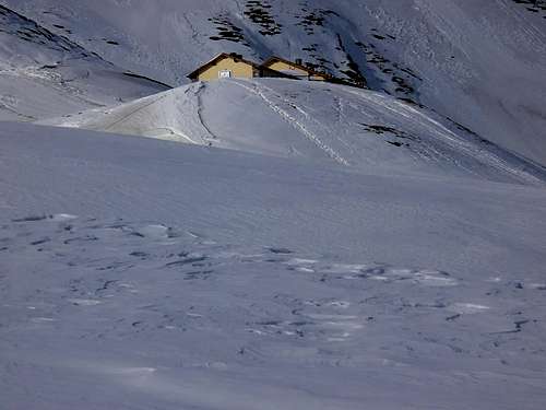
(1) - From Plan Debat to continue to north for 500 meters~ to Champillon (fountain and monumental Cross Notre Dames de Neiges), where the path of the Alta Via n° 1. With direction N-W to reach the Alpe Pessinoille (2.146m), then toward east the Alpe 2.297m and to the Refuge Letey - Champillon (2.430m1h'00). Go up again to the Champillon Pass (2.709m) and for the Crest N-NW to easily reach the peak (a passage of 40 meters~, exposed and delicate it wanders to W (2h'30/3h'00).
(2) - From Plan Debat or from the Arp du Praz (2.048m) with direction NW to overcome a small vallone and to climb the easy Crest E-SE, after having gone beyond a small saddle (2.574m2h'15/2h'30).
(3) - From the attainable Mont Saron with the paths 24 and 25, to continue toward N and, climbed over the Tête du Praz (2.751m), easily enough for the South Crest to the peak (4h'30/5h'00 from Pied du Plan (1.722m).
(1) - Da Plan Debat continuare a nord per 500 metri~ a Champillon (fontana e Croce Monumentale Notre Dame de Neige), dove inizia il sentire dell'Alta Via n° 1. Con direzione N-W raggiungere l'Alpe Pessinoille (2.146 m), poi verso est l'Alpe 2.297 m e il Rifugio Letey - Champillon (2.430 m1h'00). Risalire al Colle Champillon (2.709 m) e per la Cresta N-NW raggiungere facilmente la vetta (un passaggio di 40 metri~, esposto e delicato si aggira a W (2h'30/3h'00).
(2) - Da Plan Debat o dall'Arp du Praz (2.048 m) con direzione NW superare un piccolo vallone e salire la facile Cresta E-SE, dopo aver oltrepassato una piccola sella (2.574 m; 2h'15/2h'30).
(3) - Dal Mont Saron, raggiungibile con i sentieri 24 e 25, proseguire verso N e, scavalcata la Tête du Praz (2.751 m), abbastanza facilmente per la Cresta Sud alla vetta (4h'30/5h'00 da Pied du Plan (1.722 m).
"Guida delle Alpi Occidentali", di Giovanni Bobba e Luigi Vaccarone C.A.I. Sezione di Torino Volume II (parte II), 25 Maggio 1896.
"Guida dei Monti d'Italia-Alpi Pennine" (Vol.I°) di Gino Buscaini-Club Alpino Italiano/Turing Club Italiano, Luglio 1971 (in Italian).
"Diari Alpinistici" di Osvaldo Cardellina e Indice Generale accompagnato da Schedario Relazioni Ascensioni 1964-2019 (unpublished).
"80 itinerari di Escursionismo Alpinismo e Sci Alpinismo in Valle d'Aosta", di Osvaldo Cardellina, Ed. Musumeci, Giugno 1977 (in Italian); seconda Ed. Luglio 1981; terza Ed. Luglio 1984; (in French), prima Ed. Febbraio 1978; seconda Ed. Marzo 1980.
"Guida della Valpelline" de l'Abbè Joseph-Marie Henry-Societè Editrice Valdotaine 1925 II Edition e Collana Reprint Musumeci (1986).
MAPS:
Kompass "Monte Bianco Valle d'Aosta Sentieri e Rifugi" Carta turistica 1:50.000.
Parents refers to a larger category under which an object falls. For example, theAconcagua mountain page has the 'Aconcagua Group' and the 'Seven Summits' asparents and is a parent itself to many routes, photos, and Trip Reports.

 5033 Hits
 81.18% Score
 13 Votes