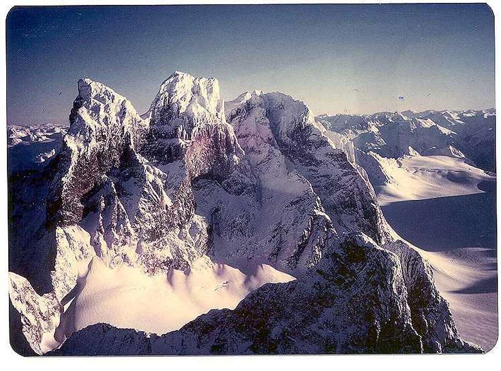
Devil's Paw, Juneau Icefield, Alaska Coast Range.
Devil's Paw, on Juneau Icefield:
Alaska-Canada border runs along crestline. Connects boundary peaks along ridge of Coast Range.
(Devil's Thumb is on the Stikine Icefield, 20 miles South across the Taku River Canyon, on the crest opposite Petersburg, Alaska.)
"Michael's Sword", is the multi-thousand foot blade rising vertically out of the icefield in the foreground right. It is connected to the massif by ring of granite in left foreground, to base of Paw.
The North Face, on left, has vertical face overhanging the bergschrund of the Tulsequah Glacier, which wraps around the East side into B.C., Canada, descending to the Taku River, which then flows out through Alaska to seawater of the Inside Passage.
The Coast Range gets more cyclonic storms than anywhere else in the world, except the Straits of Magellan off the tip of South America. Storms blow in off the North Pacific and the Gulf of Alaska, bringing cold wet air into freezing elevations, shifting between sleet rime and heavy snow for weeks -- sometimes months. Skiplanes can easily get stuck in the heavy snow, so helicopters on pontoon floats are preferred.
Even if decent snow, heavy winds or fog can make landing and timing of exit windows difficult at any time of the year.
Taku Glacier flows from the center of this photo, at the base of the West Face, and flows South, spilling off the rock plateau 3,000 feet down several glaciers, into the Taku River Canyon. The Taku is beneath the peak and cliff in the middle distance to the right.
Peaks in left background are Eastward, toward the Cassiar Range of Northern BC, near Dease Lake. Distant peaks on right horizon are Stikine River headwaters. In the intermediate distance the Inklin and Nahlin flow South to North into the Taku.
When winter winds blow from the East, those cold Interior air masses moving down the venturis of the river canyons and across the Icefields sometimes reach 200 miles per hour for days on end.


Comments
Post a Comment