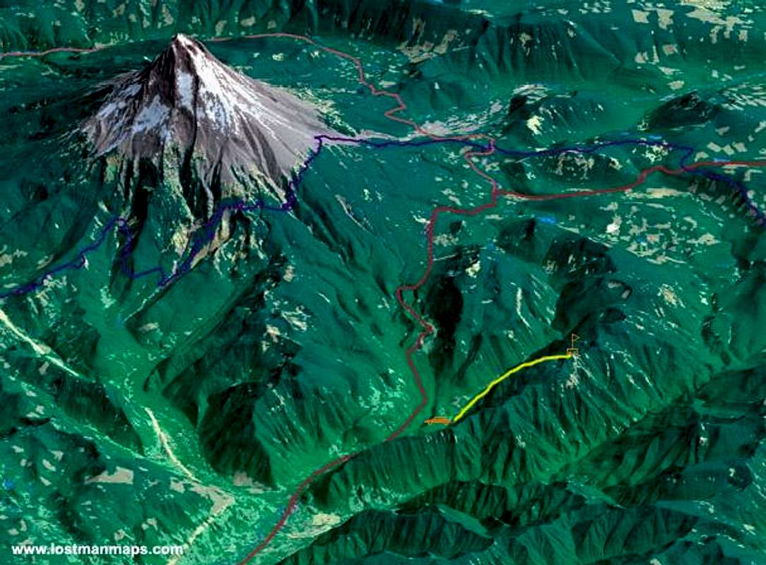
Quick rendering of the Cool Creek Trail route in yellow. (Highways in red/pink and PCT in purple; note the significant vertical exaggeration) I apologize to geographers for the lack of a scalebar or north arrow (north is left). Taken from the Pacific Northwest Panorama.


