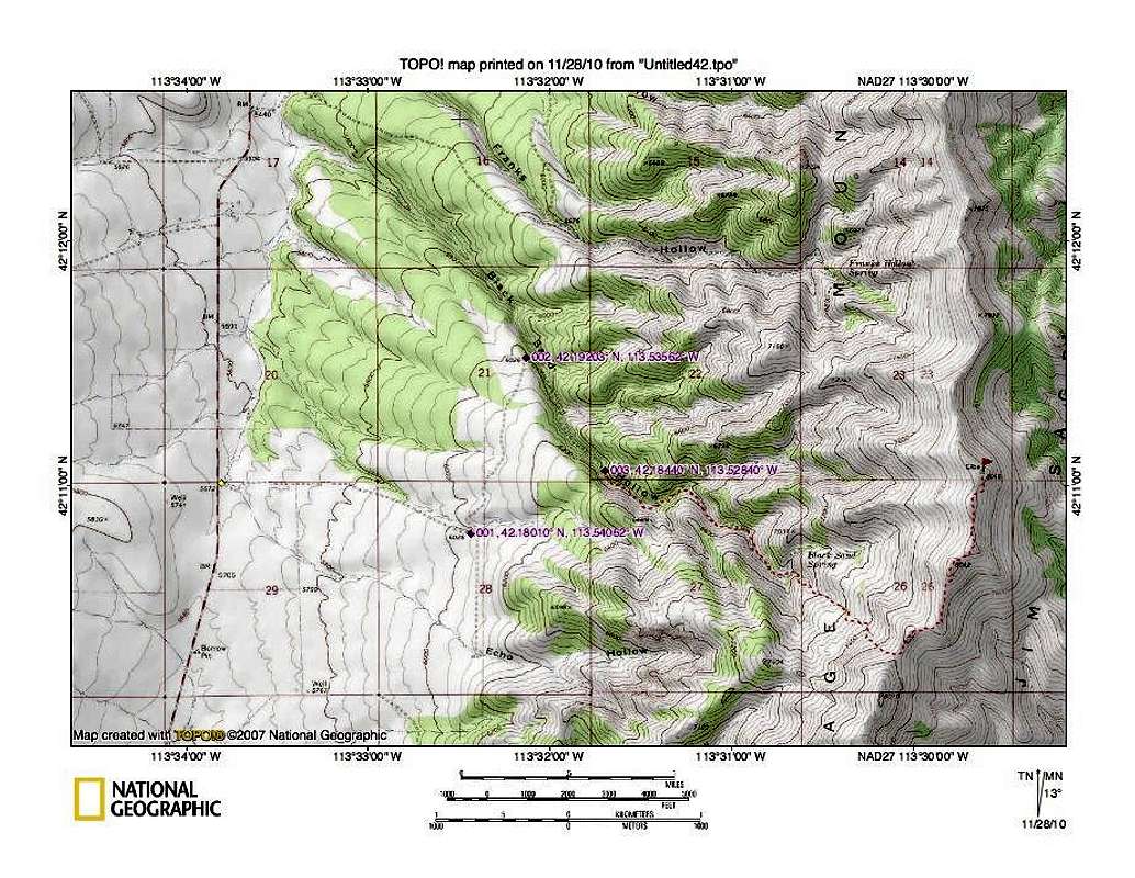
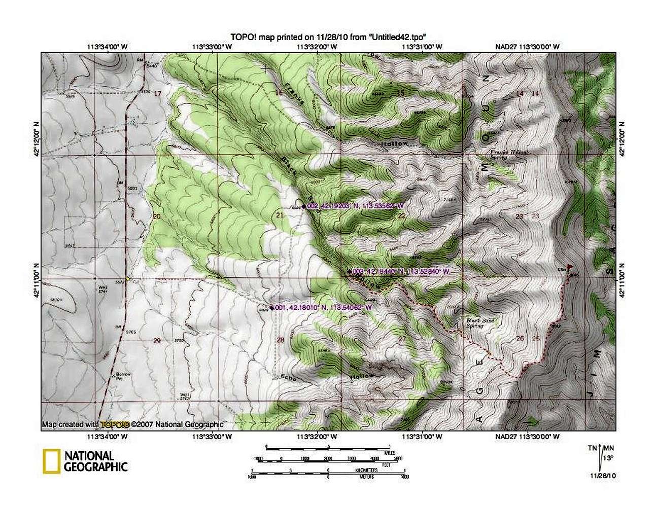
this map shows our route in. The waypoint at the highway was
lat/long nad 27 42.1832 113.5634 Distance from highway to where we parked was under 3 miles. The red dotted route follows the jeep track for a ways from where we parked and as long as we followed the jeep track & ATV track, we avoided brush and when we hit the ridgeline, it was simple cross country over to the peak.


