Toggle navigation
Mountains
Routes
Images
Trip Reports
Forum
What's New
People
Areas & Ranges
Articles
Trailheads
Canyons
Huts & Campgrounds
Albums
Logistical Centers
Fact Sheets
Lists
Custom Objects
Gear
Plans & Partners
WELCOME TO SUMMITPOST
SIGN IN
REGISTER
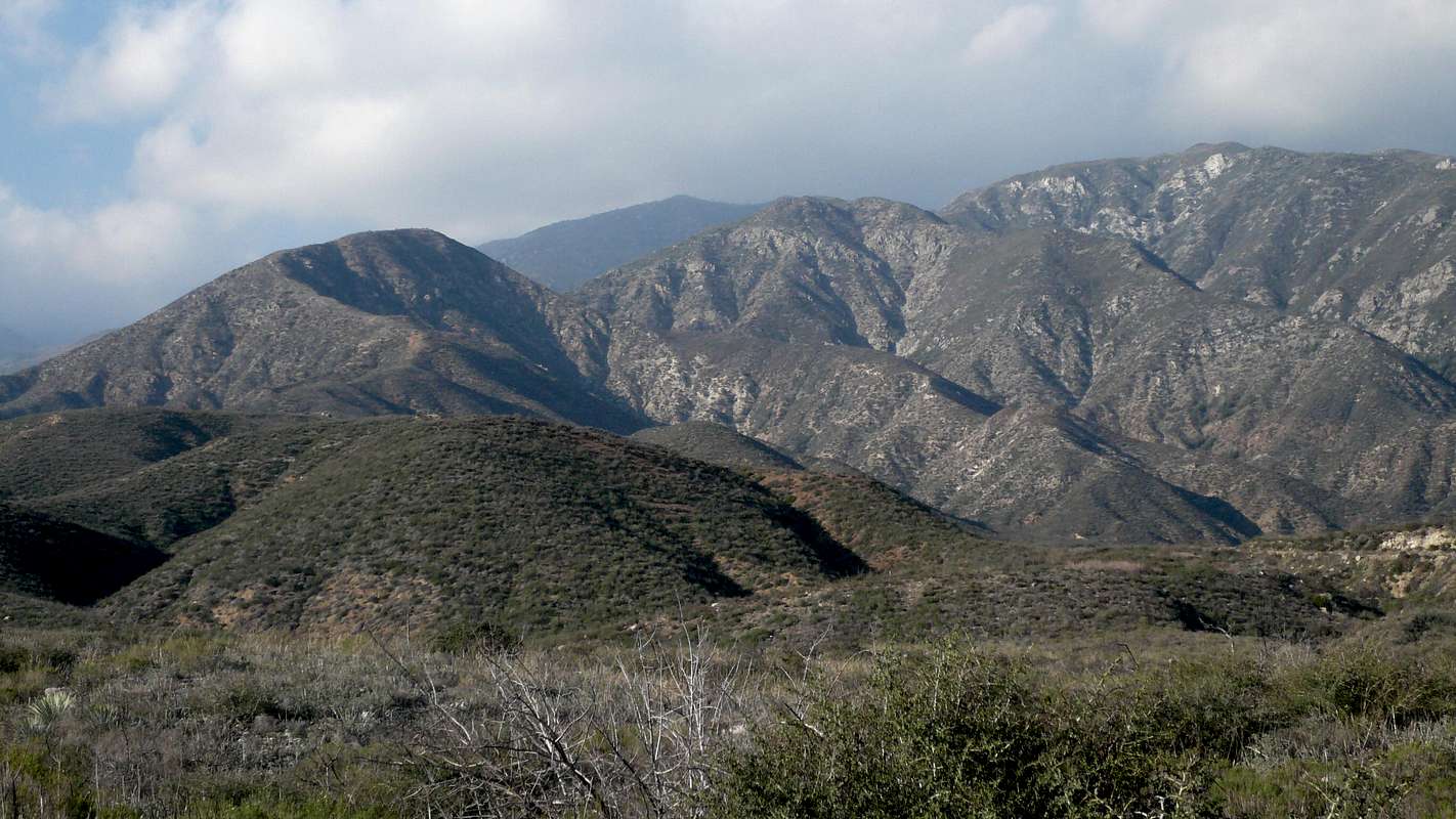
Etiwanda Ave Ridge
View High-Resolution Image
Etiwanda Ave Ridge
Shot south of the ridge along the dirt road. Etiwanda Ave is the best descriptor of this south ridge coming off the main San Sevaine-Buck Point ridge (Jan 08)
« PREV
NEXT »
bechtt
on
Jan 21, 2008 3:53 pm
Comments & voting
Other parents
Lat/Lon:
34.19700°N / 117.53°W
Image ID:
374510
3392 Hits
76.66
% Score
7
Votes
Log in to vote
Comments
No comments posted yet.
to post!
Don't have an account?
Etiwanda Ave Ridge
(Route)
You are at
the First
Image
Viewing
#1 of 1
GALLERY
You are at
the Last
Image
bechtt's Image Gallery
« PREV
Viewing
#43 of 274
GALLERY
NEXT »
Etiwanda Ave Ridge
(Route)
Loading....
A Day in the Brush with Coco: San Sevaine Lookout and Buck Point
(Trip Report)
Loading....
×
You need to login in order to vote!
User Name
Password
Remember me
Forgot your password?
Log me out when I close my browser.
Keep me logged in all the time.
sign in as a user
Don't have an account?
Register now for FREE
Rating available
Suggested routes for you
People who climb the same things as you
Comments Available
Create Albums
Register Here


