Toggle navigation
Mountains
Routes
Images
Trip Reports
Forum
What's New
People
Areas & Ranges
Articles
Trailheads
Canyons
Huts & Campgrounds
Albums
Logistical Centers
Fact Sheets
Lists
Custom Objects
Gear
Plans & Partners
WELCOME TO SUMMITPOST
SIGN IN
REGISTER
Freel Peak
Additional Parents
Image
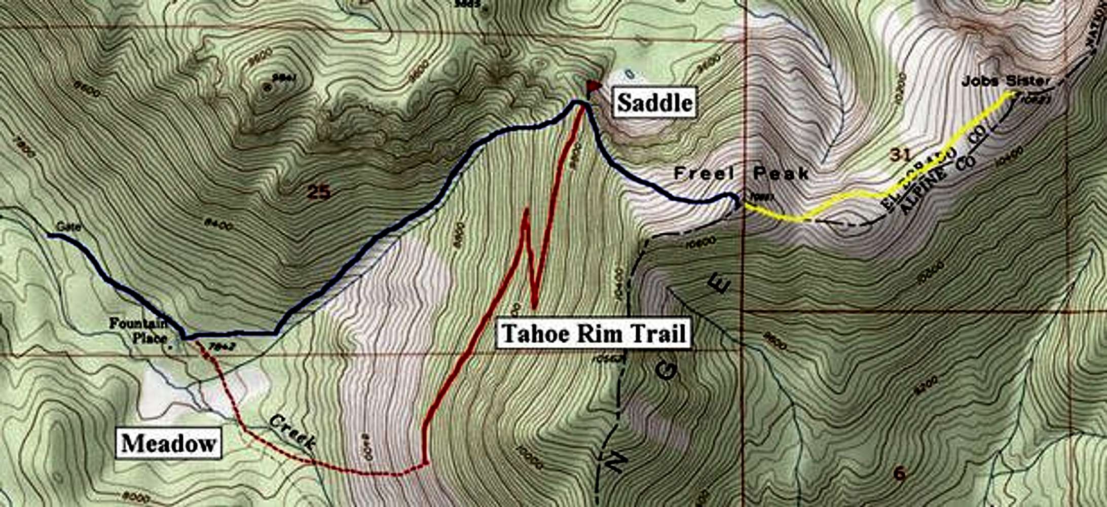
Freel Peak routes. Blue line...
View High-Resolution Image
Freel Peak routes. Blue line...
Freel Peak routes. Blue line is the main Trout Creek Route; solid red line is the Tahoe Rim Trail; dashed red line is the beginning of the alternate route; and yellow line is the traverse to Jobs Sister.
« PREV
NEXT »
Dave K
on
Nov 12, 2002 10:26 pm
Comments & voting
Other parents
Lat/Lon:
38.85690°N / 119.9002°W
Image ID:
13927
17540 Hits
75.3
% Score
6
Votes
Log in to vote
Comments
No comments posted yet.
to post!
Don't have an account?
Freel Peak
(Mountain/Rock)
« PREV
Viewing
#33 of 131
GALLERY
NEXT »
Dave K's Image Gallery
« PREV
Viewing
#64 of 114
GALLERY
NEXT »
Trout Creek
(Route)
Loading....
×
You need to login in order to vote!
User Name
Password
Remember me
Forgot your password?
Log me out when I close my browser.
Keep me logged in all the time.
sign in as a user
Don't have an account?
Register now for FREE
Rating available
Suggested routes for you
People who climb the same things as you
Comments Available
Create Albums
Register Here


