Toggle navigation
Mountains
Routes
Images
Trip Reports
Forum
What's New
People
Areas & Ranges
Articles
Trailheads
Canyons
Huts & Campgrounds
Albums
Logistical Centers
Fact Sheets
Lists
Custom Objects
Gear
Plans & Partners
WELCOME TO SUMMITPOST
SIGN IN
REGISTER
Walkin' on Water
Additional Parents
Image
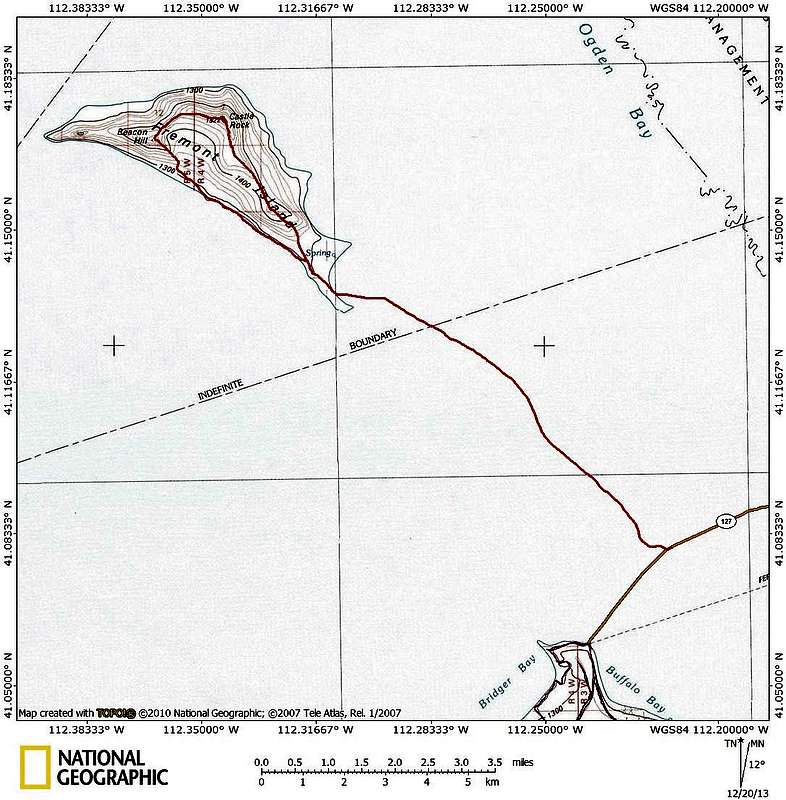
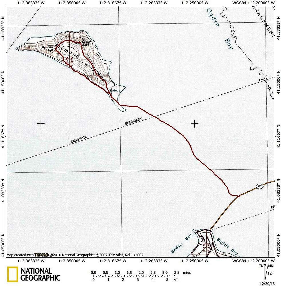
Fremont Island topo
View High-Resolution Image
Fremont Island topo
Topo map of Fremont Island in the Great Salt Lake. The red line shows the path we took across the intermittent land bridge that runs between the Antelope Island causeway and the island.
« PREV
NEXT »
ZeeJay
on
Dec 20, 2013 6:51 pm
Comments & voting
Other parents
Lat/Lon:
41.17411°N / 112.34365°W
Image Type(s):
Topo/Diagram
Image ID:
880319
2050 Hits
77.48
% Score
8
Votes
Log in to vote
Comments
No comments posted yet.
to post!
Don't have an account?
Walkin' on Water
(Trip Report)
« PREV
Viewing
#22 of 27
GALLERY
NEXT »
ZeeJay's Image Gallery
« PREV
Viewing
#887 of 1388
GALLERY
NEXT »
×
You need to login in order to vote!
User Name
Password
Remember me
Forgot your password?
Log me out when I close my browser.
Keep me logged in all the time.
sign in as a user
Don't have an account?
Register now for FREE
Rating available
Suggested routes for you
People who climb the same things as you
Comments Available
Create Albums
Register Here


