Toggle navigation
Mountains
Routes
Images
Trip Reports
Forum
What's New
People
Areas & Ranges
Articles
Trailheads
Canyons
Huts & Campgrounds
Albums
Logistical Centers
Fact Sheets
Lists
Custom Objects
Gear
Plans & Partners
WELCOME TO SUMMITPOST
SIGN IN
REGISTER
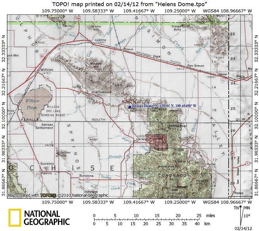
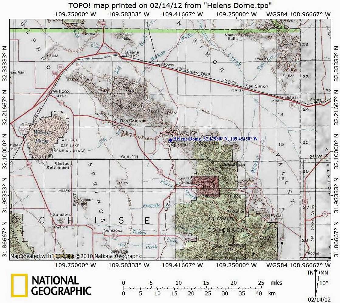
Helens Dome
Additional Parents
Image
Getting There Map
View High-Resolution Image
Getting There Map
Fort Bowie Historic Park is 116 miles east of Tucson, AZ via I-10, and 227 miles from Phoenix, AZ. There are two primary access points for this peak: Through Fort Bowie National Monument or directly from Apache Pass.
Map designed February 2012
« PREV
NEXT »
Sarah Simon
on
Feb 21, 2012 9:42 am
Comments & voting
Other parents
Lat/Lon:
32.12930°N / 109.4545°W
Image ID:
777603
1472 Hits
72.08
% Score
2
Votes
Log in to vote
Comments
No comments posted yet.
to post!
Don't have an account?
Helens Dome
(Mountain/Rock)
« PREV
Viewing
#17 of 17
GALLERY
You are at
the Last
Image
Sarah Simon's Image Gallery
« PREV
Viewing
#3784 of 5480
GALLERY
NEXT »
×
You need to login in order to vote!
User Name
Password
Remember me
Forgot your password?
Log me out when I close my browser.
Keep me logged in all the time.
sign in as a user
Don't have an account?
Register now for FREE
Rating available
Suggested routes for you
People who climb the same things as you
Comments Available
Create Albums
Register Here


