Toggle navigation
Mountains
Routes
Images
Trip Reports
Forum
What's New
People
Areas & Ranges
Articles
Trailheads
Canyons
Huts & Campgrounds
Albums
Logistical Centers
Fact Sheets
Lists
Custom Objects
Gear
Plans & Partners
WELCOME TO SUMMITPOST
SIGN IN
REGISTER
Golden Horn
Additional Parents
Image
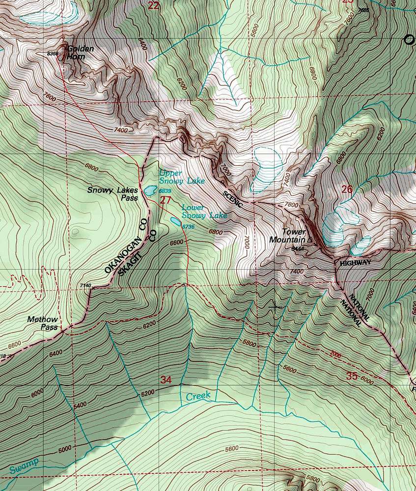
Golden Horn Topo
View High-Resolution Image
Golden Horn Topo
This is a topographic map of Golden Horn Mountain. The solid red line is where the trail starts disappearing but there is a unofficial boot path to Snowy Lakes.
« PREV
NEXT »
Josh Lewis
on
May 22, 2011 2:48 am
Comments & voting
Other parents
Image Type(s):
Topo/Diagram
,
Informational
Image ID:
717471
5199 Hits
72.08
% Score
2
Votes
Log in to vote
Comments
No comments posted yet.
to post!
Don't have an account?
Golden Horn
(Mountain/Rock)
« PREV
Viewing
#51 of 64
GALLERY
NEXT »
Josh Lewis's Image Gallery
« PREV
Viewing
#2475 of 4303
GALLERY
NEXT »
×
You need to login in order to vote!
User Name
Password
Remember me
Forgot your password?
Log me out when I close my browser.
Keep me logged in all the time.
sign in as a user
Don't have an account?
Register now for FREE
Rating available
Suggested routes for you
People who climb the same things as you
Comments Available
Create Albums
Register Here


