
|
|
Mountain/Rock |
|---|---|
|
|
47.84575°N / 121.1537°W |
|
|
Snohomish/Chelan |
|
|
5597 ft / 1706 m |
|
|
Overview
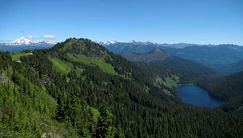
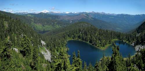
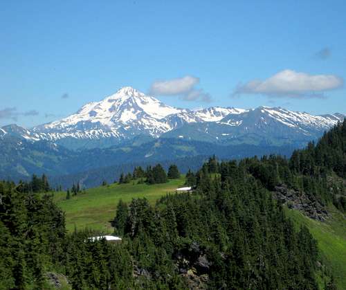
Point 5770 and Heather Lake from Grizzly Peak - the burned summit above the lake is Shoofly Mountain
Note: It has been brought to my attention that Point 5770 is sometimes referred to as 'Grizzly's Hump', and the title for the page has been changed to reflect that.
Grizzly Peak and Point 5770 from Point 5650
Grizzly Peak and Point 5770 from false east summit
Getting There
From Stevens Pass, follow US2 east for four miles to the Smithbrook Road (FR6700). US2 will be divided here - use caution crossing the westbound lanes. Follow FR6700 northwest for 2.8 miles to the obvious Smithbrook trailhead (3950').
Route
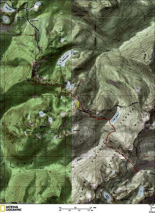
Grizzly Peak route map - Red line shows normal hiking approach via Smithbrook, yellow lines show scramble routes up Point 5770 and Point 5650, blue lines show alternate approaches from the PCT.
From the trailhead, follow the Smithbrook connector trail for about one mile, to its junction with the Pacific Crest Trail (PCT) near Union Gap (4700'). At Union Gap, turn right, and follow the PCT for 2.2 miles to Lake Janus. Shortly before Lake Janus, you will pass a nice little waterfall. This would probably be the best place to top off your water bottles in late season. One could certainly accomplish this task at the lake, but my suspicion is that the waterfall source is a little cleaner.
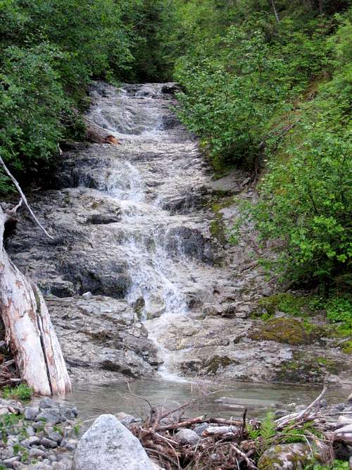
Waterfall near Lake Janus on Grizzly Peak approach
Lake Janus is a pleasant lake, assuming that you do not arrive at the height of bug season. For those who desire an overnight, there are numerous campsites available.
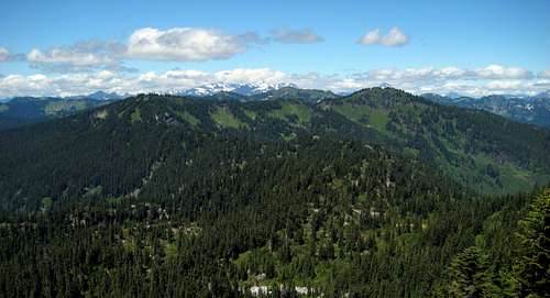
After leaving Lake Janus, the PCT will begin a steady climb, reaching a 5200' gap after 1.5 miles. At this point, you will be just southeast of Point 5650, which is a fantastic viewpoint in its own right (more on that later). From the gap, the trail will never dip below 5000' for the remainder of your journey. While you still have over three miles to go, you will hardly notice, as your attention will constantly be diverted by scenic vistas, lakes, and meadows. Several rocky viewpoints are available as you hike along the ridge - use caution, as some of them are quite exposed.
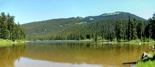
Glasses Lake on Grizzly Peak approach
Roughly one-half mile before Grizzly Peak, the PCT will climb through a series of switchbacks as you ascend from 5200' to 5600'. There is nothing to indicate that you have arrived near the summit, besides the fact that the trail levels off. The true summit will be off to your right - if you keep your eyes open, you will notice a faint path leading towards it and a small campsite. Truthfully, the views will be a little disappointing, but that's okay, because the 'real' Grizzly Peak is just a short scramble away.
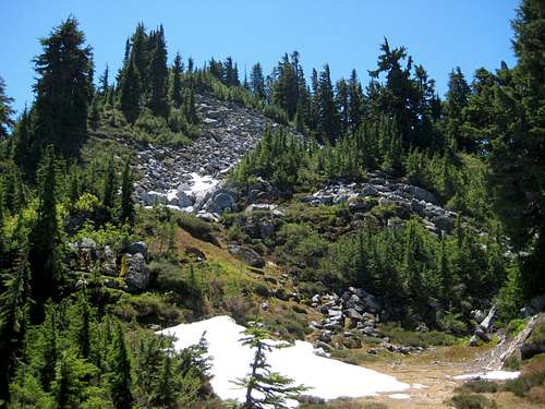
Continue north on the PCT for 0.7 miles, as the trail makes a gradual descent to a well-defined notch at 5400'. At this point, a very faint climber's path/game trail will lead right off the PCT, and start up the southwest ridge extending off of Point 5770.
Point 5770 from Grizzly Peak - photo taken just above the 5400' notch
Generally speaking, it is best to stay just to climber's right of the ridge crest for a mostly brush-free experience. The scrambling should be mostly class 2, and game trails can be followed most of the way up. The true summit will be recognized by 30' rock cliffs on the south side. Just before reaching the summit, cross to the other side of the ridge, and finish on the gentle north slope. While Point 5770 does not have a full 360 degree view, visiting a couple of closely-spaced viewpoints will give unrestricted views in all directions.
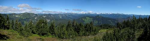
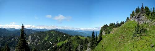
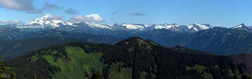
North pano from Point 5770 (Grizzly Peak)
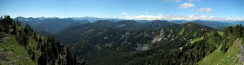
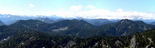
South pano from Point 5770 (Grizzly Peak)
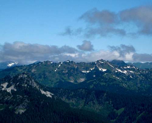
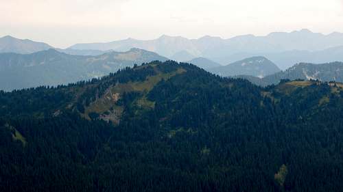
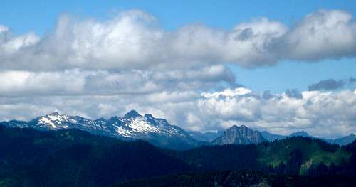
Skykomish Peak from Point 5770 (Grizzly Peak)
Scrabble Mountain from Point 5770 (Grizzly Peak) - Point 5650 on far left
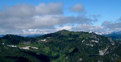
Bonus Peak: Time permitting, make sure you tag Point 5650 on your way to/from Grizzly Peak. Unlike most of the peaks in the area, it offers unrestricted 360 degree views for a modest amount of effort. I chose to ascend via the north ridge, which was an easy class 2 scramble (a few low-exposure class 3 moves at the top). Alternatively, one could ascend from the 5200' gap southeast of the summit, at the expense of a few more class 3 moves.
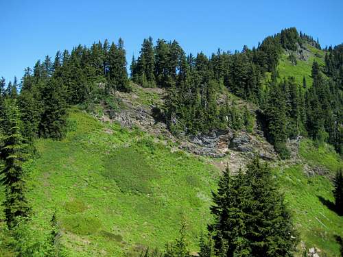
Point 5650 north ridge final scramble
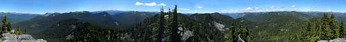
Point 5650 pano
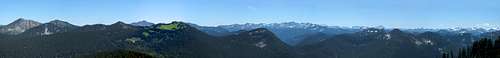
Point 5650 south pano - Labyrinth Mountain on far left, Mount Howard just left of Jove Peak (big green patch), Union Peak center, Lichtenberg Mountain and Mount McCausland in right third of photo.
Red Tape
When to Climb
Most campers will probably prefer Lake Janus. As I am not a huge fan of bugs, I would probably camp near the summit of Grizzly Peak. There are several other small campsites available along the length of the trail.