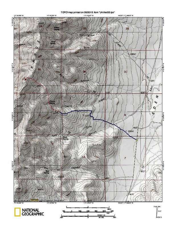
Blue indicates dirt road tracks that we were able to drive to get close to Cherry Springs. Red dots indicate best route up to the summit area.
lat/long nad 27
Turn off from Eden Valley road
41.1917 117.3951 Elev 4850
Cherry Spring trailhead
41.2013 117.4295 Elev 5660
Driving distance on blue track 2.25 miles
Hiking distance on red dot track 1.35 miles Elev gain 1250'


