Toggle navigation
Mountains
Routes
Images
Trip Reports
Forum
What's New
People
Areas & Ranges
Articles
Trailheads
Canyons
Huts & Campgrounds
Albums
Logistical Centers
Fact Sheets
Lists
Custom Objects
Gear
Plans & Partners
WELCOME TO SUMMITPOST
SIGN IN
REGISTER
Indianhead Peak
Additional Parents
Indianhead Peak West Ridge (Standard Route)
Image
Indianhead Peak
View High-Resolution Image
Indianhead Peak
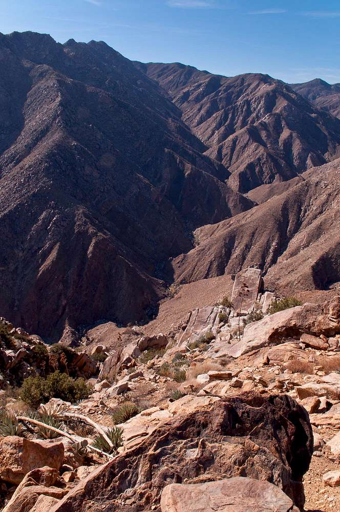
More than 2,000 feet of elevation loss until we reach the Borrego Palm Canyon on our way down from Indianhead Peak.
Anza Borrego Desert State Park, January 2012
« PREV
NEXT »
SoCalHiker
on
Jan 22, 2012 12:19 am
Comments & voting
Other parents
Lat/Lon:
33.31254°N / 116.43835°E
Image ID:
772313
2190 Hits
77.92
% Score
9
Votes
Log in to vote
Comments
No comments posted yet.
to post!
Don't have an account?
Indianhead Peak
(Mountain/Rock)
« PREV
Viewing
#11 of 81
GALLERY
NEXT »
SoCalHiker's Image Gallery
« PREV
Viewing
#1208 of 3483
GALLERY
NEXT »
Indianhead Peak West Ridge (Standard Route)
(Route)
Loading....
×
You need to login in order to vote!
User Name
Password
Remember me
Forgot your password?
Log me out when I close my browser.
Keep me logged in all the time.
sign in as a user
Don't have an account?
Register now for FREE
Rating available
Suggested routes for you
People who climb the same things as you
Comments Available
Create Albums
Register Here


