|
|
Mountain/Rock |
|---|---|
|
|
48.47860°N / 121.94193°W |
|
|
Skagit |
|
|
4793 ft / 1461 m |
|
|
Overview
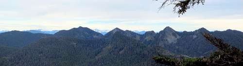
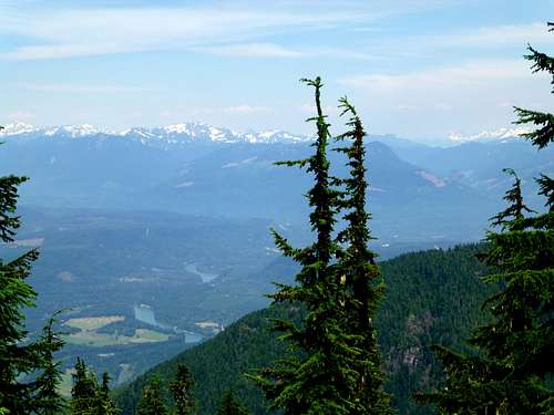
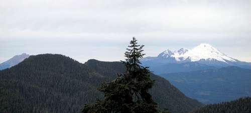
Iron Mountain from 'Lumber Mill Mountain'
I never did find the cool air, but I did find Iron Mountain, a 4793' peak located four miles southeast of Hamilton, WA. While not a particularly tall mountain, it does offer a respectable 1573' of prominence, ranking it 30th in Skagit County, and 6th in the area known as Logger's Island (the area bound by the Skagit, Suak, and North Fork Stillaguamish). Views from the actual summit are disappointing, but there are several spots in the vicinity that offer good views. For those who need just a little bit more, 'Lumber Mill Mountain' (Pt. 4750) and 'Lumberjack Mountain' (Pt. 4596) can also be accessed from FR1775, but these will probably only be of interest to prominence peakbaggers.
Getting There
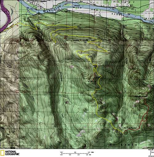
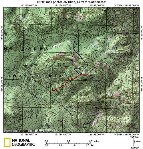
Iron Mountain and 'Lumber Mill Mountain' route map. Yellow lines show the roads I drove, red lines show my scrambling routes.
Note: The Weyerhauser Company is currently conducting operations on FR1775. Until this logging is complete, it may be best to avoid this area on weekdays.
Route
From the end of the aforementioned spur, scramble south through brushy second growth for approximately 200', then follow easy open forest up the south ridge to the summit (15-20 minutes). The first high point is not the true summit, continue another few hundred yards to the second high point. Optional routes to the summit are shown in blue on the route map.The following pictures are taken from several locations within 1/4 mile of Iron Mountain's summit - only one is taken on the actual summit.
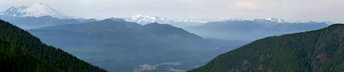
Iron Mountain north pano. The spur that I used to access the mountain can be seen in center of photo.
Iron Mountain NE pano
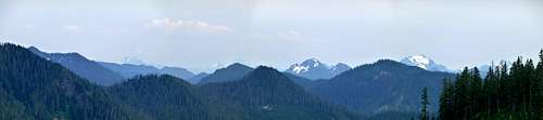
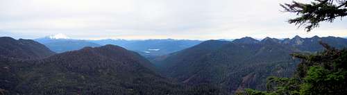
Iron Mountain southeast pano. Picture is a bit hazy, but you can make out Pugh, Sloan, Round, Whitehorse, and Three Fingers.

Iron Mountain west view

NE view from Iron Mountain true summit
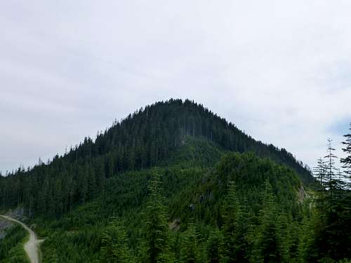
Iron Mountain from north. The spur I used to access the summit can be seen in the lower left part of photo. In hindsight, it might have been just as easy to continue a short distance up the road, and follow the ridge west to the summit (less brush).
I was feeling a little bit guilty about 'driving up' Iron Mountain, so I decided to pay my penance on 'Lumber Mill Mountain' (Point 4750', 2 miles E/SE of Iron Mountain). To access it, I continued another 3.3 miles on FR1775, and parked at a spur that led off to the left. I followed this spur to its end (very brushy), then scrambled up the south ridge as seen on the route map. While this peak offers acceptable west views, it should only be of interest to prominence peakbaggers (1170' of prominence).
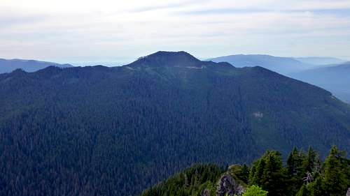
'Lumber Mill Mountain' from Iron Mountain

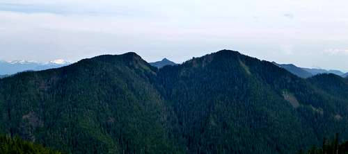
'Lumber Mill Mountain' south view. The spur I used to access the mountain can be seen on the right (horrible bushwacking). 'Lumberjack Mountain' (Pt. 4596) can be seen in the center of this photo, just behind the two bumps on Lumbermill's south ridge.
Update: I decided to do a scramble up 'Lumberjack Peak' yesterday (10-13-14) to finish off the prominence peaks in this area. Due to its close proximity to Iron and 'Lumbermill', I have attached some information for the peak to this page.

'Lumberjack Mountain' from 'Cumberland Cap'. This rocky promontory (Point 3770) is a quick, 20 minute scramble from the 'pass' on FR17 (between Iron Mountain and Coal Mountain.
'Lumberjack Mountain' route map. Red line shows my route from FR17. Blue line shows a probable route from FR1775, but is untested by yours truly.
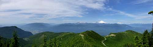
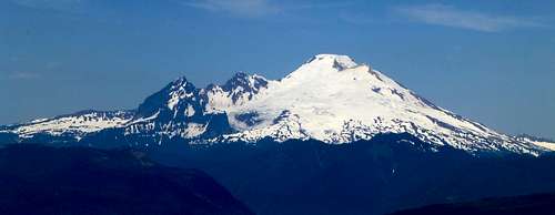
'Lumbermill Mountain' from 'Lumberjack Mountain'. South Twin Sister on the left, Mount Baker on the right.
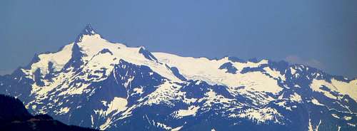
'Lumberjack Mountain' north through east pano