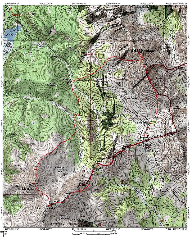
This map outlines our route on the "LaBoreas Loop", connecting Bald Mountain, Red Peak, Hoosier Ridge, and Red Mountain. This area is just outside of Breckenridge, Colorado.
Take note of the direction of travel and the location where we parked.
The second half of this hike is in one of the
Hidden Gems Proposal areas. These areas deserve protection! If you agree, please sign the
Open Letter of Support for the Hidden Gems.


