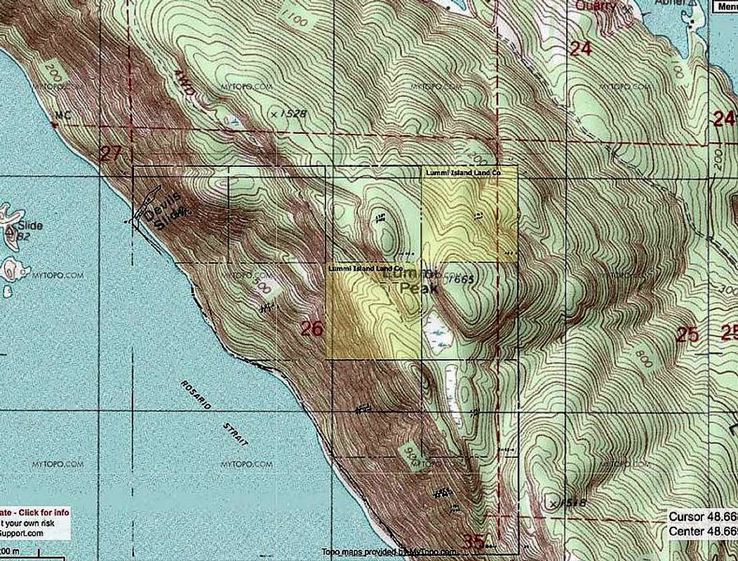
Somebody who claimed on another website to have previously worked for both the Department of Natural Resources as well as the Washington Department of Fish & Wildlife, supposedly with direct knowledge of Lummi Island/Lummi Point private property boundaries, recommended visiting a particular official Whatcom County website that shows private property boundaries on Lummi Island. This person claimed the map on that website proved that the Lummi Island Land Company owned the land containing the summit. However, as seen in this copy of that map, the summit is *not* on LILC land. When this was brought to the attention of the person who had recommended the website from which he had said to trust, he disputed the findings once again (despite coming from an official Whatcom County website). This essentially discredited the person making the claim of LILC property boundaries, although I suspect the controversy will linger on.


