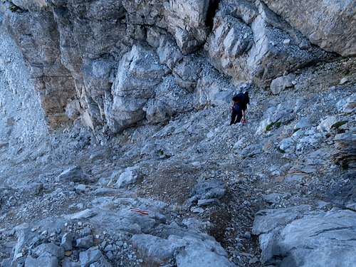
|
|
Route |
|---|---|
|
|
42.52249°N / 19.84197°E |
|
|
Hiking, Scrambling |
|
|
One to two days |
|
|
Swiss Hiking Scale: T3-T4; YDS class 2-3, chossy |
|
|
Overview
|
Page created anew in November 2024. 
This page deals with the waymarked trail to the summit of Maja Jezercë (Jezerca, Jezerski vrh), which is normally hiked, often in two days, by people based in Montenegro. (NB In the valley head the winter route seems to run well off the designated path described here.) The trailhead (car park, restaurant) is at Vodopad Grlja (Grlja Falls) on the southwestern fringe of the village of Vusanje, at the mouth of the Ropojana Valley. If your car is sturdy enough, you can drive a couple of kilometres into the valley, and in a 4x4 car you can get as far as Katun Zastan, which is located about two kilometres from the Montenegro-Albania border. Information on border crossing is to be found in the Red Tape & Camping chapter. Route statistics (approximate) Distance (one-way): 13 km (7.5 km from Katun Zastan) Total elevation gain: 1,700 m (1,350 m from Katun Zastan) Time of ascent: 7-8 h (5-5.5 h from Katun Zastan) |
Route Description
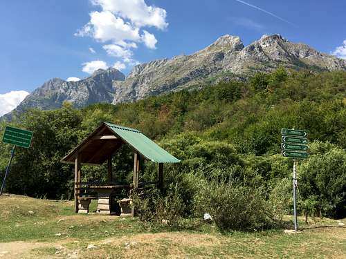
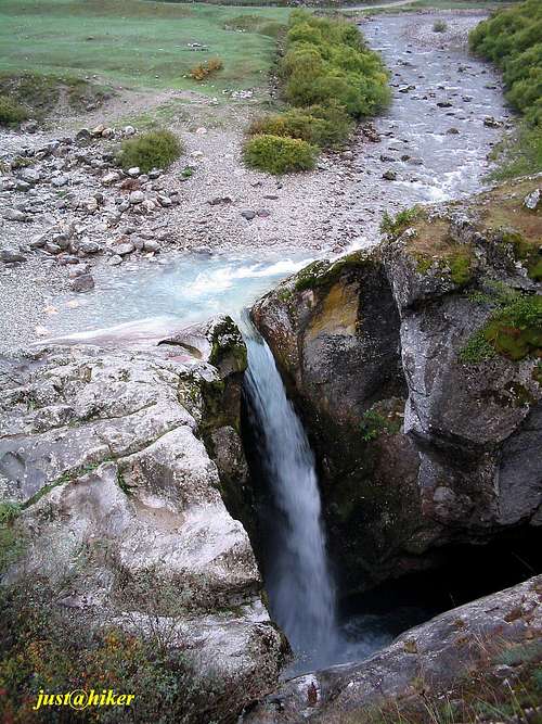
Vodopad Grlja (Grlja Falls) at the trailhead is a natural attraction even when the waterfall has run dry (which usually happens in summer), because just below it the Grlja has carved a slot canyon whose upper end is visible from the viewpoint.
The first part of the route is a rather gentle, nearly five-kilometre walk along a dirt road, into and up the Ropojana Valley. 
A bit less than a mile from Grlja Falls, a signposted path branches off to your right. The path leads to a karst spring known as Oko Skakavice, which is located just a few dozen metres away. 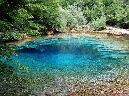
Half a kilometre past Oko Skakavice is a toll gate where a fee for entering the national park is collected. There is a little designated campsite just before the toll gate. 
You continue along the dirt road taking in the scenery. Especially captivating are the cliffs on your left, with a characteristic tower. 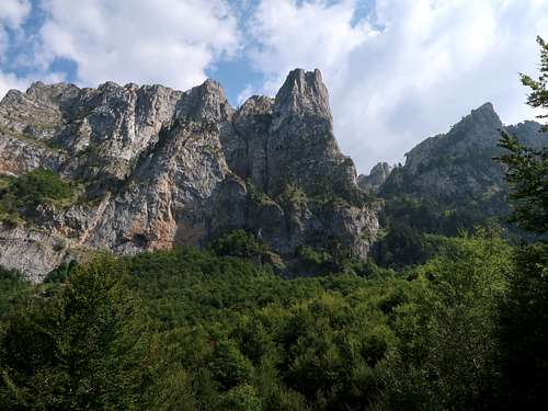
About 2.5km from the toll gate the road forks. You can go on up either of its branches for nearly 400m as far as a junction with a signpost. But a better idea (unless you are on a bike or in a 4x4 car) is to look for a well-trodden path several metres away to your left. This path, whose beginning you have just missed as it is not signed, is a short-cut leading through a beech forest to Katun Zastan (Vusanjski Zastan). 
A katun is an equivalent of a Scottish shieling or an alp in the Alps, i.e. it is a seasonal settlement in the mountains where livestock are bred in the summer. Katun Zastan lies at about 1350m in an overdeepening created at the confluence of two glaciers one of which flowed from the foot of Maja Jezercë through the valley of Buni i Jezercës. The cottage at Katun Zastan, after being abandoned by its original owners, served as a border police station for a while. Now (year 2024) it is dilapidating but it can still shelter several people. 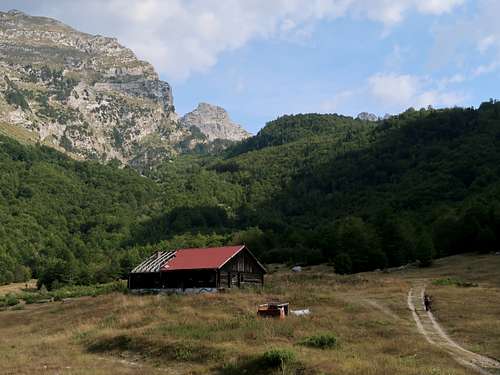
About 200m after the ruin of the hut, just by the track you are on is a source of drinking water – the only one along the way. When we got there in the last week of August 2024, a strong stream of water was coming out of the pipe so it seemed the spring never ran dry in summer, but the owner of the eko katun we were staying at warned us that it does. 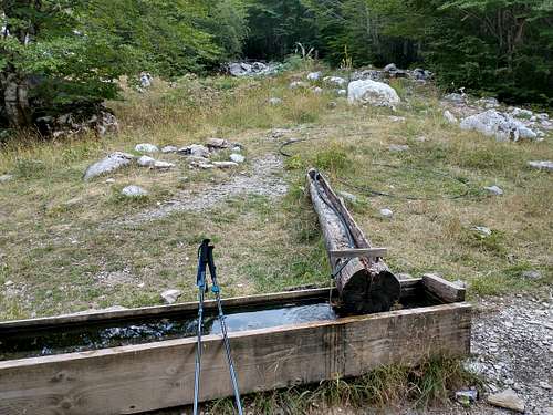
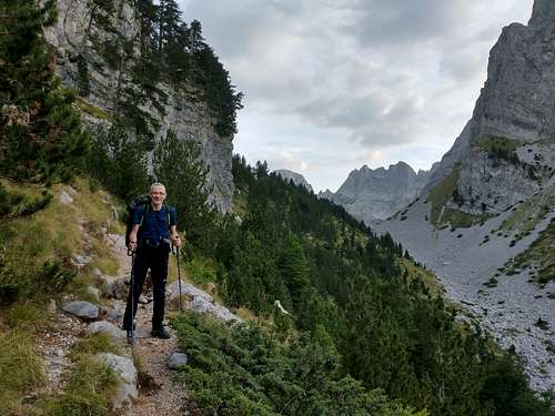
Just after the water trough you pass by a little house, just renovated, then the meadow ends and the track turns into a path entering a beech woodland where red marks instantly appear. They fork after several metres – you turn right since the other path leads to Maja Rosit. Thus begins a nearly 2km long walk up a wooded step in the valley, nearly 450m high (photo above), towards the Montenegro-Albania border. 
When you get to the border stone at 1780m, you have gained about 800m of elevation since the start. Now comes a more relaxing and the most scenic portion of the route – the valley of Buni i Jezercës. 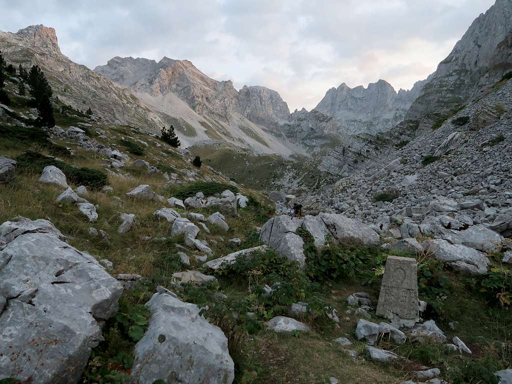
The valley is famous for its tarns. Both the valley and Maja Jezercë took their names from these lakes. Lakes are a rather rare feature in the Accursed Mountains and an important component of the scenery of the valley, but it retains its beauty even when they are drying up. And they do dry up or shrink dramatically every summer. The lowest lake sits just 150 metres off the international border at the eastern foot of the massif of Shqokishtes/Šćokištes. 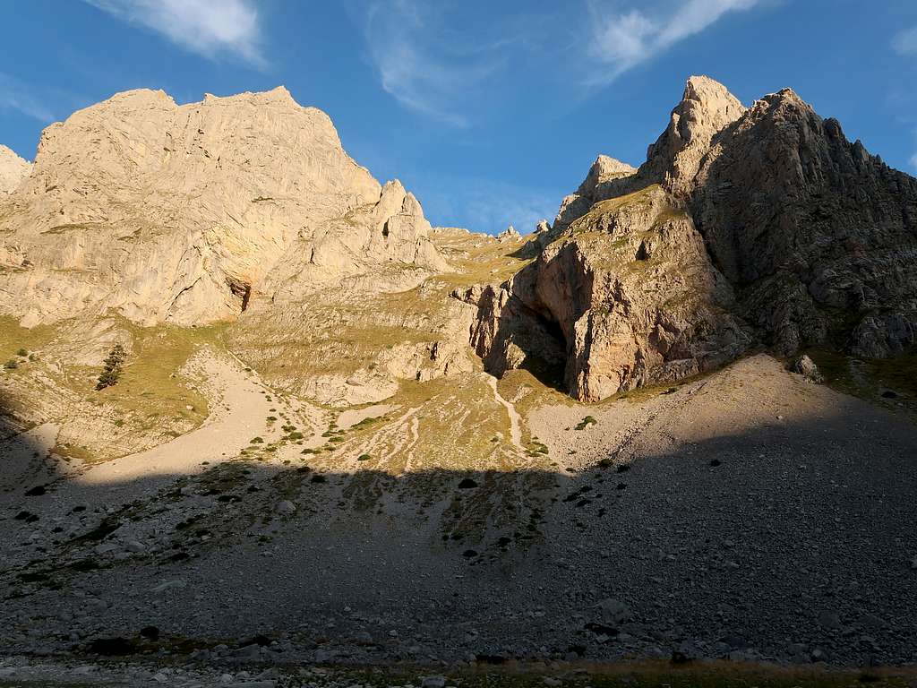
Three hundred metres after the lowest lake the trail nears the northeastern tarn. It is called Lulashit and seems to be a bit deeper than its neighbours, which makes its vicinity one of the trekkers' favourite places for wild camping. 
On your right, across a set of three lakes, the eastern face of the Shqokishtes/Ščokištes massif shows off. 
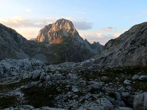
Now the path climbs a distinct, although no more than fifty metres high, step in the valley, beyond which lie the two highest tarns. The scenery is spectacular, the serrated ridge of Majet Malisores / Malet Malësores (2490m) ahead of you being especially alluring. 
Before you see them, when you get to the top of the step, you will have an excellent view of the lower tarns lying at the foot of the Shqokishtes. Here, at a sharp bend in the trail, you come across a structure which looks like the foundations of a small hut. In fact, this is a bunker – a legacy of the totalitarian regime from the second half of the 20th century, which obsessively feared invasion. The bunker can be used as a shelter by a couple of hikers. After the bunker, on your right some twenty metres below the trail sits a tarn known as Liqeni i Mjelsave. 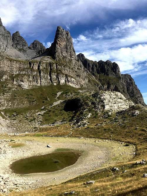
When you have passed it, you will be approaching the highest tarn, named Liqeni i Madh i Jezercës (The Great Lake of Buni i Jezercës), another popular wild camping spot. The lake lies at about 1800m, which means that since you crossed the Montenegro-Albania border and saw the lowest lake, you have hardly gained any elevation despite covering a distance of almost a mile. So there is still roughly 900m of ascent left (and about 4km distance). Ahead you see the next step in this post-glacial valley, fairly rocky, steep and about two hundred metres high. The trail skirts the right-hand edge of the tarn, then does not tackle the step directly, but angles right to ascend up the grassy slope. 
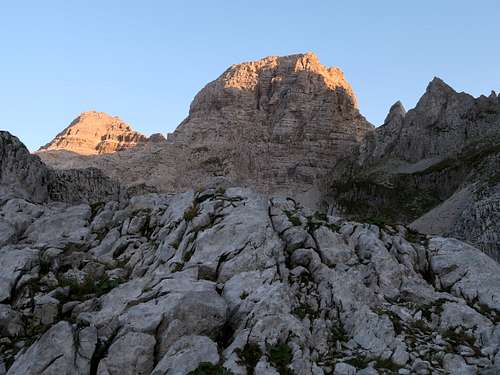
Above that valley step, at about 2000m, at the foot of Majet Malisores, the valley takes a right-angle turn to the left. Terrain also changes dramatically and shows signs of a recent glaciation – a glacier filling all of the valley head, over one kilometre long, is marked on a geologic map from 1918 made by Károly Telegdi-Roth (www.dinarskogorje.com/grupa-popluks-popluk.html). Now to get to the valley head, you will be walking over moraine blocks or glacier-scoured bedrock, in places riddled with karst pits and crevasses: First the trail follows the crest of a moraine embankment, which it descends soon angling left into a hollow covered in some snow. It is actually here that the valley takes the sharp turn left to run up in the southeast direction. Across the hollow is the uppermost valley step, roughly a hundred metres high, to climb. Watch out here as despite the trail still being waymarked, it is not easy to spot the marks in this rocky maze. There are cairns off the designated path, which makes you confused. But in fact it does not matter whether you follow the marks or the cairns as they soon join anyway. As for the views while crossing this uppermost valley step (whose upper part forms the lip of the overdeepened albeit lakeless, due to its calcareous bedrock, valley head), when you look back, to the north, Maja Bojs/Bojës at 2461m shows off. Ahead you see the massive, nameless, western foresummit of Maja Jezercë (2508m), then the main summit first pops up to its left. A bit later, just after crossing an area full of karst pits on the other side of the valley step, you will see most of the valley head, bounded by the northwest ridge of Maja Kokërhanes/Kokervhakes (2495m) to your left. After crossing the uppermost valley step (which takes less than half an hour if you do not stray), a well-defined path reappears. It will traverse the southern side of the valley for three quarters of an hour, gradually gaining elevation, up to its head at a saddle called Qafa Emal, which is less than a kilometre away. You cannot lose your way here on the way up, but if you do not pay enough attention while coming back, you can easily stray from the right path and find yourself too far north and down – we can tell you from experience. On the way down, the key to an efficient passage along the designated path is to keep to the southern side of the valley without losing elevation too quickly. 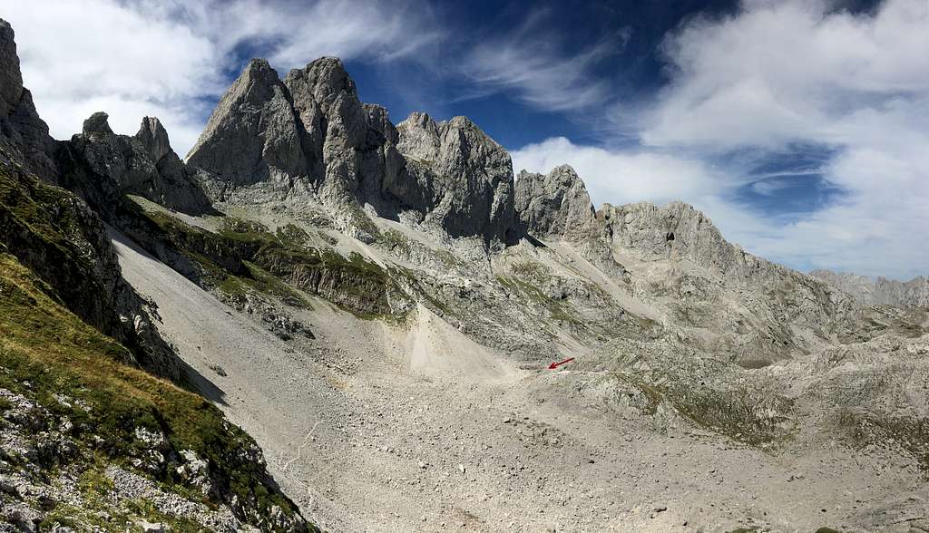

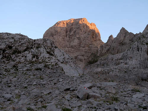
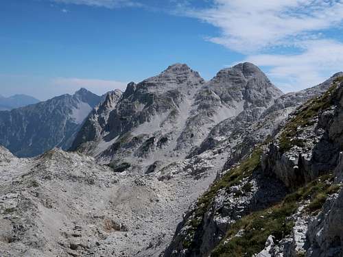
Qafa Emal at about 2300m gives a good view of the southwest face of Maja Kokërhanes. In the opposite direction Maja Jezercë is partly obscured by nearby rocks. In the southeast are the twin peaks of Maja Rragamit (2474 and 2482m). At the saddle the final part of the ascent (roughly 1.5hrs and 370m elevation gain) begins. Luckily, most of it will be up the north face of the mountain, which around midday will shelter you from the scorching sun. Some fifty metres above the saddle you get a better view of the mountain, but its summit will not be seen until almost the end of the climb, which is a combination of rather easy scrambling up a series of rock steps (no harder than YDS class 3) and walking over scree and talus. 
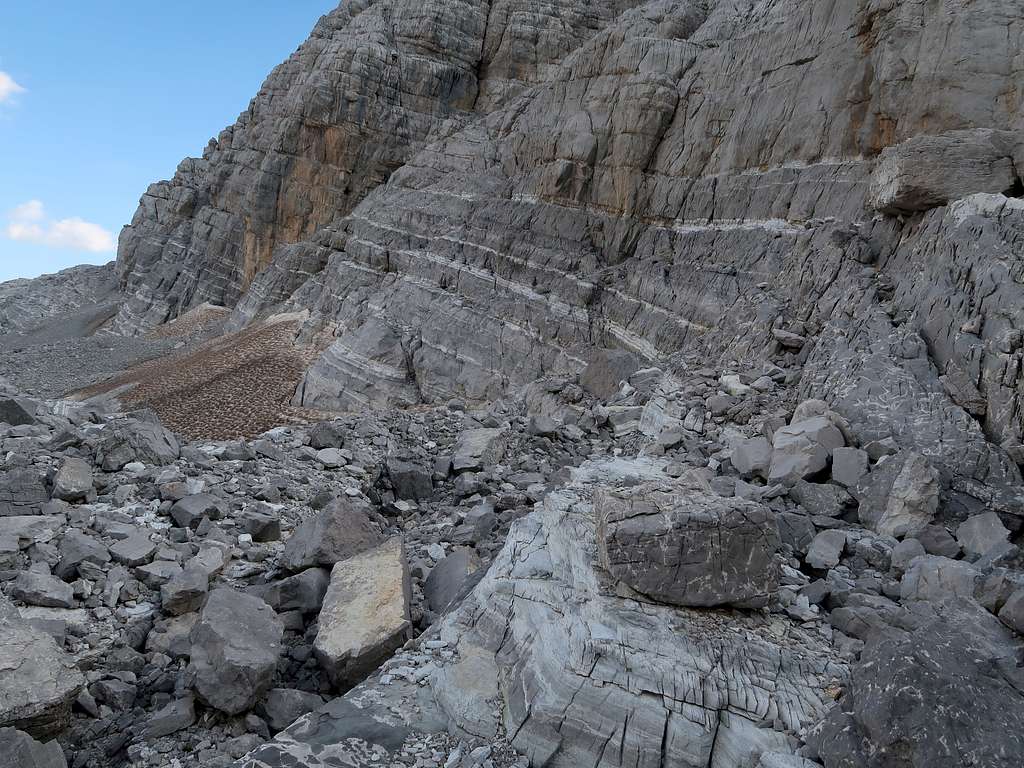
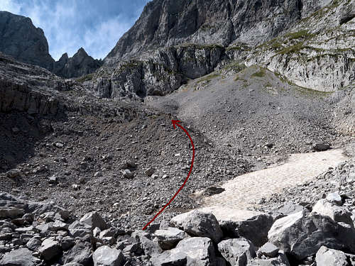
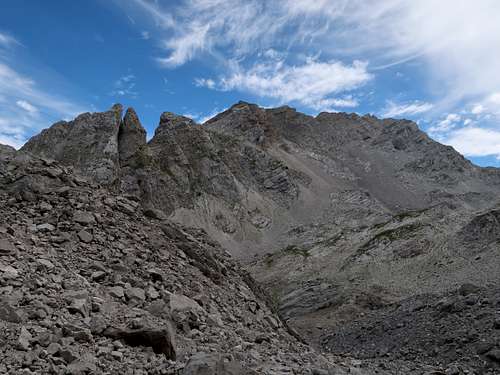
The crux of the route is just below the crest of the mountain. It is an oblique chute which would be fairly easy to climb (YDS class 2 or perhaps easy 3) if it wasn't full of loose material. The best way to handle this couloir is to keep to its left side, where you can use the adjoining rock wall for handholds, then nearer the top of the couloir, where its left side rears up, to cross it angling up towards its right-hand side. Snow in the couloir complicates things. A lingering snow patch will push you off the rock wall on the left, thus denying you comfortable handholds. If there is plenty of snow, the chute may become impassable without appropriate winter gear. Depending on the year, this can happen even in the middle of the summer: please see The longest day chapter here. Just after exiting the couloir, you pass by a characteristic mushroom rock. 
The trail does run directly to the summit but detours some steep walls, traversing the west flank of the summit dome for about a hundred metres, heading for the northwest ridge of the mountain. 
When it reaches the ridge, it joins the west route from Thethi. 
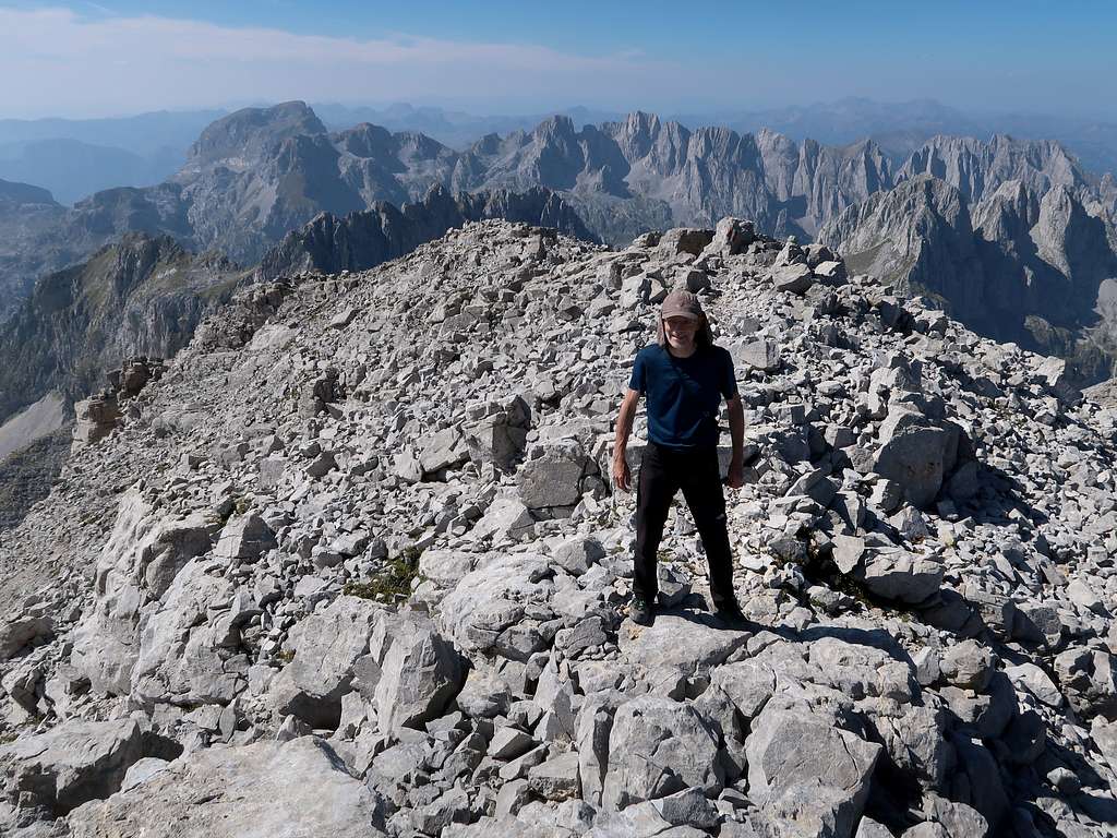
The summit lies about 200m southeast of this place, 80m higher. You should get there in a quarter of an hour. 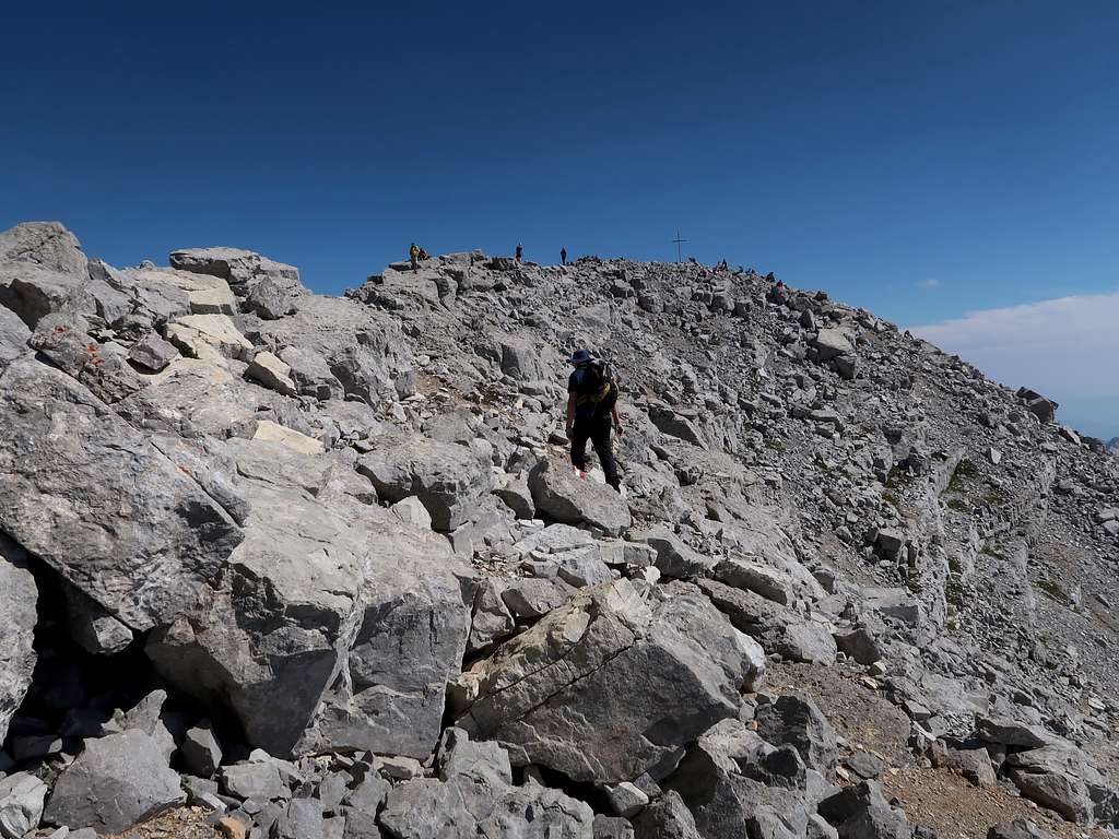
|
Essential Gear
|
In winter and spring you will definitely need crampons and ice axe. Under winter conditions above an elevation of 2,000m roping up might be needed for a safe passage. A report on a winter expedition is available on SP. |
Red Tape & Camping

Updated in 2024: The Montenegrin part of the area lies within the Prokletije National Park. The entry fee (paid at the gate near TH) is 3 euros per person. On the other side of the border stretches the Albanian Alps National Park (Parku Kombëtar i Alpeve të Shqipërisë). There is not much red tape. You do not need to stick to designated trails and wild camping seems to be allowed or at least tolerated. The communist Albania of the second half of the 20th century was completely cut off from the outside world. After the regime fell, Maja Jezercë slowly started to gain popularity with hikers. An ascent of the peak from Montenegro became possible. In the 2010s Montenegrin border police points located just outside the border (at Katun Zastan and Vusanje) were closed in the 2010s. Now you can get a permit for border crossing at the Border Police Station in the town of Plav. The cost is a few euros per person. Many hikers do not seem to bother though. The locals we asked about that claimed that if you checked in a hotel/campsite, you would not need a permit to cross the border just to climb Maja Jezercë and return on the same day. Still, bear in mind that potential punishment might be severe. To make sure what the current regulations are it may be a good idea to email Plav Tourist Information. You can apply for the permit online but this seems to be time-consuming and inconvenient: please see thesandyfeet.com. |
Getting There & Accommodation
|
The most convenient way of getting there is to fly to Podgorica, the capital of Montenegro, then rent a car. Its only a 2.5–3 hour drive from Podgorica to Vusanje (via Kolašin and Berane). In comparison, the driving time between Budapest or Zagreb and Vusanje is nearly 10hrs. You can also get from Podgorica to Gusinje by bus (Gusinje is a town just a few kilometres away from Vusanje). The journey lasts roughly 4hrs. Tourist infrastructure has considerably improved in recent years. It is possible to book accommodation online. In Vusanje and generally around Gusinje there are many family-run facilities called eko katun. These are made up of several cabins/chalets (usually with a private bathroom) and often a restaurant. The prices are very reasonable (year 2024). |
Other Information
For other information, such as maps, mountain conditions or summit views, please see the parent page.
Plenty of good info about the area as well as photographs and labelled panoramas can be found on dinarskogorje.com.
