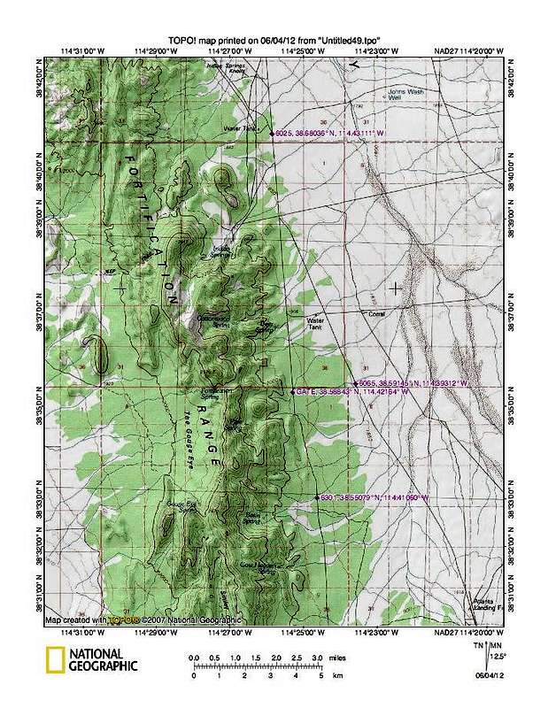
On the lower half of this map, there are three key waypoints. First, is the cattle guard at 6065 (elev) 38.59145 114.39312. After crossing the cattle guard, turn right on the road that parallels the fenceline and drive 1.5 miles to the next key waypoint, 38.58843 114.42164. You will see a gate on the road you will turn onto on the north side of the road. In this case, head south on this road as it makes its way toward the key waypoint of 6301. Look hard for a faint track that heads west toward Basin Spring. This waypoint is located at 38.55079 114.4106 If you can't find this track or don't want more scratches on your paint job, you could park off the road near this point and start your trek for the mountain. This will add a couple miles to your roundtrip.


