Toggle navigation
Mountains
Routes
Images
Trip Reports
Forum
What's New
People
Areas & Ranges
Articles
Trailheads
Canyons
Huts & Campgrounds
Albums
Logistical Centers
Fact Sheets
Lists
Custom Objects
Gear
Plans & Partners
WELCOME TO SUMMITPOST
SIGN IN
REGISTER
Great Sail Peak
Additional Parents
Image
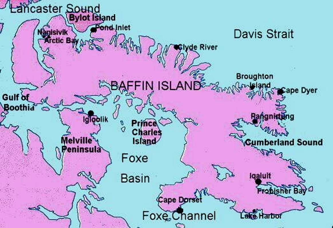
Map of Baffin Island....
View High-Resolution Image
Map of Baffin Island....
Map of Baffin Island. Auyuittuq is just to the North of Pangnirtung and Sam Ford Inlet and the Stewart Valley are just to the east of Clyde River.
« PREV
NEXT »
tlogan
on
Mar 27, 2004 3:10 pm
Comments & voting
Other parents
Lat/Lon:
70.84000°N / 68.65°W
Image ID:
47466
24816 Hits
73.06
% Score
3
Votes
Log in to vote
Comments
No comments posted yet.
to post!
Don't have an account?
Great Sail Peak
(Mountain/Rock)
« PREV
Viewing
#18 of 18
GALLERY
You are at
the Last
Image
tlogan's Image Gallery
« PREV
Viewing
#384 of 563
GALLERY
NEXT »
×
You need to login in order to vote!
User Name
Password
Remember me
Forgot your password?
Log me out when I close my browser.
Keep me logged in all the time.
sign in as a user
Don't have an account?
Register now for FREE
Rating available
Suggested routes for you
People who climb the same things as you
Comments Available
Create Albums
Register Here


