Toggle navigation
Mountains
Routes
Images
Trip Reports
Forum
What's New
People
Areas & Ranges
Articles
Trailheads
Canyons
Huts & Campgrounds
Albums
Logistical Centers
Fact Sheets
Lists
Custom Objects
Gear
Plans & Partners
WELCOME TO SUMMITPOST
SIGN IN
REGISTER
Santa María
Additional Parents
Volcán Chicabal
Image
Map of the area surrounding...
View High-Resolution Image
Map of the area surrounding...
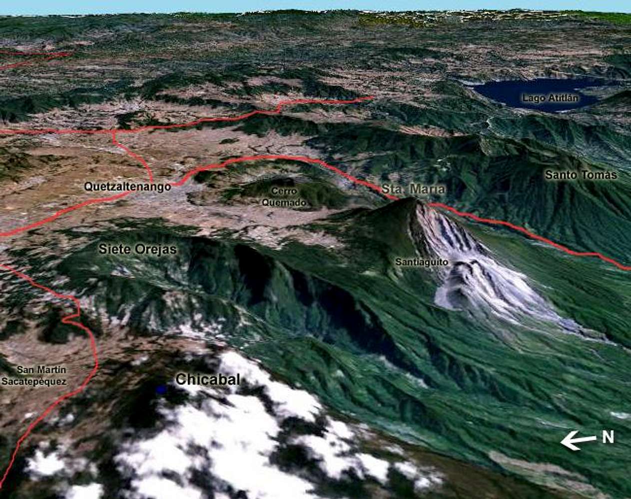
Map of the area surrounding Chicabal.
Created using Nasa's World Wind software with Landsat 7 imagery, later adding labels and highways.
« PREV
NEXT »
brendon
on
May 10, 2005 4:53 am
Comments & voting
Other parents
Lat/Lon:
14.79000°N / 91.655°W
Image ID:
104451
3580 Hits
71.59
% Score
2
Votes
Log in to vote
Comments
No comments posted yet.
to post!
Don't have an account?
Santa María
(Mountain/Rock)
« PREV
Viewing
#35 of 59
GALLERY
NEXT »
brendon's Image Gallery
« PREV
Viewing
#495 of 577
GALLERY
NEXT »
Volcán Chicabal
(Mountain/Rock)
Loading....
×
You need to login in order to vote!
User Name
Password
Remember me
Forgot your password?
Log me out when I close my browser.
Keep me logged in all the time.
sign in as a user
Don't have an account?
Register now for FREE
Rating available
Suggested routes for you
People who climb the same things as you
Comments Available
Create Albums
Register Here


