
ggia - Nov 29, 2010 11:20 am - Hasn't voted
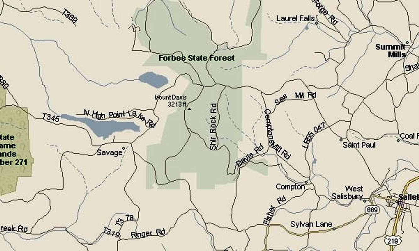
better directionsFrom the junction of 219 and 669 in Salisbury, go west across the river about a block. At the T intersection, turn north on St Paul Rd. There is a sign at the T for the high point, but only visible when coming from the east. Follow the remainder of the signs.
Or, at Meyersdale take the Mt. Davis Rd/SR2004 exit on the 219 bypass slighly north of town. Go west on Mt. Davis Rd and follow the signs. If in Meyersdale, head north from Sheetz and turn west at the army tank and the road will become Mt Davis Rd.
When approaching from this side, there will be a couple tall communications towers almost adjacent to the large picnic area with rest rooms at the north end. The "High Point" trail is at the south end. Stay on the main "High Point" trail and not on the "Mt. Davis Trail". There is a tall lookout tower at the high point, but it isn't visiable until you get there even in fall.
If you don't want to hike, continue south on the road past the picnic area and past a big green sign to the lookout tower road on the left to the tower parking lot and true high point. We didn't drive this, but it has to be within a mile of the big green sign.


Comments
Post a Comment