Toggle navigation
Mountains
Routes
Images
Trip Reports
Forum
What's New
People
Areas & Ranges
Articles
Trailheads
Canyons
Huts & Campgrounds
Albums
Logistical Centers
Fact Sheets
Lists
Custom Objects
Gear
Plans & Partners
WELCOME TO SUMMITPOST
SIGN IN
REGISTER
Korvatunturi
Additional Parents
Image
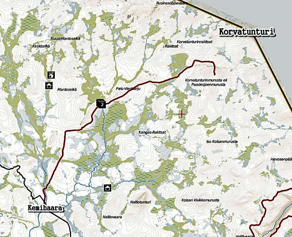
Map to Korvatunturi
View High-Resolution Image
Map to Korvatunturi
This map show the route from Kemihaara to mount Korvatunturi. The huts (and also "2") on the map show the locations of wilderness huts. The route in the picture is roughly 25km altogether, from one end to another.
« PREV
NEXT »
Jukka Ahonen
on
Feb 22, 2012 11:59 am
Comments & voting
Other parents
Image Type(s):
Hiking
,
Skiing
,
Topo/Diagram
,
Informational
Image ID:
777759
3705 Hits
0
% Score
0
Votes
Log in to vote
Comments
No comments posted yet.
to post!
Don't have an account?
Korvatunturi
(Mountain/Rock)
« PREV
Viewing
#13 of 14
GALLERY
NEXT »
Jukka Ahonen's Image Gallery
« PREV
Viewing
#26 of 33
GALLERY
NEXT »
×
You need to login in order to vote!
User Name
Password
Remember me
Forgot your password?
Log me out when I close my browser.
Keep me logged in all the time.
sign in as a user
Don't have an account?
Register now for FREE
Rating available
Suggested routes for you
People who climb the same things as you
Comments Available
Create Albums
Register Here


