
-
 2276 Hits
-
 83.1% Score
-
 16 Votes
|
|
Mountain/Rock |
|---|---|
|
|
45.66294°N / 7.78515°E |
|
|
Mountaineering |
|
|
Summer, Fall |
|
|
8891 ft / 2710 m |
|
|
Overview
This mountain is located on the divide between the Lys Valley (West) and Gressoney and more specifically in the sector that the Becca di Vlou (3.032m), the highest elevation in the stretch after the Testa Grigia (3.314m), which in the long partition Monte Rosa down to the Valley of Dora Baltea separating these two valleys. In fact, after this and Becca Torché (3.016m) the ridge, past the Col de Dondeuil (2.338m), rises again to form the Tip or Horn of Lake and even known as "Pic des Allemands" (2.747m) above four small lakes with the same name in Gressoney Valley and above the Municipality of Issime (953/80m), which Mont Crabun is the large shoulder South, before the partition runs out on the Central Valley. It consists of three crests and as many sides, of which the South is directed South to the Col de l'Arche and the Summit of Pietre Bianche (2.413m, 2.432m), after which the ridge declines towards the Croix de Corma above Municipality of Pont Saint Martin at the end of the Valley of Aosta. The other two crests are directed to the North to the Corno del Lago (Horn Lake) and East in the direction of Cima di Prial (2.424m). It has at its Summit and almost at the end of a small East Crest a refuge (2.680m; sleeps six) immediately below the large cross placed on the Top. From its summit beautiful and unusual views of the Central Valley of the Dora, on the Eastern part of Graian and the nearby entrance to the Valley of Gressoney (Perloz, Lillianes, Fontainemore and Issime Villages or Commons), while on the other side overlooking the Valley of Challand.
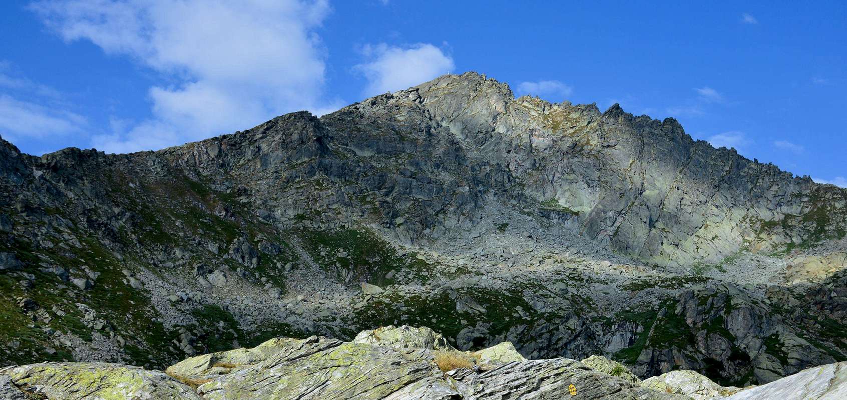
Questa montagna é sita sullo spartiacque tra la Valle del Lys (Ovest) e quella di Gressoney e più precisamente nel settore che dalla Becca di Vlou (3.032 m), massima elevazione nel tratto dopo la Testa Grigia (3.314 m), nel lungo divisorio che dal Monte Rosa scende verso la Valle Centrale della Dora Baltea separando queste due vallate. Infatti dopo questa e la Becca Torché (3.016 m) la cresta, oltrepassato il Col Dondeuil (2.338 m), si rialza a formare la Punta o Corno del Lago od anche localmente conosciuta quale "Pic des Allemands" (2.747 m) sopra gli omonimi quattro piccoli Laghi in Valle di Gressoney ed al di sopra del Comune di Issime (953/80), della quale il Mont Crabun non costituisce che la grande spalla Meridionale, prima che il divisorio si esaurisca sulla Valle Centrale della Dora Baltea. Formato da tre creste ed altrettanti versanti, delle quali quella Sud si indirizza a Sud verso il Passo de l'Arche e la Cima di Pietre Bianche (2.413 m, 2.432 m), oltre il quale il crinale declina verso la Croix de Corma al di sopra del Comune di Pont Saint Martin al termine della Valle di Aosta. Le altre due creste sono indirizzate a Settentrione verso il Corno del Lago ed a Est in direzione della Cima di Prial (2.424 m). Possiede presso la sua Cima e quasi al termine della Cresta Orientale un piccolo rifugio (2.680 m; sei posti letto) subito sottostante alla grande Croce posizionata sulla Vetta. Dalla sua Sommità belle ed inconsuete vedute sulla Valle Centrale della Dora, sulla parte più Orientale delle Alpi Graie e sul vicino ingresso nella Valle di Gressoney (Villaggio di Perloz e Comuni di Lillianes, Fontainemore ed Issime), mentre sul lato opposto domina la Valle di Challand.
First Ascents
- First on the Summit: Unknown.
- In winter: Unknown.
- Complete Traverse Becca Torché-Mont de Dondeuil-Gendarme du Dondeuil-Pic des Allemands- Mont Carabun: Osvaldo Cardellina and Giuseppe Lamazzi (this last exclusively Becca Torché), (Aug 18th,1996), from Dondeuil Alp and Pass and through Nort-northwest Ridge.
Getting There
BY CAR:
- From Torino, Milano, etc: Motorway A5. Exit Pont Saint Martin for then to continue on SR.26 for Gressoney Valley.
- From Switzerland: through the Grand Saint Bernard Tunnel or the namesake pass. Drive to Aosta, Pont Saint Martin and Gressoney Valley.
- From France: through Mont Blanc Tunnel or Petit Saint Bernard Pass. It isn't necessary to take Motorway A5: you can drive on SS.26, in the direction of Aosta and Pont Saint Martin.
BY PLANE:
- Aeroporto "Corrado Gex" Saint Christophe (Aosta).
Specific Road
From Pont Saint Martin (345m) in North through the Regional Road of Gressoney Valley, passing the Village of Perloz (to the West), Lillianes and Fontainemore Municipalities up to that of Issime (953/80m).
Approaches and Route
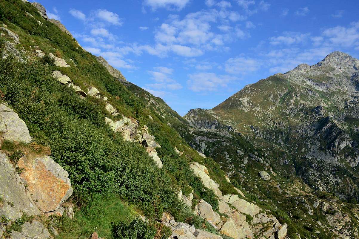
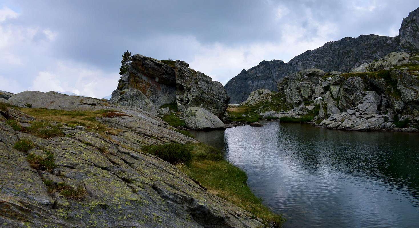
Reached Issime (953/80 m; the Church of San Giacomo) with a short detour from the regional road for the Gressoney Valley, take the path n° 1/Via Alpina that rises to the west-northwest in the direction of the Valley of Valbona. The same, after a first series of hairpin bends reaches Santa Margherita, where comes the farm road. A long diagonal passing through the Alps Zeuin, Lamatta (1.787m), vain, Vieukie, Methia, Mongiovetta salt reaching the same in succession to reach after the Alpe di Mounes Dèsott or Lower (+; 2.008 m; Chapel of "Madonna della Neve"). Leaving the West the path continues towards that Damon and Colle Dondeuil (2.338m), it continues instead to the South via a path not numbered among a sea of rhododendrons quickly reaching the small basin where sites are four small lakes (2.263 m, 2.274 m), which also ends the same. From here take, at the smaller lake surmounted by a cross at the Alpe del Lago, a small track that leads to the East Ridge at an altitude of 2.382 meters. Through steep but short grassy slopes and scree you reach the middle part consists of rocks that lead to the summit ridge, formed by rocky bumps that roam on the left (south) always using a small but safe path (E/F until the crest, then EE/F; 5h'00/5h'30 from Issime).
 |
 |
 |
 |
 |
Raggiunto il Comune di Issime (953/80 m; Chiesa di San Giacomo) con una breve deviazione dalla Strada Regionale per la Valle di Gressoney, prendere il sentiero n° 1/Via Alpina che sale verso Ovest-nordovest in direzione del Vallone di Valbona. Lo stesso, dopo una prima serie di stretti tornanti raggiunge Santa Margherita, dove arriva anche la strada poderale. Un lungo diagonale che passa per le Alpi Zeuin, Lamatta (1.787 m), Invan, Vieukie, Methia, Mongiovetta sale raggiungendo le medesime in successione per raggiungere in seguito l'Alpe di Mounes Dèsott od Inferiore (+; 2.008 m; Cappella della "Madonna della Neve"). Lasciando ad Occidente il sentiero che continua verso quella Damon ed il Colle Dondeuil (2.338 m), si continua invece verso Mezzogiorno tramite un sentiero non numerato in mezzo ad una distesa di rododendri raggiungendo in breve la piccola conca dove sono siti quattro piccoli laghi (2.263 m, 2.274 m), dove termina anche lo stesso. Da qui prendere, presso il lago più piccolo sormontato da una croce presso l'Alpe del Lago, una piccola traccia che conduce sulla Cresta Est a quota 2.382 metri circa. Tramite ripidi ma brevi pendii erbosi e detritici si raggiunge la parte mediana costituita da roccette che portano alla cresta sommitale, formata da asperità rocciose che si aggirano sulla sinistra (Sud) sempre per mezzo di piccolo ma sicuro sentiero (E/F sino alla cresta, poi EE/F; 5h'00/5h'30 dal Comune di Issime).
Difficulty
The route can be classified as E/EE to F.
L'itinerario è classificato da E/EE a F.
Gear
For Hiking.
Da escursionismo.
Campings
Remember that free camping is forbidden (except for emergency reasons, over 2.500m, from darkness until dawn).
Mountain Conditions
- You can get meteo information at the official site of the Regione Valle d'Aosta:
- Valle d'Aosta Meteo
Webcam
- WEBCAM on Aosta Valley:
- Webcam
Books and Maps
BOOKS:
- "Guida delle Alpi Occidentali" di Giovanni Bobba e Luigi Vaccarone C.A.I. Sezione di Torino Volume II (parte II), 25 Maggio 1896.
- "Guida dei Monti d'Italia" Alpi Pennine (Vol. 2) di Gino Buscaini - Club Alpino Italiano/Turing Club Italiano, Luglio 1970 (In Italian).
 |
 |
MAPS:
- I.G.C. Istituto Geografico Centrale Torino "IVREA-BIELLA e Bassa Valle d'Aosta" 1:50.000.
- I.G.C. Istituto Geografico Centrale Torino "Cervino e Monte Rosa" 1:50.000.
 |
Important Information
- REGIONE AUTONOMA VALLE D'AOSTA the official site.
- FONDAZIONE MONTAGNA SICURA Villa Cameron, località Villard de la Palud n° 1 Courmayeur (AO) Tel: 39 0165 897602 - Fax: 39 0165 897647.
- A.I.NE.VA. (Associazione Interregionale Neve e Valanghe).
Useful numbers
- Protezione Civile Valdostana località Aeroporto n° 7/A Saint Christophe (Ao) Tel. 0165-238222.
- Bollettino Meteo (weather info) Tel. 0165-44113.
- Unità Operativa di Soccorso Sanitario Tel. 118.
Acknowledgements
I am greatly indebted to my friend "Osva" for the detailed description of the route, all texts and translation into English.