
-
 2835 Hits
-
 82.48% Score
-
 15 Votes
|
|
Mountain/Rock |
|---|---|
|
|
45.67723°N / 7.01966°E |
|
|
9984 ft / 3043 m |
|
|
Overview
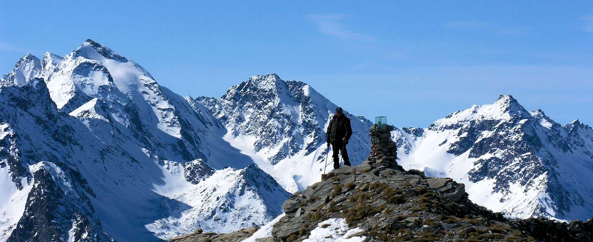
Located on the long ridge from Mont Paramont (3.301m) goes to the Northwest towards the Tete du Paramont (3.185m) and doubling it right on the same with a branch in North-northeast to the Chante-Colmet (2.352m), between the Vallons d'en Haut and Leseney, and another more to the West towards the Mont Lussé (3.055m), after Leseney Pass (2.835m). Besides the watershed splits again with a fork towards the north in the direction of the small subgroup of Becca Pugnenta (2.827m) above Lake Pietra Rossa, while the other, past the Hill of Comba Sorda (2.837m) reaches the two summits Mont Colmet (3.024m, 3.020m). From this last ridge declines in the North-northwest, which would separate the small Valley Arpy, by far the most important Valley of La Thuile, until, after attending Colle San Carlo, the promontory of the Testa d'Arpy (2.022m). Immediately to the South of this mountain, consists of three crests with the same number of sides, is the Comba des Ussellettes, just above the Refuge Albert Deffeyes (2.494m). Easily reached from the latter through the initial part of the path toward the Planaval Pass, which after abandons the right (Southeast) to reach the High Pass (2.860m), hence the short Cresta Southeast leads quickly and enough easily to the Summit; or with most direct route through the always Comba des Ussellettes and the rocky-grassy Southern Slope. Beautiful views over the whole glacial Rutor until the Grande Assaly and the nearby Mont Paramont, from here you can admire with its icy North Face and Northwest almost completely rocky.
Situata sulla lunga cresta che dal Mont Paramont (3.301 m) si dirige verso Nordovest in direzione della Tete du Paramont (3.185 m) e dalla medesima sdoppiandosi proprio sulla stessa con un ramo a Nord-nordest verso le Chante-Colmet (2.352 m), tra i Valloni d'en Haut e Leseney, ed un altro più ad Occidente verso il Mont Lussé (3.055 m), dopo il Passo di Leseney (2.835 m). Oltre lo spartiacque si divide nuovamente con una biforcazione verso Settentrione in direzione del piccolo Sottogruppo della Becca Pugnenta (2.827 m), sopra il Lago di Pietra Rossa, mentre l'altro, passato il Colle della Comba Sorda (2.837 m) raggiunge i due Vertici del Mont Colmet (3.024 m, 3.020 m). Da quest'ultimo la cresta declina a Nord-nordovest, atta a separare il piccolo Vallone di Arpy, dalla ben più importante Valle di La Thuile, fino a raggiungere, dopo il frequentato Colle San Carlo, il promontorio della Testa d’Arpy (2.022 m). Subito a Mezzogiorno di questa montagna, formata da tre creste con altrettanti versanti, si trova la Comba des Ussellettes, appena al di sopra del Rifugio Albert Deffeyes (2.494 m). Facilmente raggiungibile partendo da quest’ultimo tramite la parte iniziale del sentiero verso il Passo di Planaval, che poi si abbandona sulla destra (Sudest) per raggiungere il Passo Alto (2.860 m), donde la corta Cresta Sudest conduce in breve tempo ed abbastanza facilmente alla Sommità; oppure con percorso più diretto tramite sempre la Comba des Ussellettes ed il roccioso-erboso Versante Meridionale. Belle viste sull’intero arco glaciale del Rutor fino alla Grande Assaly e sul vicino Mont Paramont, che da qui si ammira con la sua Parete Nord ghiacciata e la Nordovest quasi completamente rocciosa. Grandi vedute anche verso il Monte Bianco.
First Ascents
- Firs on the Summit: Unknown.
- First ascent in winter: Unknown.
- E-NE Face: Osvaldo Cardellina, Alessandro Cardellina, Enzo Catani, Marco Cossard, Gigi Gadin and Giuseppe Lamazzi; (Jul 04th, 1993), in ascent from Lazey Hamlet, Joux, Val de Meitin Alpages, Montagna Alta-Val du Fond with crossing on Vallon d'en Haut.
- N-NE Edge: Osvaldo Cardellina and Alessandro Cardellina; (Jul 14th, 1995), in ascent from Joux Pasture with crossing on Walloon d'en Haut towards Chanté Colmet.
Getting There
BY CAR:- From Torino, Milano, etc: Motorway A5. Exit in Morgex.
- From Switzerland: through the Grand St. Bernard Tunnel or the homonym Pass.
- From France: through Mont Blanc Tunnel or Petit St. Bernard Pass.
- Aeroporto "Corrado Gex" Saint Christophe (Aosta).
Approach
From La Joux Hamlet: the ascent to the Rifugio Albert Deffeyes starts with the path-mule track n° 3/8. Pass a wooden bridge on the left and after almost immediately reach the first of the three spectacular waterfalls. Continue along the same path and leave Parchet Pasture (1.772m) to your right. The trail continues up large steps and in a short time passes by the second waterfall, which is not visible from the trail, but is marked by a sign and briefly after to reach the sign of the third. Continue on the steep path for another short time towards a subsequent crossroads. Take the well-marked left branch that leads to theshelter, while the right ramification, with number n° 8, leads to the two beautiful Lakes Bella Comba. Climb to the small saddle (2.130m) and then descend bending slightly to the right until Lac Glacier (2.143m). Cross the small wooden footstep over the lake outlet and, leaving the Alp of Glacier to your right, climb steeply along large hairpin bends to the plromontory where Refuge Albert Deffeyes is located at 2.494 meters, where better to make overnight (E; 2h'45/3h'15 from La Joux).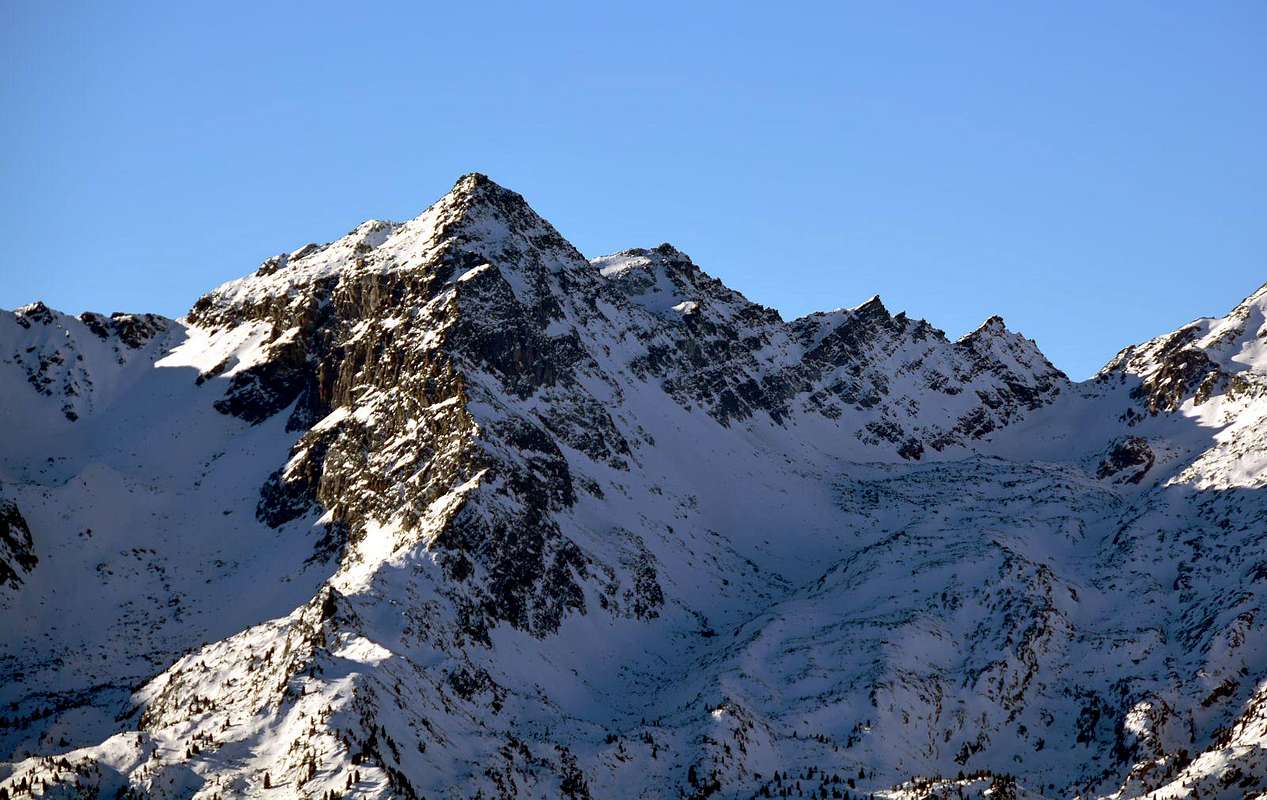
Da La Joux: iniziare la salita verso il Rifugio Albert Deffeyes sulla mulattiera segnalata con il n° 3/8; oltrepassato un ponte in legno sulla sinistra s'incontra la prima del tre spettacolari cascate. Proseguire lungo il sentiero e oltrepassare sulla destra l'Alpeggio di Parchet posto a destra (1.722 m), dopodiché proseguire sempre lungo il sentiero che da qui risale con gradoni e dopo circa un’ora si oltrepassa la Seconda delle Cascate, segnalata da un cartello non visibile dal sentiero principale e subito appresso si raggiunge la Terza Cascata. Continuare sul ripido sentiero per breve tempo sin dove lo stesso si divide; prendere a sinistra quello ben segnalato conducente al rifugio mentre l'altro con n° 8 conduce ai due bei Laghi di Bella Comba. Risalire sino alla sella 2.130 metri e da questa scendere leggermente a destra proseguendo fino al Lac Glacier (2.143 m). Oltrepassato il piccolo ponte in legno sopra l'emissario del lago ed abbandonato a Sud l'omonima alpe, riprendere a salire decisamente lungo ampli tornanti fino a raggiungere l'altipiano, ove è situato il Rifugio Albert Deffeyes (2.494 m), ove conviene pernottare (E; 2h'45/3h'15 da La Joux).
Route
From Refuge return briefly back up to take the trail n° 15, which left to right, the Alta Via n° 2 towards the Planaval Pass, runs diagonally to the bottom of the Northeast Combe des Ussellettes heading towards the Passo Alto (2.860m; High Pass) below its Southern Slope which is easy for a small grassy ramp littered with debris (E; 1h'20/1h'40 from the shelter). From the hill follow the short Crest Southeast formed by blocks and rocks very broken. After a first section just steeper, the same gradually loses in slope until reaching a hump with a small saddle not far from the Summit; some easy rocks leading to the final Top (EE/F/F +, on the edge of the ridge; 0h'45/1h'00 from Pas d'en Haut).
Dal Rifugio ritornare brevemente indietro fino a prendere il sentiero n° 15, che lasciando a destra quello dell'Alta Via n° 2 per il Passo di Planaval, percorre in diagonale a Nordest la parte inferiore della Combe des Ussellettes dirigendosi verso il Passo Alto (2.860 m) al di sotto del suo Versante Meridionale che facilmente si raggiunge per una piccola rampa erbosa cosparsa da detrito (E; 1h'20/1h'40 dal rifugio). Dal Colle seguire la breve Cresta Sudest formata da blocchi e rocce molto rotte. Dopo un primo tratto appena più ripido, la stessa perde progressivamente in pendenza fino a raggiungere una gobba, seguita da una selletta, non molto distante dalla Sommità; alcune facili roccette finali portano alla Vetta (EE/F/F+, sul filo di cresta; 0h'45/1h'00 dal Pas d'en Haut).
Difficulty
The routes can be rated as F/F+.Da escursionismo.
 |
 |
 |
 |
 |
Mountain Conditions
- You can get meteo information at the official site of the Regione Valle d'Aosta:
- Valle d'Aosta Meteo
- Meteo: You can find more weather information on the website 3B Meteo:
- La Thuile
Webcam
- WEBCAM on Aosta Valley:
- Webcam
Campings
Remember that free camping is forbidden (except for emergency reasons, over 2.500m, from darkness until dawn).
Books and Maps
BOOKS:
- "Guida delle Alpi Occidentali" di Giovanni Bobba e Luigi Vaccarone C.A.I. Sezione di Torino Volume II (parte II) 25-05-1896.
- "Guida dei Monti d'Italia Alpi Graie Centrali" di Alessandro Giorgetta - Club Alpino Italiano-Touring Club Italiano, 1985 (in Italian).
 |
 |
MAPS:
- Kompass "Massiccio del Monte Bianco Valle d'Aosta" sentieri e Rifugi Carta turistica 1:50.000.
- Kompass "Gran Paradiso Valle d'Aosta" sentieri e Rifugi Carta turistica 1:50.000.
- L'Escursionista "La Thuile-Piccolo San Bernardo" Carta dei sentieri (n° 2) 1:25.000.
- Enrico Editore Ivrea-Aosta "Gruppo del Gran Paradiso" 1:50.000.
- I.G.M. Istituto Geografico Militare Maps 1:25.000.
Important Information
- REGIONE AUTONOMA VALLE D'AOSTA the official site.
- FONDAZIONE MONTAGNA SICURA Villa Cameron, località Villard de la Palud n° 1 Courmayeur (AO) Tel: 39 0165 897602 - Fax: 39 0165 897647.
- COMPAGNIE DES GUIDES RUTOR Fraz. Entrèves tel/fax 0039.0165.885574 e-mail Guidealpine@lathuile.it
- A.I.NE.VA. (Associazione Interregionale Neve e Valanghe).
Useful Numbers
- Protezione Civile Valdostana località Aeroporto n° 7/A Saint Christophe (Ao) Tel. 0165-238222.
- Bollettino Valanghe Tel. 0165-776300.
- Bollettino Meteo Tel. 0165-44113.
- Unità Operativa di Soccorso Sanitario Tel. 118.