

Klenke - Jun 7, 2015 1:20 am - Hasn't voted
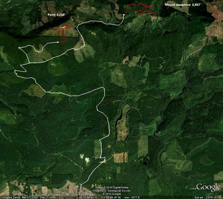
Driving accessed denied for JosephineYou can no longer drive from the public-access DNR side (south side of Josephine) as shown by your white line here. Today I encountered a sizable berm/ditch/slash pile where the road crosses the ridge east of Pt. 3210. From there you can walk (or better as a bike) 2-3 miles to the top with about 1300 ft of gain. I think the road block is fairly new (as in less than a year old).

beaudaddy85 - Jun 28, 2015 11:55 am - Hasn't voted
Road BlockThanks Klenke! I encountered the road block a few months ago also. I walked to the top with my 3 little kids. Thanks for the reminder and I'll change it in the write up.

gimpilator - Nov 29, 2015 10:21 am - Hasn't voted
Re: Road BlockI have some unfortunate news. The main access road is now gated here: (48.543185, -121.997431), right down in Hamilton. I'm kicking myself for not doing this peak earlier. It will be a long hike or road walk for now on.


Comments
Post a Comment