
|
|
Mountain/Rock |
|---|---|
|
|
48.66242°N / 122.97107°W |
|
|
San Juan |
|
|
Hiking |
|
|
Spring, Summer, Fall, Winter |
|
|
1519 ft / 463 m |
|
|
Overview
Turtleback Mountain
Turtleback Mountain is the highest point in the Turtleback Nature Preserve and the highest point on Orcas Island west of Mount Constitution. It also is important to peakbaggers by the fact that it has over 1400 feet of prominence. There are no views on the very summit but there are some views roughly 300 feet to the south of the summit. There are also views on nearby Ship Peak, a sub-peak to the south and Orcas Knob (Turtlehead) which is located to the north.
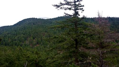
A view several feet south of the true summit
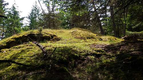
The true summit is located slightly off trail from the Raven Ridge Trail and requires an 0.2 mile walk up an abandon road to the summit rock. The summit rock is open but there are no views from it. The mossy summit rock is the true summit. I was not able to find a summit register there. There is also another high point with nearly the same height located slightly to the east views. Like the true summit there are no views on it as well.
Final summit knob
Getting There
VIA THE SOUTH TRAILHEAD: From the Orcas Ferry take Orcas Road roughly 2 miles to Deer Harbor Road. Stay on Deer Harbor Road for almost three miles as it traverses the coast. Turn on Wildrose Lane and you will then see the parking area immediately on the righthand side.
VIA THE NORTH TRAILHEAD: From the Orcas Ferry take Orcas Road roughly 2 miles to Deer Harbor Road. Make a left on Deer Harbor Road and then make a right onto Crow Valley Road. Take Crow Valley Road 4 miles north and the North Trailhead will be on your left.
Route

Map courtesy of the San Juan Land Bank Trust
Turtlehead Mountain can be reached by both the northern and the southern trailhead. From both trailhead it is roughly the same distance, 6 miles, and elevation gain which 1500 feet. From the North Trail you take it roughly 1.5 miles to the Center Loop Trail after heading up hill you make a left on the Raven Ridge and take it 1.1 miles to the height of land on the trail. There will be a very faded jeep road on your right. Take that until you see the summit rock 0.2 miles from the Raven Ridge Trail.

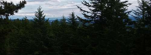
Views near neighboring Ship Peak
From the south trailhead take the South Trail up to the Lost Oaks Trail. Take the steep Lost Oaks Trail, which does have views along the way to the Ridge Trail. Take the Ridge Trail to Center Loop Trail. Here right on the Center Loop Trail and take it to the Raven Ridge Trail. Take that to the height of land where you will see a fading jeep road on you left hand side. Take that faded road all of the way to the summit mossy knob of Turtleback Mountain. On the way back take the extra time to back Ship Peak, which is a sub-peak of Turtleback Mountain. Though it is not very prominent it does have excellent views to the east towards Mount Constitution.
Red Tape
There is no red tape except that this is a day use park only.When to Climb
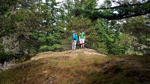
Turtleback Mountain Summit
Hiking can be done here at any time of the year. In winter monitor the temperatures and weather and be prepared if there has been snow in the lowlands recently.
Camping
There is no camping allowed on the Land Trust or Preserve.External Links
Turtleback Mountain Peakbagger Page
Information on Turtleback Mountain Conservation
Seattle Times Article on Turtleback Mountain