
|
|
Mountain/Rock |
|---|---|
|
|
33.73212°N / 112.07379°W |
|
|
Maricopa |
|
|
Hiking |
|
|
Spring, Fall, Winter |
|
|
2383 ft / 726 m |
|
|
Overview
Union Peak is a summit in North Phoenix accessed from the Desert Vista Trailhead.
It is part of a mountain oasis that has quickly been surrounded by suburbia. As part of the Sonoran Preserve, it is protected from development, allowing people to enjoy some wilderness within the encroaching development.
There is an excellent trail network in the area, leading to a few summits in the area, including Dixie Mountain 2,270’ to the north, and Union Peak 2,383’ to the south. Both can easily be done in a day.
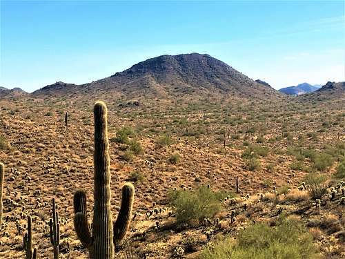 Union Peak from the north
 Union Peak from the South
Union Peak is the highest in the immediate area. It can be accessed via a windy trail leading 2.9 miles to the summit. The trail has multiple junctions, which makes it confusing. However, if you do some research beforehand, you can easily find the route on Google Earth™, or a topographic map.
Expect company in weekend mornings; particularly during the colder weather months. While not yet a well-known trailhead in the Phoenix area, there isn’t many parking spots at the trailhead itself.
The best time to hike here is during the colder weather months; particularly October through April.
Getting There
The Desert Vista Trailhead is at 1901 W Desert Vista Trail, Phoenix, AZ 85085. It is located not far off of I-17 at exit 219 for Jomax Road. It is easy to find with your phone or GPS navigation. The trailhead entrance is right past a series of condos. There is a Do Not Enter sign with warnings of tire damage. That just refers to the left lane. The right lane enters the road to the trailhead.
Route
From the trailhead, take the main Hawks Nest Trail for about a quarter mile, and then turn right downhill on the Desert Tortoise Trail. Continue for about a mile, and you will see a larger dirt trail. Take a right, and continue towards the summit. As noted above, the trail is windy and there are numerous connectors. The map at the trailhead isn’t very helpful. Maps I printed out were helpful.
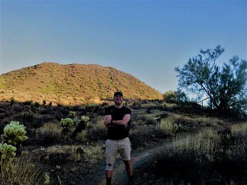 Looking up towards the summit
 Heading up the summit trail
It is a little under 2.9 miles to the summit gaining about 800’ with all the ups and downs. The hike isn’t very difficult. Most of the gain is in the last mile, but even that isn’t too bad. There are potentially shorter routes from the neighborhoods where the connector trails lead, but it isn’t necessarily worth it, since it isn’t too long a hike.