
|
|
Mountain/Rock |
|---|---|
|
|
47.47418°N / 121.33397°W |
|
|
King |
|
|
Hiking, Mountaineering, Scrambling |
|
|
Spring, Summer, Fall |
|
|
6230 ft / 1899 m |
|
|
Overview
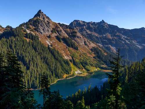
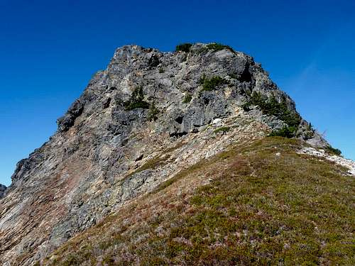
Huckleberry Mountain (left) and Joe Lake
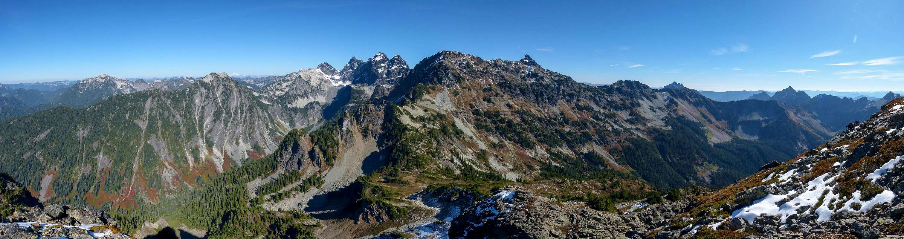
Huckleberry Mountain Summit View
Getting There
Most will access Huckleberry Mountain from the PCT Trailhead at Snoqualmie Pass. From the Seattle area take I-90 east and take exit 52 and turn left, heading under the freeway. Take your first right, following signs to the trailhead. A link to the trailhead on Google maps can be found here.Route Discussion - East Ridge Route described here
Hike the PCT, or take the Commonwealth basin shortcut (recommended, and meets up with the PCT saving about a mile) and hike up past the Kendall Katwalk, past Ridge Lake, around Alaska Mountain, and around Huckleberry mountain until you are pretty much due east from Huckleberry's summit. It is approximately 9-10 miles to this point where the routes begin. Due to the length of this trip many parties will do this in 2 or even 3 days with a camp at Ridge or Gravel Lake, or where ever else you'd like really. Fit parties on a mission can do this trip in a single day. This was how I did it and it was an 11 1/2 hour day for me and my partner. Be prepared for a long day if you choose this option.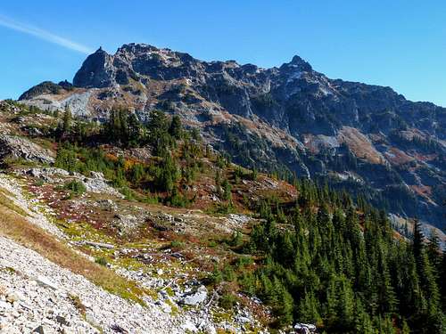 Chikamin Peak from the PCT | 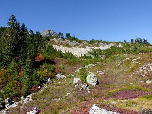 Start of the route to Huckleberry Mountain |
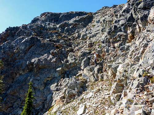
 East Ridge start - route goes along the right side linking the tree patches | 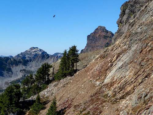 Huckleberry Mountain - Becky Route Start |
From the PCT due east from Huckleberry's summit take off cross country heading west up steep heather or talus until you get to the base of the climb where mellow terrain ends and the route gets rocky. Here the going gets rough. You have a couple options. The Becky route heads left at the base of the rocks and accesses a steep loose gully which leads to a notch and the final summit block. The east ridge route heads right up the ridge along class 3+ terrain. The Becky route seems to be losing favor and more climbers seen to be taking the east ridge route these days. The loose gully on the Becky route has turned some parties around due to rock fall danger. Since I took the east ridge route that is what I will describe here.
The route goes up the right side of the east ridge, basically going from tree patch to tree patch (the start of the route is pictured above on the lower left). Looking up at it, it is not really clear where the route goes. It's hard to piece together with your eyes. Once you start and are on route, the next move is fairly obvious though. Staying towards the right is the way to go at the beginning of the route. The scrambling is stiff class 3 with probably a few class 4 moves. This is certainly not a beginners scramble. Some parties do a running belay up this section, but others will be fine just scrambling. About half way up, maybe a little further, depart the ridge proper by heading left and doing a short traverse to reach a blocky ramp which you ascended to reach a high point right before the summit block. Descended about 20 feet to reach the notch and the start of the summit block. To get down to the notch you can either go straight down or go skiers right and do a class 3 traverse to reach a ramp that leads down to the notch. Both work fine.
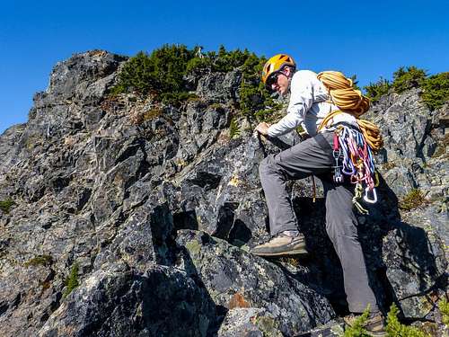 Starting up the East Ridge of Hucklebery Mountain | 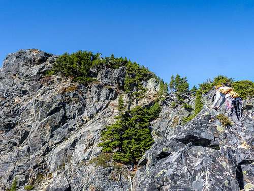 Scrambling Huckleberry's East Ridge |
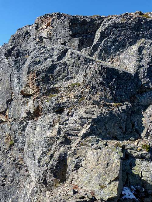
 The right to left ascending blocky ramp | 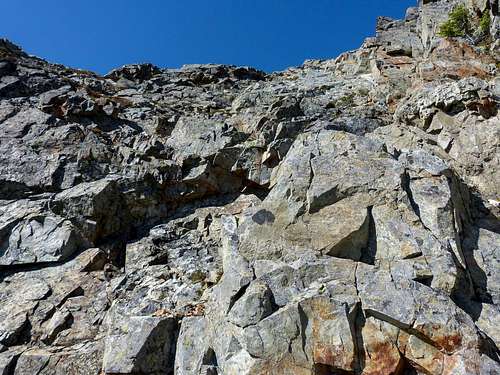 Accessing Huckleberry's Blocky Ramp |
The route on the summit block goes up the middle of the first photo below, up to the obvious slabby ramp. From there you can do a short class 5 crack, or follow the ramp climbers left to access the summit via exposed class 3/4. On my ascent we took the class 5 crack and only placed one piece of protection, a #1 camalot at the start of the class 5 crack. The rack we brought was total overkill, but better safe than sorry. We also brought a 60m rope and were happy with the choice. We considered a 30m, but it would have been insufficient for the rappel off the summit block. 60m is the way to go.
 Huckleberry Mountain's Summit Block | 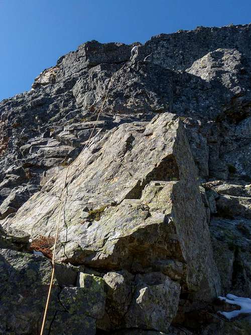 Climbing Huckleberry's Class 5 Crack |
Gear
Helmet, harness, ATC
60m rope
Small alpine rack (exact pro varies, we only used a #1 camalot)
There is a lot of variety in how much parties protect this route. If you are ultra conservative you could belay the entire east ridge. At the same time this, route has been free soloed but this is not recommended at all. In other words you're going to need a rope. Even very experienced scramblers prefer to rappel the summit block at the very least (there is another rap station on the east ridge as well). It is highly recommended to bring a 60m rope to rappel off the summit block.