
-
 3326 Hits
-
 82.48% Score
-
 15 Votes
|
|
Mountain/Rock |
|---|---|
|
|
37.90666°N / 107.46294°W |
|
|
Hindsdale |
|
|
Hiking |
|
|
Spring, Summer, Fall, Winter |
|
|
13454 ft / 4101 m |
|
|
Overview
 Campbell Creek Peak
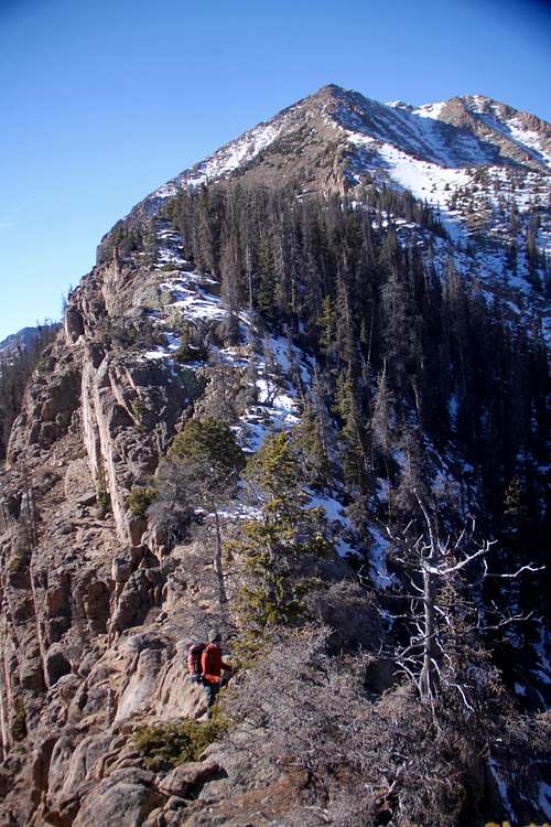 East Ridge
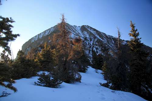
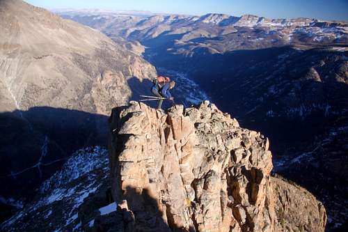
The peak offers several routes up, I chose an approach via east ridge, which is pretty aesthetic line, and you can avoid infamous San Juan scree. The trailhead is accessible in the winter. This route is per my opinion class 2+ with some exposure.
If you have time, stop by the Alfred Packer site. Alfred Packer is Colorado's famous cannibal. The site is located just about 1/4 mile past the intersection from 149 to Lake Cristobal.
Lake City is a nice historical town with restaurants and souvenir shops. They even have Packer Saloon, but no human meat is served.
Colorado Rank: 287 (tricentennial)
Line Parent: 13795
Nearby Peaks:
- Unnamed 13795 0.99 miles
- "Quarter Peak" 1.80 miles
- "Sundog" 2.20 miles
- Handies Peak 2.31 miles
- Sunshine Peak 2.31 miles
- Whitecross Mountain 2.34 miles
- American Peak 2.75 miles
- Half Peak 2.93 miles
- Redcloud Peak 3.26 miles
- "Cataract Peak" 3.41 miles
Getting There
From Lake City take Hwy. 149 south, 2.5 miles. Turn right on the road to Lake San Cristobal. Follow the paved road about 4 miles, then continue on dirt road for another 8.3 miles. Bear right at the fork - well signed road up Cinnamon Pass; and travel another 4.2 miles to the Silver Creek Trail if combining Campbell Creek Peak with Handies and Unnamed 13795 . Obviously, you can access this trailhead also if coming over Cinnamon Pass from the west - Silverton area. You do need a 4WD high clearance vehicle to reach this trailhead.
For East Ridge: Do not head up towards Cinnamon Pass, but turn left to a well signed Sherman site site (just before the road starts to steeply climb up). Continue on this road for about 1 mile and park at the Cataract Gulch TH - small paring lot and toilet. The dirt road up to Cataract Gulch is in a good condition and accessible by 2 WD vehicles.
The road is open year round up to Sherman townsite (only a ghost town currently with very few buildings left), the road up towards Cinnamon Pass is closed from November (conditions dependent, could be earlier) till late May.
Route
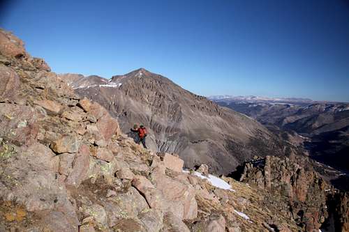
East Ridge: I explored this route when climbing Sherman Ice Fall, the ridge appeared aesthetic and guarded on its south side by steep cliffs. From the parking at Cataract Gulch trailhead, find the easiest path through forest towards the ridge. You will cross some dead trees, but nothing too hard. Once you gain the ridge, continue initially through forested parts of it - the ridge is wide here. I found an animal trail and follow it at places. You will find a few rock outcroppings, easy to negotiate. Continue higher up above the treeline. At some sections the ridge will be narrow and will require a few climbing moves, it gets steep, but views are spectacular. The summit is big, and is decorated with a small cairn and glass summit register.Traverse from Unnamed 13795: per reports requires a short section of climbing up to class 4-5, but most of the traversing is easy, the distance is about 1 mile. Watch out for the weather during the monsoon season.
From Campbell Creek Drainage from the north: there is no trail, but this provides another route through a basin and possibly connection with 13795.
 East Ridge
 | 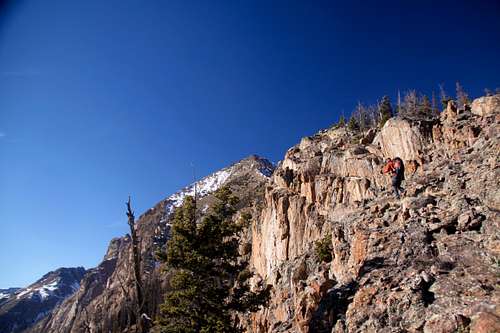 East Ridge
 |
 Rock outcroppings
 | 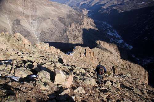 East ridge
 |
 East Ridge
 | 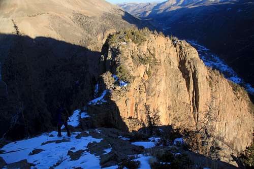 East Ridge
 |
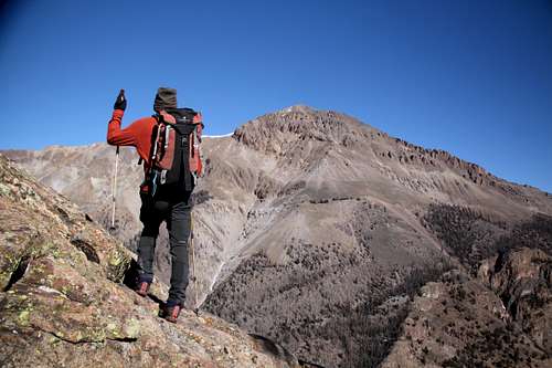
Summit Views
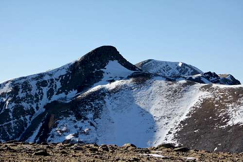 UN 13795 and Handies Peak
 | 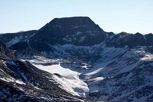 Half Peak
 |
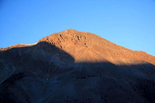 Sunshine Peak and shadow of Campbell Creek Peak
 | 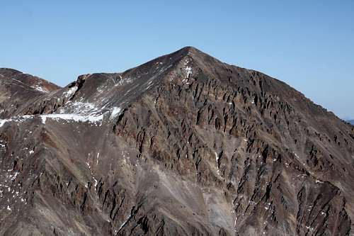 Sunshine Peak
 |
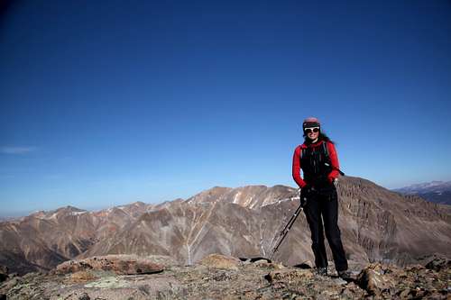 Summit of Campbell Creek Peak
 | 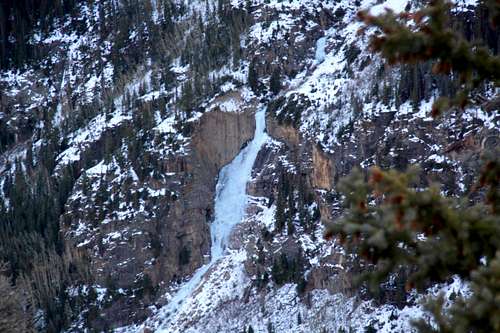 Sherman Ice Fall
 |