
|
|
Mountain/Rock |
|---|---|
|
|
48.95736°N / 119.78478°W |
|
|
Okanogan |
|
|
Hiking |
|
|
Spring, Summer, Fall |
|
|
7881 ft / 2402 m |
|
|
Overview
Chopaka Mountain is a high-elevation peak located in the northeastern edge of the Washington Cascades. Despite an elevation of 7881', the peak is accessible for much of the year due to being located in a typically drier part of the Cascades, as well as having a high starting elevation and relatively short distance for hiking purposes. The peak is non-technical. The mountain is perhaps most notable to peakbaggers due to its 1811' of clean topographic prominence, making Chopaka Mountain the 183rd-most prominent peak in Washington. The summit has 360-degree views, and if enough time allows there are 3-5 more peaks on the same ridge system that can be attempted.
The summit area of Chopaka Mountain is part of the Chopaka Mountain Natural Area Preserve, comprising 2764 acres that features a mountain goat population and various rare plants. The last surviving native herd of bighorn sheep in Washington was located on the peak until being hunted out during the 1920s; bighorn sheep have since been reintroduced to the region.
"Chopaka" has several possible meanings. According to the British Columbia Geographical Names Information System, Chopaka either originally meant an Okanagan hunter changed to stone by a coyote, or a maiden changed to stone. In recent decades, famed peakbagger Fred Beckey had claimed that Chopaka meant "high mountain."
Getting There
From Loomis, WA:
1) Drive approximately 2.0 miles north along Loomis-Oroville Road.
2) Turn left onto Toats-Coulee Road (Forest Road 39).
3) After 5.7 miles, veer right to remain on Toats Coulee Road (towards North Fork/Ninemile). After 2.0 miles further, veer right again (towards Cold Springs, Hurley Peak, Chopaka Mountain) onto Ninemile Creek Road.
4) Continue following Ninemile Creek Road for 6.5 miles until reaching the Cold Springs Trailhead (TH)/parking area.
IMPORTANT: Although most of the road system will be gravel, the driving approach is doable by most street-legal vehicles.
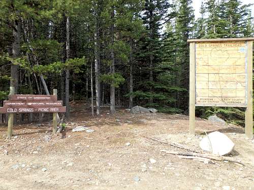
Cold Springs TH
Route
The shortest, most direct approach for Chopaka Mountain is via the South Ridge. Other approaches are possible, including via the Joe Mills/Hurley Peak Trails.
SOUTH RIDGE APPROACH: 1) From the Cold Springs TH, hike north towards Chopaka Mountain along the Joe Mills/Hurley Peak Jeep Trail. This is a dirt road turned into a trail for public use.
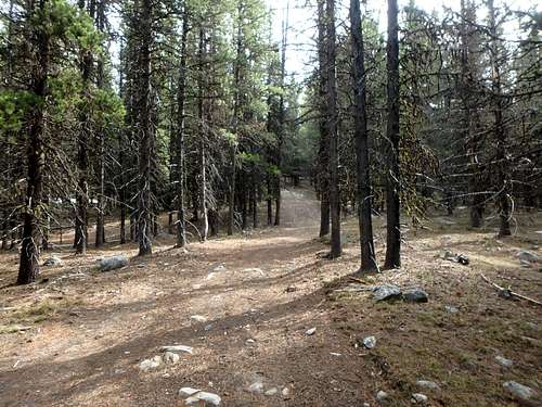
Jeep Trail (road-trail)
2) After approximately 0.25 miles, the road-trail bends left/west. Shortly after this trail-bend, head due north, off-trail.
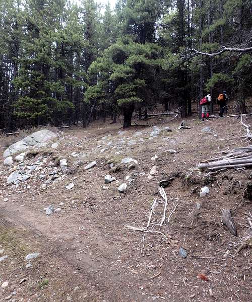
Leaving The Jeep Trail...
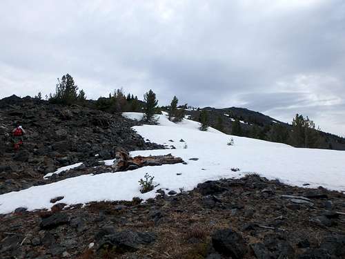
3) The first 0.4-0.5 miles of off-trail travel involves interweaving between pine forest and meadows. During Spring and early Summer, the meadows might be soggy and boggy. If wet meadows are encountered, just reroute around them and continue in a generally northward route.
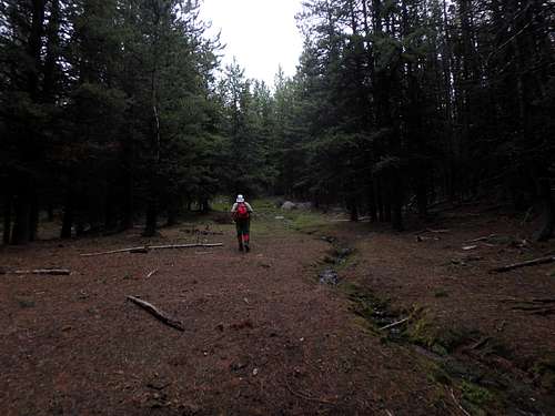
Chopaka Mountain Off-Trail
4) At approximately 7000'-7100', a fenceline is reached. There are multiple section of fenceline that are down or missing.
5) Beyond the fenceline, the south ridge becomes more open and rocky. Try to remain on the south ridge as it heads up just to the WSW of the true summit area.
Chopaka Mountain - South Ridge
TOTAL DISTANCE/ELEVATION GAIN: 1.7 miles (one-way) with approximately 1650' elevation gain.
Red Tape
The entire route is on State Land (Department of Natural Resources; DNR). Discover Pass required. At approximately 7000'-7100' along the South Ridge route, a fenceline will be crossed. This fenceline marks the boundary between the Loomis State Forest and the Chopaka Mountain Natural Area Preserve.
No special gear required during normal hiking months.
When to Climb
The optimum season is from mid-May through early November, when the Cold Springs Trailhead parking area is typically snow-free. Winter attempts can be made, although some of the open slopes might be prone to avalanche danger.
Camping
Cold Springs Campground is located within approximately 0.20 miles prior to the trailhead.
External Links