
|
|
Mountain/Rock |
|---|---|
|
|
47.43082°N / 121.66506°W |
|
|
KING |
|
|
Hiking |
|
|
Spring, Summer, Fall, Winter |
|
|
2600 ft / 792 m |
|
|
Overview
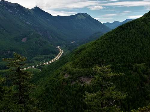
Web and Defiance from Hall Point
Ok I was not going to ever write about Hall Point but with this little rocky sub-peak gaining popularity by the minute so I decided to put it. I also wanted to distinguish it from its neighbor, Olallie Point. Hall Point only has about 40 feet of prominence but it is a well noted viewpoint on the Change Creek Trail and the amount of people going to this hike double every five years. I won't lie Hall Point, like it lower but much interesting objective northern neighbor, Ollalie Point has stunning views. They are similar but not quiet the same. One thing should be of note, Hall Point is just purely a hike. It is steeper in area but it is just a hike. Ollalie Point has some scrambling on it and can be very dicey in wet or icy conditions. Hall Point on the other hand is much better to do in winter or wet conditions.
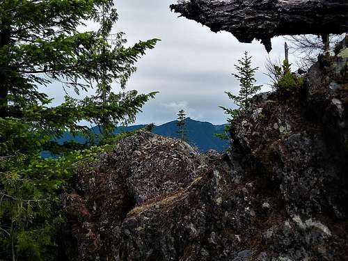
Looking toward Teneriffe
Getting There
VIA Exit 38 on I-90: Once off of the road head east for about one mile until you see a parking area for Olallie State Park on your left (1 mile). Park there and walk to the east 200 yards to the gated trailhead on your righthand side.
Route

Map to Olallie Point
Start from the trailhead of Zig Zag Trail and take it up to the John Wayne Trail, which was formally a railroad that cut through Snoqualmie Pass. You will notice it by the very large bridge that goes over Hall Creek. From there go over Hall Creek and go past a number of good sport climbing areas. From there you go over another small bridge. If you look carefully you will see the Change Creek Trail that goes up behind the bridge. Take this trail go up as it steeply switchbacks up a steep wooded slope. From there this trail will continue to rise up this slope. As you go higher there will be a number of good views off to the east. Continue on the trail as it steeply rises all the way to the saddle separating Hall Point and peak 4360 and Olallie Point. Veer left and head up roughly a half mile to another sign that points to Hall Point which will be to your left. Take that trail all the way to the Hall Point lookout. where you will enjoy good views to the east and north.
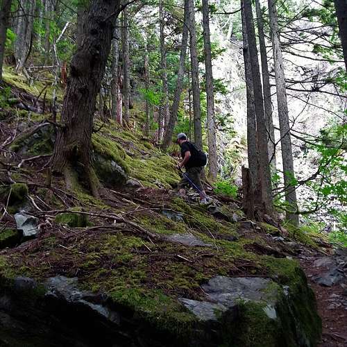
Heading up the Change Creek Trail
Red Tape
Discover Pass required which is $10 for the day or $30 for the year. Here is the link to the Discover Pass
When to Climb
If you are just going to Hall Point then you can do this hike during any time of the year. Nearby Ollalie Point should though be avoid if the conditions are wet and icy.
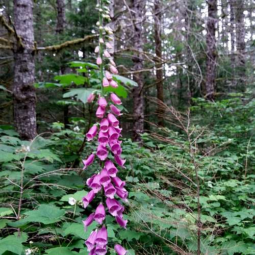
Summer flowers
Camping
No camping allowed at the park. Parking is only available from dusk until dawn.
External Links
Winter trip report to Hall Point