
-
 3006 Hits
-
 79.04% Score
-
 10 Votes
|
|
Mountain/Rock |
|---|---|
|
|
38.07166°N / 107.51482°W |
|
|
Hinsdale |
|
|
Hiking |
|
|
Spring, Summer, Fall |
|
|
13377 ft / 4077 m |
|
|
Overview
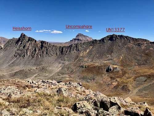 Heisshorn and UN 13377 as seen from UN 13206
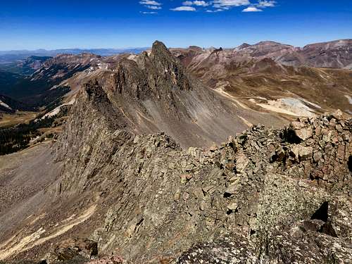 The ridge to Heisshorn from UN 13377
Class: 2
Parent Lineage: Heisshorn (the saddle between Heisshorn and UN 13377 is at 13,020 feet making it just over 300 feet and a ranked peak). As mentioned below in citation from Guide to Colorado Mountains, the ridge between UN 13377 and Heishorn looks difficult and very loose.
Wilderness: Uncompahgre
Guide to Colorado Mountains with Robert Ormes (sort of a Bible of Colorado Mountains) provides a brief description: "At the base of the Middle Fork basin are two more seldom visited thirteen's that give outstanding views of nearby Coxcomb and Wetterhorn. Leave the Middle Fork trail just as it turns east at about 11,600 and bee-line due south to reach the saddle between Peak 13,206 and Peak 13,337. Head right for the former, a very short walk-up. Or turn left for the taller one, passing one obstacle on the right. Don't attempt the ridge between Peak 13,377 and Heisshorn to the north because of several notches".
Nearby Mountains:
- Heisshorn 0.46 miles
- Unnamed 13206 0.58 miles
- Wetterhorn Peak 0.79 miles
- Unnamed 13300 C 1.09 miles
- Matterhorn Peak 1.12 miles
- Coxcomb Peak 1.18 miles
- Redcliff 1.46 miles
- El Punto 1.50 miles
- "Fortress Peak" 1.99 miles
- Unnamed 13340 A 2.12 miles
- Unnamed 13222 B 2.71 miles
- Uncompahgre 2.86 miles
- Broken Hill 3.07 miles
- Precipice Peak 3.46 miles
Getting There
Approach via Middle Fork of Cimarron: From Montrose follow US Highway 50 for approximately 20 miles to the intersection with County Road 858 (sign for Silver Jack Reservoir). Turn south on CR 858 and continue approximately 18.7 miles to Silver Jack Reservoir. Country ROad 858 becomes Forest Service Road # 858 at the forest boundary. Continue on FSR for approximately 1 mile to Forest Service Road # 861.1. It is signed for Middle Fork of the Cimarron. Turn right and follow this road for approximately 4.6 miles to the trailhead.
Route
 Heisshorn and UN 13377
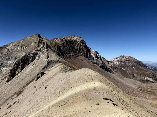 Cox Beak UN 13206 from the saddle to UN 13377
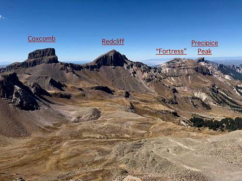
I chose to follow a signed Coxcomb Trail #132 since my objective was also Unnamed 13206, unofficially called "Cox Beak" (name obtained from the summit register). I took this trail all the way up to the saddle between Coxcomb and UN 13206. Coxcomb looked incredible from this view, like a long spire. There is a shorter way to go up to head directly for the saddle between UN 13377 and UN 13206 (I went this way down), but the Coxcomb trail was nicer and I did not mind exploring. The way up UN 13206 was easy, mostly grassy with some stable talus. From the summit of UN 13206 I continued on a very straightforward ridge to UN 13377. The descent was a little bit steep at places and going up 13377 was very easy, there was a small trail and it was easy to follow. One of the best views one can get in Cimmaron's along this hike.
I placed a small glass summit register on the summit of UN 13377. There was a small cairn. Descent: I came the same way down to the saddle with UN 13377 and followed mostly grassy slopes down to Middle Fork Basin where I intercepted the trail.
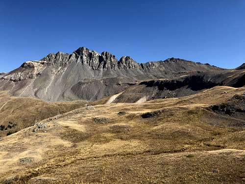
 Unnamed 13377
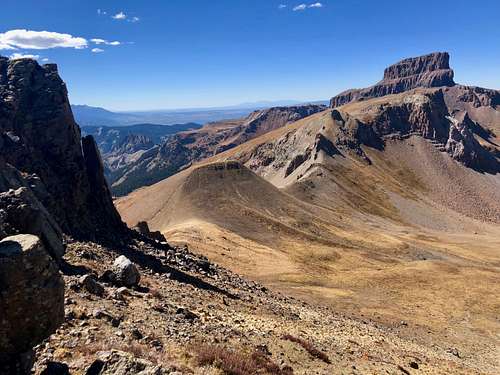 UN 13206 and Coxcomb from the hike up UN 13377
Red Tape
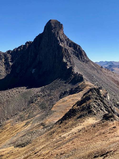 Wetterhorn Peak
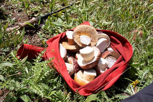 Mushroom picking
Uncompahgre Wilderness was designated in 1980. The name comes from a Ute Indian word with one of the translations being "dirty water". There are two fourteeners and at least twenty five 13,000 foot peaks.
Wilderness rules apply here: ALL VISITORS PROHIBITIONS:
1. Entering or being in the restricted area with more than 15 people per group, with a maximum combination of people and stock not to exceed 25 per group.2. Camping within one hundred (100) feet of any lake, stream, or National Forest System Trail. 3. Building, maintaining or using a fire, campfire, or wood-burning stove fire:a) within one hundred (100) feet of any lake, stream or National Forest System Trail.b) above treeline. 4. Storing equipment, personal property, or supplies for longer than seven (7) days. 5.Hitching, tethering, hobbling or otherwise confining a horse or other saddle or pack animal: 1) in violation of posted instructions, or 2) within 100 feet of all lakes, streams, and National Forest System Trails. 6. Possessing a dog which is not under control, or which is disturbing or damaging wildlife, people, or property. Note: the term "under control" is defined as the dog being leashed, and/or under direct verbal control by the dogs owner or handler at all times. 7. Shortcutting a switchback in a trail.
When to Climb
Best is June through October, early May will still have too much snow. If traveling in the winter, always check avalanche conditions and be prepared to spend the night out.Camping
Wilderness backpacking is excellent and highly recommended. The upper Middle Fork basin has plentiful beautiful camping spots.
You can sleep in the car right at the trailhead - comfortable flat parking.
There are also many campsites on your drive in along the Middle Fork road, great for car camping. Silverjack reservoir has a developed campground, which is a popular destination with locals. You have to pay fee to camp at Silver Jack.