|
|
Mountain/Rock |
|---|---|
|
|
34.54670°N / 112.5192°W |
|
|
Yavapai |
|
|
Hiking |
|
|
Spring, Summer, Fall, Winter |
|
|
6514 ft / 1985 m |
|
|

Overview
Thumb Butte is the most prominent features from downtown Prescott. The most direct trail to the summit is Thumb Butte Trail #33. This a moderately challenging route and just a 10 minutes drive from downtown Prescott but located in the Prescott National Forest. This well maintained trail and the elevation lets you take a glimpse at both forests and desert scenery. Along the trail, there is an interesting mix of plant life including cactus, Ponderosa pine, scrub oak, Manzanita, and Yucca Trees.
Getting There
To reach the trailhead, drive West through Prescott on Gurley Street. Gurley Street that turns into Thumb Butte Road. This street winds and climbs through a residential area then enters the National Forest. Once entering the forest a large and clearly marked parking area which can hold about 100 cars is to the right. Entrance to parking lot is on the far West end. As you drive toward the parking lot entrance, you will see the large trail sign on the left. Restrooms with running water are on the East end of the parking lot adjacent to the group camping site.
Route
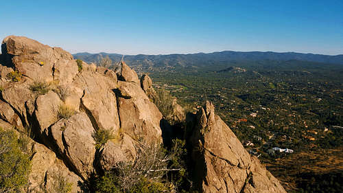
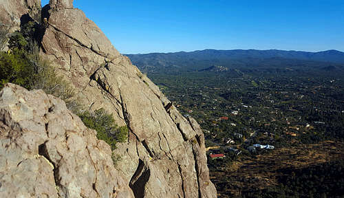
Trail 33 is an asphalt paved loop, slightly than 2 miles in length. Elevation at the trailhead is 5,730 feet according to my GPS. From the trailhead taking the left fork or going counter-clockwise on the loop, is the most direct route to the top of Thumb Butte. Along this wide and well-groomed trail are benches and rest areas as well as signs marking the nature trail. The trail has railing and block retaining walls in many sections of the trail. After 0.67 Mile and 570 feet of elevation gain, is the high point of the paved trail, From here is a non-paved use trail heading to the true summit of the butte. At the first the trail is very pronounced, but starts heading up the Butte in several locations. On the southwest side is a large pine tree with a rectangular trail marking scar visible from the use trail. This appeared to offer a class 3 (check your 6 on the way up) route to the summit, unfortunately this lead to the top of a large rock spur about 50 feet below the summit and separated from the summit by a 25 foot wide gap and 30 feet deep with to way to climb down. The route to summit is about 200 feet east of the tree and up with some class 3 scrambling. The view from the summit is spectacular, with the town of Prescott directly below and Granite Mountain, Mingus Mountain, and the Bradshaw Mountains in the distance.
Red Tape
Parking Fee is $5 per car or free with senior pass. To pay requires filling out on envelope at the self service pay kiosk at the center of the parking lot. Put the completed envelope with the $5 (or senior pass number) in the self service slot. Hang the receipt on your rear mirror. There is a gated entrance to the parking lot and it closes at the time posted on the gate. Hours are adjusted with the season. March to April, 7 a.m. to 7 p.m.; May to September, 6 a.m. to 8 p.m.; October, 7 a.m. to 5 p.m.
When to Climb
Depending upon snow, this is a 4 season climb.
Camping
No camping, day use only


