Mount Kissavos (1,978m) [“Ορος Κισσαβος”] also called “Ossa” is located on the Easter boundary of the Thessaly plain across the city of Larisa and separates it from the sea. It is the second highest among the Ultra summits of Thessaly, Olympus (2,917m) and Pileon (1,624m). It is separated from Olympus through the valley of Tempe while its slopes are considered to be a “Botanical Garden” due to the extensive vegetation and biodiversity, especially of trees. On its Northern slopes, lies the refuge of Kissavos.
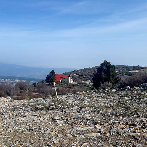
Panoramic view of Kissavos N-NW
The main summit cone of Kissavos forms a number of ravines and gorges in all directions as a result of the high levels of rainfall. The main village on the cone is Spilia (“Σπηλια”) on its Northwestern slopes, an area above which hunting for the plentiful deer, wild boar, and assorted birds is permitted. The mountain is designated as a Natura 2000 protected area with the majority of its Northern slopes being included due to the large and dense forests they are home to.
History & Area Guide
In Greek mythology the Aiolides were said to have attempted to stack Kissavos and Pileon seeking to scale Olympus and take Hera and Artemis, however, they were killed by Apollo before doing so. In antiquity the area was inhabited by the Magnets, the residents of Magnesia region, extending to modern day Pelion and Volos. They mainly worshiped Dimetra, Asklipios, and Hercules – the latter is said to have died on the mountain. The worship of Dimetra and Asklipios provides potential clues as the use of the land during ancient times, namely stationary agriculture and gathering (medicinal plants etc.).
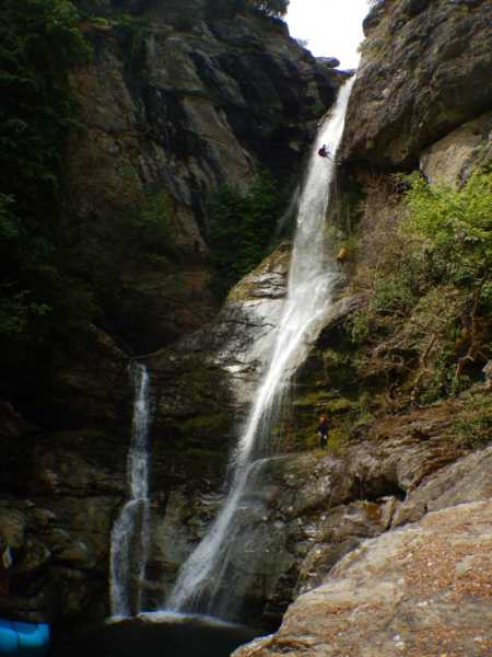
Waterfalls of Calypso
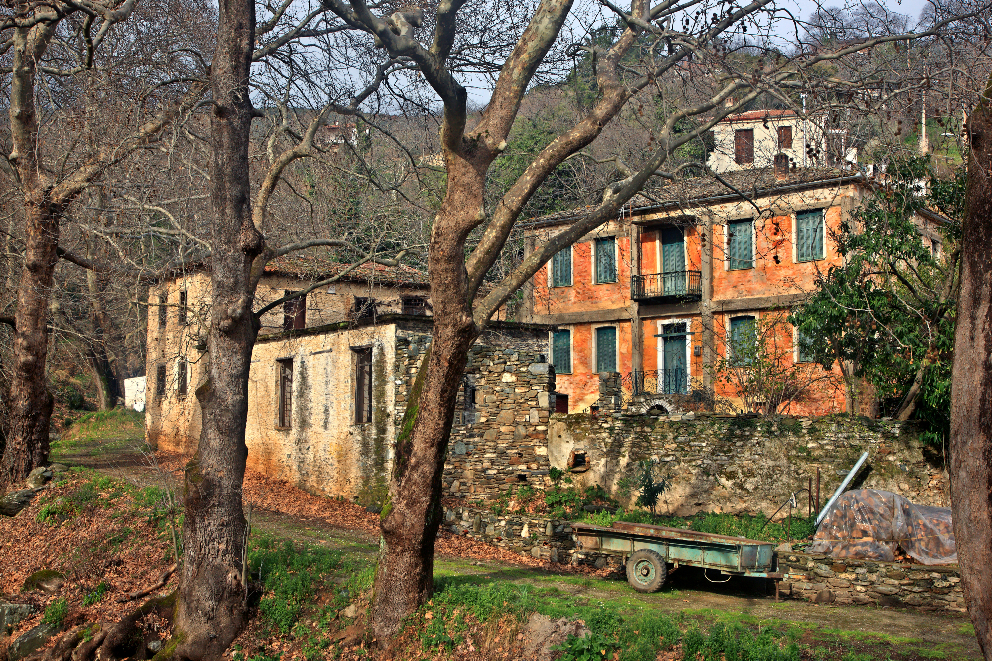
The houses of Metaksoxori
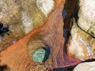
Spring of river by Spilia
The region has, alongside lush forests, a number of streams and rivers, all due to its rainy location – more so, its name “Kissavos” comes from the Serbian word for rain or wet, “kisha”, before the 11th century it was known as Ossa. Near the village of Karytsa (“Καρυτσα”) lies the gorge of Kalypso ("Φαραγι της Καλυψο"), where the 75m tall Kalypso Waterfalls make their way through the red-earth and rocks. During medieval times the area was developed with a number of fortifications, especially on the lower slopes, however, no large population centers ever developed.
From the 17th century onwards the slopes of Kissavos became home to silk farmers, while in the 19th century large settlements the Metaksoxoria (“Μεταξοχωρια”) dedicated to trade developed, especially in the South. Men from the villages worked in silk farming while women wove end-products. Their trade continued to grow by operating as processing villages for cotton from the Thessaly plain. The economic collapse of Ambelakia (“Αμπελακια”) enabled them to take over the export of red fabric to Western Europe. The 1870s were the peak for the region, when Swiss businessman Faver moved to Metaksoxori (“Μεταξοχωρι”) and introduced industrial methods both for farming and industry. Today the villages, factories and Faver’s mansion can be seen as part of the protected villages.
Getting There
The Mountain of Kissavos is easily accessible from both Athens and Thessaloniki through main highways. The road from Larisa interchange to the refuge is also well-paved and usually cleared, including from snow in the winter. The route to the refuge will take you through the village of Spilia.
The mountain has a number of different routes, including ones not crossing the summit of “Kostas Palamiotis”, where the underground chapel of Profitis Ilias lies.
Standard from Refuge (North Face)
The telecom tower and Northeast slopes from the ridge
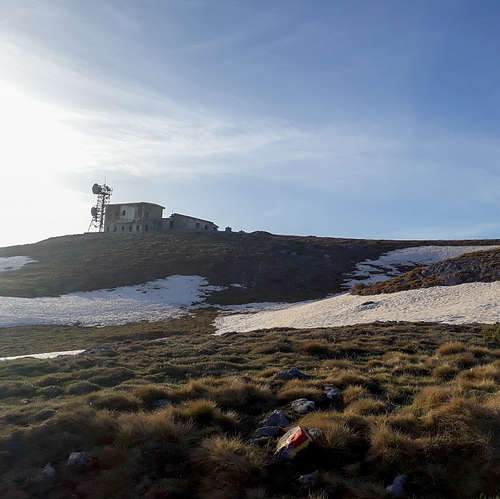
This is the standard and shortest route to the summit, using the North face and starting from the refuge it takes less than 2 hours and has mellow steepness. It has an elevation difference of about 500m and passes through the old telecommunications tower on the shoulder.
Starting from the refuge the trail heads South-Southeast on the alpine cone, the route goes through the remains of an old ski slope, with the old tow-bar equipment still visible (as of 2018). The trail continues along the access road here while orientating a bit more South, it will meet the road at the telecom tower at 1,817m on the shoulder. From here the trail follows the summit ridge which has a slight incline – it offers views across from Olympus, the Aegean Sea, and the Gulf of Magnesia. At the summit of “Kostas Palamiotis” one may access the underground chapel of Profitis Ilias when there is no snow-cover.
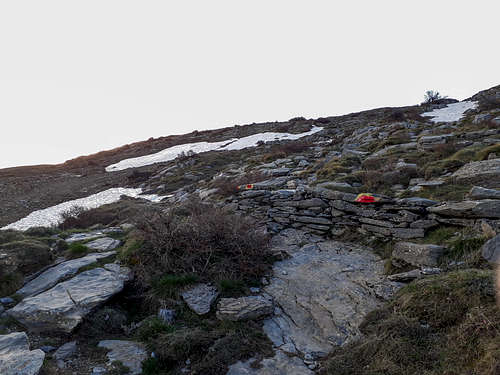
Trail markers near the refuge on an old wall
The Old Telecom station on the shoulder (1,815m)
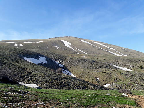
The North Face of Kissavos (1,978m)
When to Climb
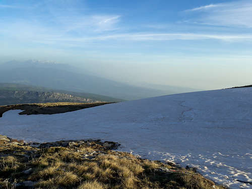
The last snow-patches of Kissavos (1,978m) on April 16th
The mountain is generally accessible year-round as the road to the refuge at 1,500m is maintained and cleared of debris and snow. For hikers it is best to attempt between mid-April and mid-June, since the mountain is very dry and gets quite hot. It is also good between late-October and early-December. Mountaineers and skiers would have the best time on the mountain in mid-January to mid-March - a stormy February is usually best.
Everyone, even if not summiting, should be warry of extreme weather, especially excessive rainfall which can make both hiking and driving difficult and/or dangerous.
Huts & Camping
The Kissavos Refuge
Kissavos refuge from the trail
At 1,500m on the Northern slopes of Kissavos, just where the sub-alpine conifer forest ends, and the bald summit cone starts, lies the Kissavos Refuge, a 60-bed hut which was first constructed in 1939. Its renovation into a modern hut took nearly 50 years, first proposed in the 60s, and finalized in the early 2000s. Even today it has no grid connection and is powered by a generator. It is operated by the National Mountaineering Club of Larisa (EOS Larisas). The refuge can potentially be requested to be opened through the club - it may be open over certain periods during the summer.
In Greece wild camping is generally permitted. The area of the cone is conductive to camping given good weather. However, the abundance of wildlife including large (and well accustomed to humans) hogs could be an issue. Outside the summit cone the rest of the area is rather remote and only recommended for those with experience. Due to the area being protected under Natura 2000, visitors must be careful when camping and mindful of waste and destruction of nature.
Natura 2000
The area of Kissavos is home to a Natura 2000 protected area (GR1420007), especially designated for the protection of birds, with more than 100 species being marked under the scheme. According to Natura, the area's habitats, marked by an abundance of all types of trees both in the North and South, offer ample protection and food for these bird species. There is lesser bio density at the area of Spilia, due to human habitation, but that does not keep away non-protected mammals such as Boars or ferrets. For those with relevant knowledge the area is of extreme botanical interest, most notably it is home to "pure beech forest which becomes mixed in the zone of 1000 - 1450 m with Fagus trees and fir-trees (Abies borisii-regis). There is also Abies cephallonica forest (the endemic Greek fir) covering a small part of the mountain".
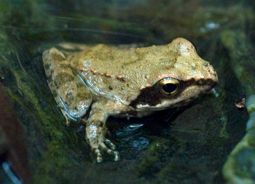
Local toad
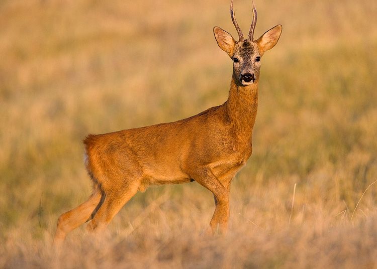
Capreolus capreolus
Gypus fulvus
On the North is the aesthetic forest of Kissavos which is home to very dense forests with extreme biodiversity with plants such as maples, oak, chestnut, and strawberries. In the streams of the area fire salamanders, Hermanns tortoise, and other amphibians live. Read more about the flora and fauna of the aesthetic forest on this blogpost by naturagraeca.
The area is also classified as an "Important area for Birds in Greece" (GR058) by the Hellenic Ornithologic Society (HOS) with many birds of interest making the mountain their home, at least temporarily. Their watchlist includes a number of vultures, some of which migratory, but note that the species of Eurasian Grifon Vulture has stopped reproducing locally. Eastern Imperial Eagles also migrated through the mountain.
Kissavos Marathon Race
Since 2017 locals have organized the annual Kissavos Marathon Race, a multi-route trail running race on the mountain complex, the race takes place in late April. It has a total of 3 races between 12k, 20km and 40km. The 40km trail, the "Kissavos Marathon Race" sees participants connecting a number of villages across the massif, as well as summiting the mountain - about half way. The total elevation difference for the 40km race is 2,470m; a valid time must not exceed 9 hours.
As we've previously mentioned, the location of the mountain directly next to the Aegean Sea yields larger than expected snowfalls and creates a localized climate prone to high winds and precipitation; this has made the mountain a location for skiing since the 1940s. This is compounded by the relative mellow incline of the North-facing slope which played host to a 300m tow lift back in 1977 whose remains can still be seen today on the way to the summit.
In recent years the mountain has been a location for backcountry skiing and snowboarding, especially its North aspect. It does, however, tend to present dangers to riders as its mellow slope is prone to human-triggered avalanches when the snow is weak or heating up extensively. In colder conditions towards early-March corn skiing on the North face can be exceptional.

 1969 Hits
 0% Score
 0 Votes