
-
 3078 Hits
-
 79.78% Score
-
 11 Votes
|
|
Mountain/Rock |
|---|---|
|
|
38.58790°N / 107.7996°W |
|
|
Montrose |
|
|
Hiking, Scrambling |
|
|
Spring, Summer, Fall, Winter |
|
|
7802 ft / 2378 m |
|
|
Overview
 Red Rocks
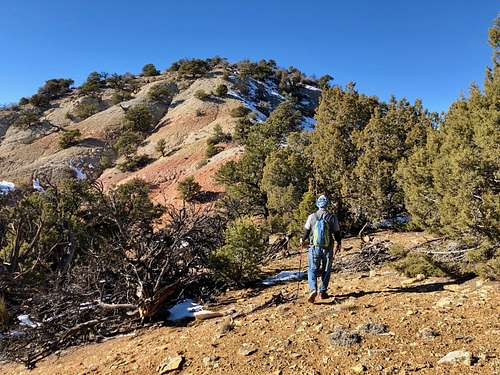 Subpeak of Red Rock Benchmark
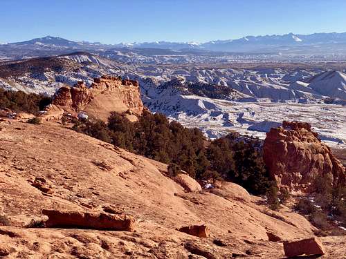
Expect solitude here. The hike starts in the Gunnison Gorge Conservation Area (dogs allowed) and eventually you enter Black Canyon of the Gunnison N.P. where the peak is located (normally dogs would not be allowed, but there are no signs and no trails here). The views deep into the canyon and river are rare, but the scenery if spectacular. You get to see the upper sections of the canyon and San Juan Mountains in the distance. The area has red sandstone formations and offers even some rock climbing (not officially established yet, but some of the towers were climbed). Lower down near the motorcycle trail are some established boulder problems.
I did not find route finding that hard, but I know the area. The hike starts initially on a motorcycle trail, which you leave after about 10-15 min and have to gain the ridge at a weakness in the cliffs - this is the crux of the hike. Class: 2 if you find the weakness, otherwise you can get onto a steep terrain requiring more scramble and climbing.Getting There
 Red Rock Benchmark
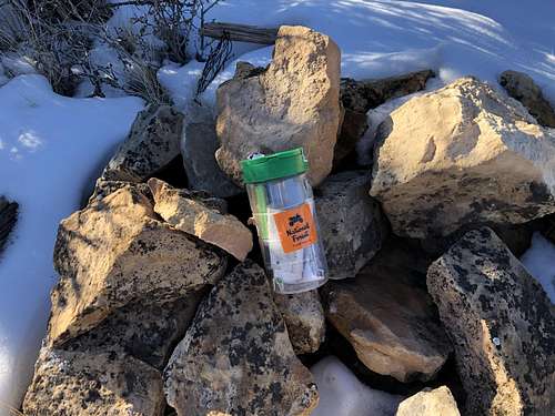 Summit cairn
Continue on 6350 Rd past the Flat Top turn off, enter Gunnison Gorge Recreation Area. The road is dirt, but usually well passable for all vehicles. It starts to wind through adobe hills. You will pass through a large parking area with a toilet and information kiosk - Elephant Skin Recreation Area. This area is popular with motorcycles.
Elephant Skin Road ascends west and northwest through the adobe hills until you reach a sharp curve where the road turns east. (see Gaia website below). Park here. Your hike follows a single track motorcycle trail from here.
Route
As any mountain there are many routes to reach the summit. I chose one which did not require much driving and appeared relatively short. I also chose to explore red rock formations on my descent and explore the area for potential of rock climbing.
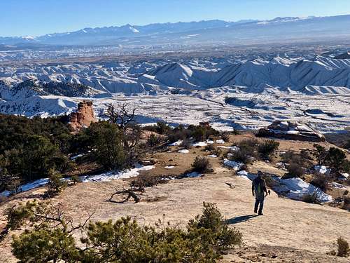
Follow the motorcycle trail up for about 10 to 15 min, you reach a small hill where the trail would start to drop down again. Look west and you should see a weakness in the granite cliffs. Find a path through this weakness. There are many cacti here and if you zigzag through the difficulty should not exceed class 2. There are a couple of cairns at the top of the cliff. From here follow a long ridge first to the sub peak of Red Rock Benchmark and then the main summit. There was a small cairn and plastic summit register. Enjoy the views!
Red Tape
Hiking, scrambling and getting into the area is free. Although it is located within boundaries of the Black Canyon National park, the approach is via dirt roads in Gunnison Gorge Recreation Area. There are no stations, rangers to check whether you paid national park entry fee.
When to Climb
Summer can be hot (start early). I did this peak in mid December and the weather was excellent. However, if there is a lot of snow, it may be difficult to drive in on nice dirt road. Any of the season should be suitable.
Camping
There is no official campsite, but you can car camp in a large parking lot with toilets - well marked as Elephant Skin Recreation Area.
You can set up a camp also on off road pull outs - the area along the road are adobe hills and it can be popular with motorcycles.