
|
|
Mountain/Rock |
|---|---|
|
|
33.66990°N / 111.1924°W |
|
|
Gila |
|
|
Hiking |
|
|
Spring, Fall, Winter |
|
|
3559 ft / 1085 m |
|
|
Overview
THE JUNE 2020 BUSH FIRE HAS LIKELY IMPACTED THIS TRAIL AND THAT MAY CAUSE LIMITATIONS DURING THE FALL 2020 and WINTER 2020/2021 HIKING SEASON.
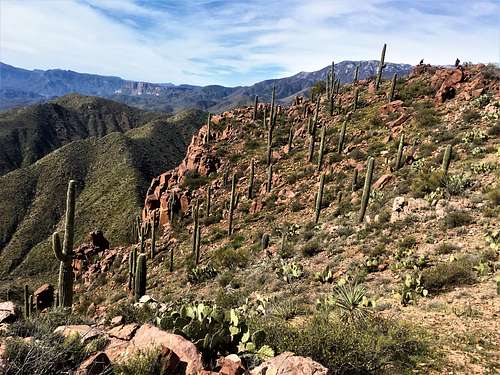
Nestled between Roosevelt Lake and the Browns Peak massif are the Vineyard summits. They are accessed from the Vineyard Trailhead via the Arizona Trail. While not lofty summits, their location makes them a spectacular destination. They are easy to reach from the Phoenix area. It is about 100 miles from downtown Phoenix, all on highway or major route ways. Not terribly far in order to beat the crowds and visit a beautiful place.
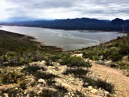 Roosevelt Lake from the Vineyard Trail
Vineyard Mountain is the lower summit at 3,458’, with 238’ of prominence. Vineyard Mountain West Peak is the higher summit at 3,559’, with 459’ of prominence. The summits themselves are not on the trail. Reaching them requires 300 yards of off-trail hiking. However, the off-trail sections are open enough to cause no issues. Vineyard Mountain is 100’ above the trail, and Vineyard Mountain West Peak is 200’ above the trail. There is lots of cactus on this hike. It’s easy to avoid while stunning to look at. There are numerous varieties, and some areas have a copious amount of them. Hiking both summits out and back from the trail requires only about 6 miles total. However, the trail continues past the summits and it would be easy to add on another 6 ½ miles by taking the trail to a dirt road, continuing up the trail up to 3,700’ where a road loops back down to the trail/road junction again. You can add a little distance, by hiking to the building on the north side of the trail. The building isn’t interesting. It just houses a couple water tanks. If you bushwhack ¾ miles off the trail, you can reach Point 3,423’, which has an unencumbered view of Roosevelt Lake. Although, Inspiration Point has a similar view and it is right off the Arizona Trail on the way to Vineyard Mountain.
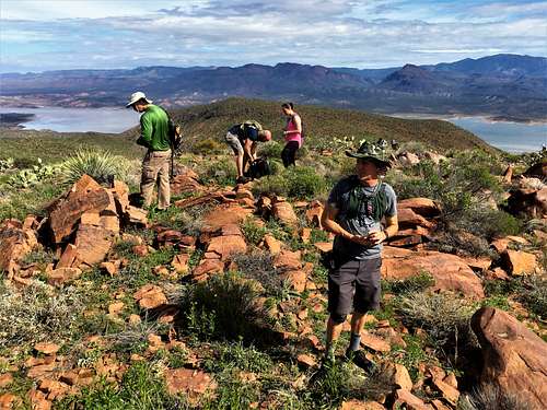 Group on Vineyard Mountain West Peak with view to Roosevelt Lake
The Vineyard Trail is best hiked between November and March. Avoid hiking above 70 degrees which is snake weather, since there are those couple of short sections off-trail to reach the summits. Since the area is outside of the urban heat center, you are most likely fine if it is 75-80 degrees in the valley.
Getting There
The primary route from the Phoenix metro area is via the 87 Beeline Highway. About 10 miles past Mount Ord Road is the turn off to Highway 188, which is taken for 30 miles to the trailhead. The Beeline Highway is the fastest route for nearly all Phoenix metro residents. Only those in East Gilbert and East Mesa might be able to take Highway 60 through Superior to reach the trailhead. Parking is just north of the bridge over the Salt River, so it is pretty easy to find.
Route
Cross the road and there is a little trail sign. The trail is easy to identify. The trail is very steep in the beginning. It climbs nearly 1,200 feet in the first mile and a half. From there, it levels out. You will pass a structure on the mountain. Stay past that and you come to a plateau about 100’ below the summit. Choose your path off the trail and head to the edge of the mountain, where the high point rises above the view down to the Salt River. There is a little jar with some paper and a pencil as a register. The path is fairly open, with plenty of space to avoid cactus.
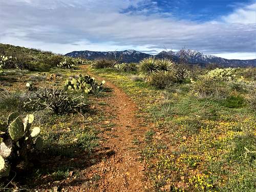 First view of the higher mountains from the trail
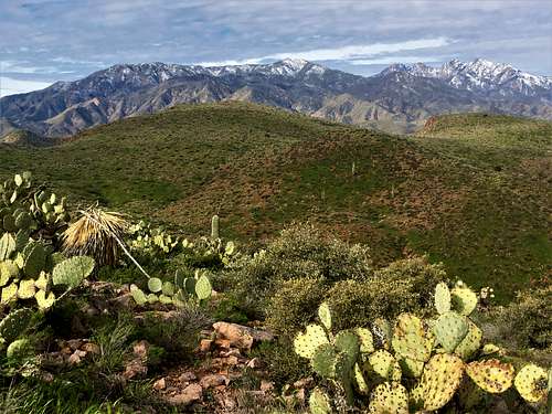 Vineyard Mountain West Peak from Vineyard Mountain
From Vineyard Mountain, the route to Vineyard Mountain West Peak is fairly obvious. The two summits are separated by about ¾ of a mile as the crow flies, but it takes another 1 ¼ miles by heading back to the Arizona Trail and then taking an off-shoot of the Arizona Trail to the west summit. The summit of Vineyard Mountain West Peak is far more obvious. It is a rocky area on a cliff edge. The views are tremendous!
 Summit rocks of Vineyard Mountain West Peak
The saddle between the summits is at 3,220’, making the West Peak feel pretty easy after the steep hike to get to Vineyard Mountain. The total elevation gain for just the two summits is 1,600’ with an additional 170’ or so on the return to the trailhead.
Red Tape
There is no red tape, but the trailhead has only enough spaces for about 20 cars
External Links