
-
 4289 Hits
-
 78.87% Score
-
 10 Votes
|
|
Mountain/Rock |
|---|---|
|
|
43.46117°N / 12.70432°E |
|
|
Hiking, Skiing |
|
|
Spring, Summer, Fall, Winter |
|
|
5581 ft / 1701 m |
|
|
Overview
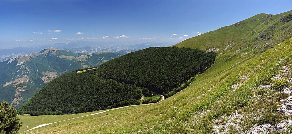
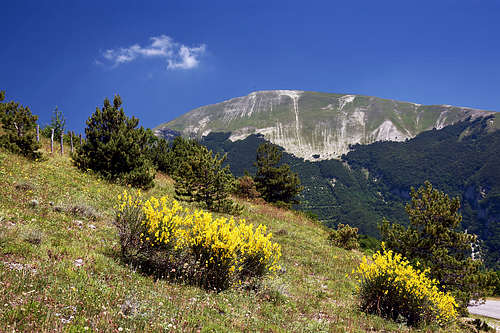
Catria is the highest summit in its small subgroup in the northernmost part of Appennino Centrale. So, those mountains are not very high (still, the highest between Monte Sibillini on the south and Appennino Bolognese on the north), but for sure they are very special. The highest summits are gentle and mostly grassy, but many lower parts are hiding surprises. As these mountains are built of quite pure limestone (Jurassic and Cretacious), karstification is very strong. Especially the massifs of Monte Cucco and Monte Nerone are known by abundance of deep and nice caves, but world famous is the Frasassi canyon and its karst caves. The most popular of them is visited annually by 350.000 tourists and its system is one of the longest in Europe. Due to all characteristics, part of the massif is protected as Parco Regionale del Monte Cucco.
Monte Catria is a mountain for hikers and in winter and spring for sure also for tour skiers. On the northern slopes of the neighbouring Monte Acuto, 1669 m, there are also ordinary ski terrains. Due to big altitude gain, mountain bike tours can be quite demanding, but nice.
Panorama
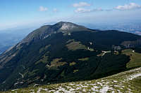
As nearby there are no higher mountains, the panorama is very broad - in a clear day from Adriatic sea on one side to the central Italy on other. And of course along the chain of Appennines, of whom the nearest mountains are nicely seen.
Getting There
Between the summit of Monte Catria and Monte Acuto NW of it, there's a high saddle which from the SW side a good, asphalted road reaches. The saddle is called Madonna degli Scout, 1368 m (in Google Maps: Crocevia Catria, 43.469876, 12.697532), and the road reaches is from the villages Chiaserna and Cantiano.
From Madonna degli Scout saddle the mountain road continues around the whole neighbouring mountain of Monte Acuto, or, if you wish, it comes on the saddle from Frontone on the other side of the massif. But that's not a wise approach for Monte Catria.
NE of the summit of Monte Catria there's a big, picturesque monastery, called Monastero di Fonte Avellana, 689 m. If you visit it, you may perhaps find that the macadam road from there to Madonna degli Scout saddle is also passable and allowed. So that could be the second way of approach.
From other sides (S and SE) mountain roads are also reaching up the slopes of Catria, but I have no information how high you would be able to drive there.
If you are really a bit lazy, Madonna degli Scout saddle may even not be the point where you stop driving up on Monte Catria. A good macadam road goes up some 2 km more, to the parking place by Rifugio della Vernosa, 1480 m. From there it's really only good 30 minutes to the top.
The Usual Ascent
Show a bigger map
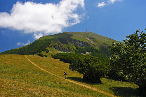

From Madonna degli Scout saddle you follow the marks towards the SE (the road goes left around the ridge). Through a short forrest stretch the marked path soon reaches the meadows below the Vernosa hut. I guess animals are usually kept there. From the hut you continue left (eastwards) by a rugged cart-road and then through a nice forrest towards the SE. When you're out, the path simply keeps right and up. You soon reach a shallow valley below the summit and then the highest point on the left.
The route is all the times easy, on the Swiss Hiking Scale it would be graded T2/T1 (most of it T1). 1 h from Madonna degli Scout saddle.
In winter or spring this can for sure be a nice ski tour. Only the road to Madonna degli Scout is of course not cleaned in those months.
The bike & hike round tour would have these characteristics: Chiaserna, 470 m, - biking up - Madonna degli Scout saddle, 1368 m, - (biking up or hiking) - Rifugio della Vernosa, 1480 m, - hiking up - Monte Catria, 1701 m, - hiking down - Rifugio della Vernosa, 1480 m, - (biking or hiking down) - Madonna degli Scout saddle, 1368 m, - biking down - Monastero di Fonte Avellana, 689 m, - biking down - Avellana valley, 500 m, - biking up - saddle 650 m - biking down - Isola Fossara, 450 m, - biking up - saddle, 650 m, - biking down - Chiaserna, 470 m. So, some 1600 m of ups and the same down.
When To Ascend
Monte Catria can be ascended any time of a year. In winter conditions the ascent can be more enduring, but nowhere demanding.
Mountain Huts
You really don't need them if you have a car. The Vernosa hut is just north below the summit and it's probably a private one. In June 25th, 2019 nobody was there, but on the mountain there were cows and horses. On the southern side of the mountain there are two more huts, but in lower regions.