
-
 2229 Hits
-
 78.27% Score
-
 9 Votes
|
|
Mountain/Rock |
|---|---|
|
|
37.82880°N / 107.8129°W |
|
|
San Miguel |
|
|
Hiking, Mountaineering |
|
|
Spring, Summer, Fall, Winter |
|
|
13528 ft / 4123 m |
|
|
Overview
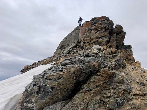 Summit of V 3
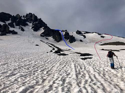 V 3
V 3Colorado Rank: 238
Parent Lineage: Ulysses Grant
Class: 2+/3 (lots of loose scree in the summer)
Nearby Peaks:
- US Grant 0.43 miles
- V 4 0.56 miles
- V 2 1.15 miles
- South Lookout Peak 1.36 miles
- Yellow Mountain South 1.36 miles
- Pilot Knob A 1.47 miles
- Golden Horn 1.79 miles
- Vermilion Peak 2.21 miles
- Fuller Peak 2.32 miles
- V 5 2.35 miles
- Beattie Peak 2.75 miles
- Lookout Peak 2.91 miles
Getting There
From Telluride travel west on Highway 145 for approximately 3 miles and turn south on Highway 145 south. Continue south for 6.5 miles to the intersection with Forest Service road 630, Ophir Pass Road. Travel east on this road through the town of Ophir for 3.5 miles to a gated road on the south side of the road. The trail begins beyond the gate.
Swamp Canyon - the trail climbs to the top of Swamp Canyon. It can take you over the pass to Island Lake and Ice Lake Basin area. The trail is not well marked. Remember you have to turn off this trail for climbing V 3.
Route
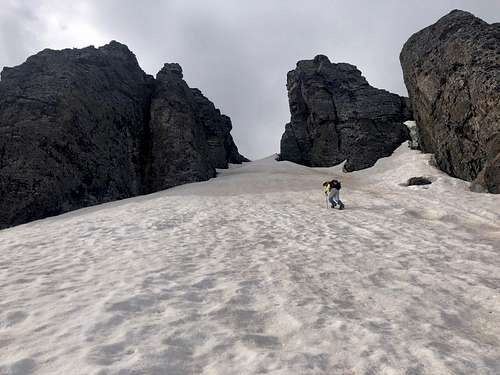 Couloir up V 3
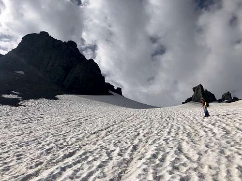 V 3
V 3Red Tape
The peak is located in Uncompahgre National Forest. There are no fees to drive Ophir Pass Road, park and hike.
When to Climb
I think early summer is the best time to climb when the scree slopes are still covered with snow. We encountered wonderful conditions and climbed a couloir leading high up to the access gully for the summit.
Later in the summer expect to deal with infamous San Juan screen.
Winter can be dangerous since snow if often unstable and there is a high avalanche danger.
Camping
There is camping at the turn off for Swamp Canyon, primitive and undeveloped. The closest developed campground would be Sunshine campground. Click here for more information.