
-
 11810 Hits
-
 78.27% Score
-
 9 Votes
|
|
Mountain/Rock |
|---|---|
|
|
43.02746°N / 89.85376°W |
|
|
Iowa |
|
|
Hiking |
|
|
1719 ft / 524 m |
|
|
Overview
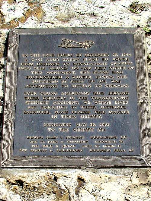
One of the most significant peaks in Wisconsin is Blue Mound (the west summit), located at Blue Mound State Park in Iowa County about 35 miles west of Interstate 90. At 1,719 feet, it is the highest summit in the southern half of Wisconsin. It dwarfs the east summit by approximately 230 feet. More importantly, Blue Mound is the point of highest prominence in the state. Lists of John places Blue Mound as number one for prominence, with 932 feet of rise and number thirteen overall for elevation. Because of the gentle slope and thick forests of the Blue Mound, the visual significance of the prominence can be easily lost. However, when one views the summit from several miles north or south, the significance of the prominence becomes more obvious.
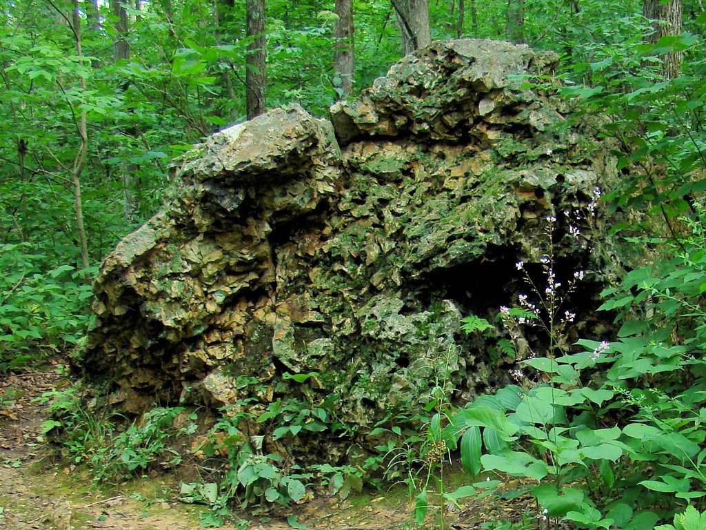
Though much of Wisconsin was sculpted by glaciers, Blue Mound was not, which places it in the “Driftless Area” of the region, because it is devoid of accumulated glacial rock. Blue Mound is a monadnock that has a 100-foot thick layer of Niagara dolomite limestone and shale. However, there is less exposed rock here than one will find at nearby Devil’s Lake or even some summits in other counties.
The forest of Blue Mound is comprised of red oak, white oak, bur oak, sugar maple, basswood, hickory, black cherry, black walnut, birch, jack pines and red pines. The mixture of hardwood trees make for stunning color in the autumn. Wildlife commonly seen on the mound includes deer, squirrels, fox, opossums, weasels, skunks, rabbits, bats, woodchucks, fishers, raccoons and coyotes. Long ago, black bears, timber wolves, mountain lions, elk, bobcats, lynx and bison were commonly seen here. Now, on extremely rare occasions a stray wolf or bear might be seen in the area. But the abundance of visitors to the state park tends to keep these animals away.


Blue Mound State Park
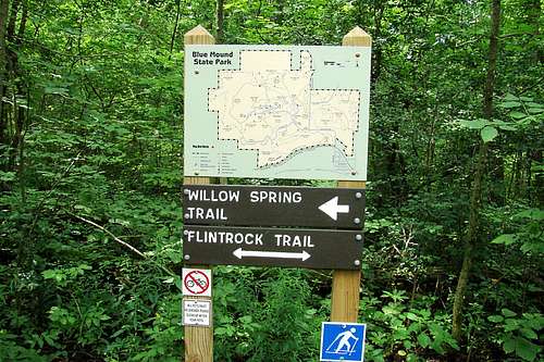
Blue Mound State Park is one of the most visited parks in the state. It has two observations towers in the summit area – the west tower and the east tower. Both towers offer great views of the region, though the height of the mature trees in the summit area can still obscure some of the view. Nevertheless, on a clear day one can see the Baraboo Range to the north, Madison to the east and several villages in various directions. The 1,153 acre park has plenty of camping and picnicking sites, plus a swimming pool and a rustic cabin for people with disabilities. A variety of trails brings the total trail distance to over 20 miles. Forgotten camping supplies can be obtained at nearby towns like Blue Mounds or Mount Horeb.
Getting There
Blue Mound State Park is north of the town of Blue Mounds, around 25 miles west of Madison on Highways 18/151. Turn north on County Highway F and then turn left on County Highway ID into Blue Mounds. From Blue Mounds, just follow the many signs to Blue Mounds State Park. If you choose to hike to the summit from town or from the Military Ridge Trail, you will need to park at Mounds View Park or some other location near the trail and hike from there. Otherwise, there are a variety of trail options at various locations in the state park to choose from for your visit there.
Route Options
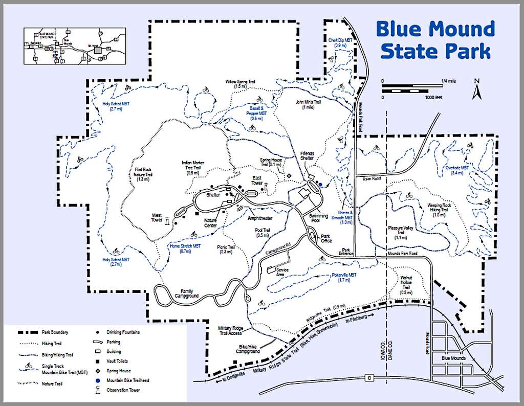
Blue Mound is kind of like Rib Mountain, the second-most prominent summit in the state, in that each has a large summit area with many trails, parking and visitors facilities. In most cases, hikers often start from one of the summit trailheads and hike down and back on one of many loops, or combinations of loops. The Blue Mound State Park map shows the variety available to hikers. For those who prefer an actual ascent, there are several options.
One of the options for hiking up to the summit begins on the Military Ridge Trail, which is located on the south edge of the state park. It runs 40 miles from Verona to Dodgeville on an old railroad bed that followed an 1855 military route. A free trail map is available for download by clicking here: Military Ridge Trail Map This trail, which crosses the Ice Age Trail, could theoretically be combined with many other Wisconsin trails to hike to Blue Mound from elsewhere in the state. The park access trail to the summit area is about 0.7 mile west of Mounds Park Road on the Military Ridge Trail. By using this trail combined with the Picnic Trail and some park roads, it is less than a mile from the Military Ridge trail to the summit area.
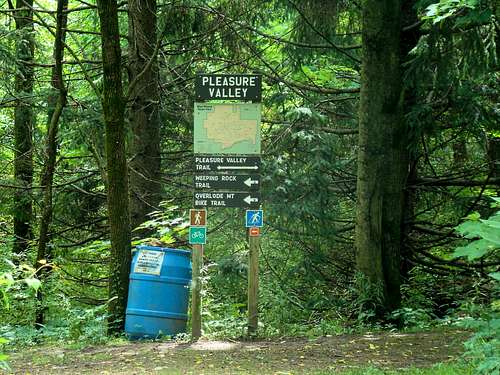
Perhaps the most scenic trail route to the summit would be to park near the state park entrance and go north on the trail that crosses the road just east of that entrance. In a very short distance, the trail intersects with Pleasure Valley Trail. Go east on that trail and follow it until you arrive at the Weeping Rock Trail. Follow the Weeping Rock Trail for some of the best views in the park. It will eventually intersect again with the Pleasure Valley Trail, which will lead you to a trailhead on the Mounds Park Road. Cross the road and continue your hike on the connecting trail up to the Indian Marker Tree Trail. That trail will take you up to the summit area near the East Lookout Tower.
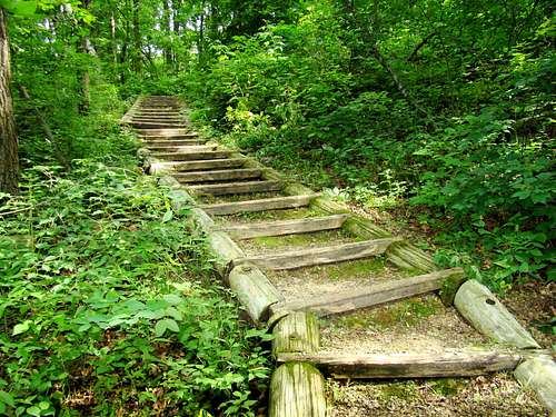
If you prefer to drive to the summit area to begin your hiking explorations, you will find several trails that will take you through beautiful forest past small springs, streams, rock outcroppings and boulders on trails that range from narrow and rugged, to wider and smoother trails (that double as winter ski routes). The trails can range from easy to a little bit strenuous. For a downloadable park and trail map, click here:
A number of biking trails are also available at the state park and are shown on the official trail map.
Red Tape

Park fees apply for some services at Blue Mound State Park. A vehicle admission fee is required. For more information, click here:
Camping fees and regulations in the Wisconsin State Park System apply at this park. For more information, click here:
For hunters, state licenses or permits are required in-season.
When to Hike
Blue Mound State Park is one of the more popular state parks in Wisconsin, meaning summer weekends can be crowded at times. This could be a factor in your planning if you dislike crowded conditions. Special events are occasionally held at the state park, so it pays to check ahead.
Also, it is best to avoid hiking there during hunting seasons. For more details on those seasons, check out this link: Blue Mound Hunting Guide
Summer lightning storms and winter blizzards, of course, are other times to avoid a visit to the park. To check on the latest forecast and conditions, click on this link:
Camping

Blue Mound State Park has 77 campsites, most of which are open all year. That includes several handicap accessible sites. There is no vehicle access to the campsites. There is also a rustic cabin available for people with disabilities. Flush toilets and showers are located by the campground. Campfires are allowed in the special fire rings, but all firewood must be purchased from the park office. Reservations can be made by phone at 888-947-2757.
There is another campground located next to Blue Mound. For up-to-date information, check out their site by clicking here:
For Additional Information...
Blue Mound State Park Phone: (608) 437-5711
Mount Horeb, Wisconsin Services