
-
 28962 Hits
-
 81.84% Score
-
 14 Votes
|
|
Mountain/Rock |
|---|---|
|
|
44.83312°N / 91.50715°W |
|
|
Eau Claire |
|
|
Hiking, Toprope, Scrambling |
|
|
975 ft / 297 m |
|
|
Overview
 A Curious Deer on Mt. Simon
There are three named summits within the small metro area around Eau Claire, Wisconsin. However, the only one with any hiking trails or rock climbing opportunities is Mt. Simon, located on the northwest edge of Mt. Simon Park. On almost any given day, young locals will go there for hiking, rock scrambling, rock-climbing, cliff-jumping into the Chippewa River, geocaching, fishing and snowshoeing, depending of course on what the weather allows for their interests. The park adjacent to Mt. Simon is also a favorite for Frisbee golfers. Kayakers and canoers on the Chippewa River have their portage point here also.
 A South Side Trail on Mt. Simon
According to Lists of John, Mt. Simon has 100 feet of prominence. The Chippewa River flows around the base of Mt. Simon on three sides, making it kind of a peninsula. Long ago, the summit was around 200 feet above the river, but with the construction of the Dells Dam and much deeper water now, that difference is currently about 180 feet. That dam also keeps the river in check from eroding the land connection on the south side away and actually turning it into an island. The Dells Dam was built around 1880, during the height of the rush to harvest timber from the vast forests of northern Wisconsin.
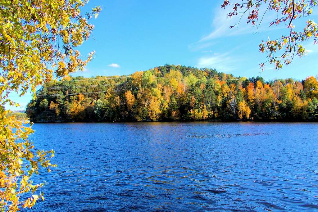
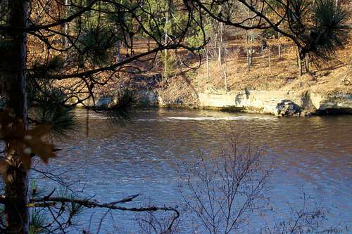 Upper Edge of the Former Dells on the Chippewa River
Before 1880, the Chippewa River narrowed into dells along the base of Mt. Simon between high sandstone walls, the tops of which can still be seen above much of the lake shoreline. It was recognized the rocky walls and rocky riverbed, through which rapids flowed, would be a natural place for a secure dam to store water for a flume the logging industry felt was needed to run their logs to Half Moon Lake for processing. The dells were very beautiful before all the industrial development along the river. To some, it seems like a shame that the dam put it all underwater into a small lake that is now called Dells Pond.
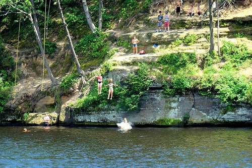 Mt. Simon Cliff Jumpers
Earlier in the history of the area around Mt. Simon, the Ojibwe and Sioux Native American tribes battled often over who would control the region. The area had great value to them for its resources, especially buffalo and other game. English travelers first came through the area in 1767. Then in 1784, two mixed-race fur traders built a settlement there. French fur traders often wintered in this area too. However, the first permanent settlement by people of European descent happened in 1845.
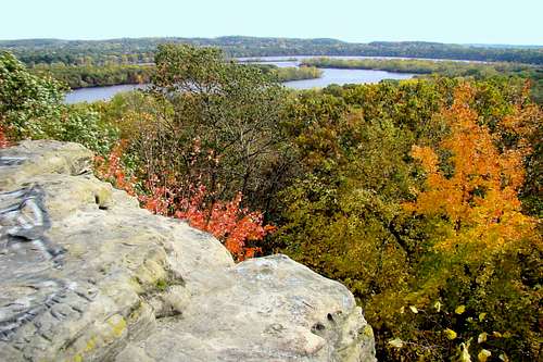 View Southeast from the Summit
The Mt. Simon escarpment is a geological point of interest, for it provides the basis for the name “Mt. Simon Sandstone”, a type which is found not only in Wisconsin, but also Minnesota, Illinois, Michigan, Ohio and Kentucky. The Mt. Simon Sandstone overlies pre-Cambrian granite and underlies Eau Claire Sandstone, a shaly type of sandstone. The cap of Eau Claire Sandstone at Mt. Simon is about ten feet thick and is harder and more erosion-resistant than the Mt. Simon Sandstone below, aiding the stability of rock climbing on the summit block. In most locations where the rather porous Mt. Simon Sandstone is found, it is normally deep underground.
Thick forests of white pines and hardwoods still cover most of this little peak. Though it is located within the city limits and quite removed from the forests surrounding the city, there is still a deer population on the summit and park. With no natural predators there, squirrels abound throughout the forest. Many types of birds find this a great sanctuary as well.
Getting There
 Largest Trail Junction on East Side of Mt. Simon
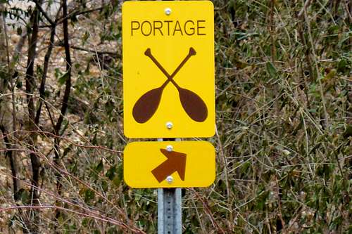 Portage Area on Mt. Simon
Because Mt. Simon is situated on a peninsula of sorts, access is somewhat limited. The closest through street is the combination of Madison, Germania and Birch Streets to the south. This is a busy route and an odd combination of streets, and that route also actually changes into Cameron Street further west and splits into River Prairie Drive further east. Keep a good city map with you if you are unfamiliar with Eau Claire.
There is kind of a loop route up to the Mt. Simon Park area. The west end of the loop is Forest Street, not too far east of the Chippewa River. Following Forest Street north, you will find yourself going through the Cascade paper plant and then making a sharp turn right under an old railroad bridge. This will turn into Sheridan Blvd., which is the other portion of the loop. By turning onto Addison or Snelling Streets, you will be able to reach different access points for Mt. Simon’s trail network.
If you wish to access this loop from the east, you will have to turn north onto Eddy Lane at the corner of Germania and Birch Streets. Follow Eddy Lane and it will magically turn into Sheridan Blvd. I’m not sure what they were thinking when they assigned all these different street names. Perhaps it was due to the local politics of that era.
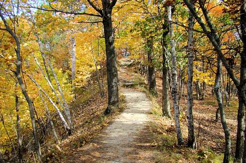
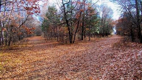
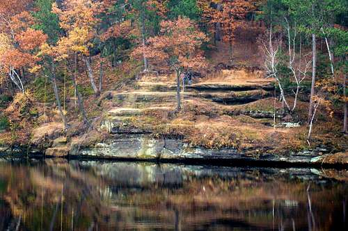
 Mt. Simon Autumn Colors 2019
Route Options
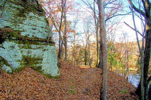 Bluff-side Trail on North Side of Mt. Simon
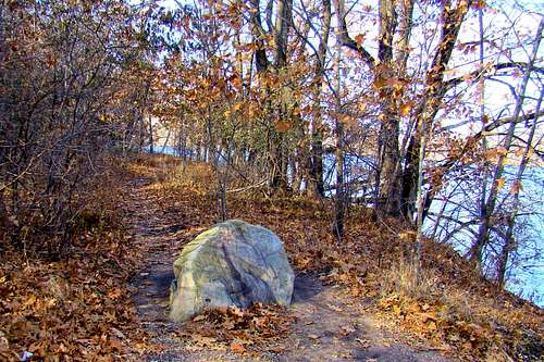 Mt. Simon Eastside Shore Trailhead
Because this is not a large, major peak, all trails around Mt. Simon are quite short (see map). You will probably also find a few other small trails not shown on the map. No trail segment is longer than .3-mile, and most are less. There is no trail maintenance on Mt. Simon, so the only thing that keeps the main trails from becoming overgrown with vegetation is the high volume of foot traffic most of the year. There seems to be one major trail loop that forms an upside-down “U” around the perimeter of the peak (perhaps an old road?). This route is wider and has a couple of short branches. From this core trail are many other narrower branches that resemble game trails, plus there are two other very short, but well-used trails semi-independent of the core trail, that go directly to the summit. The eastern one actually goes directly to the base of the summit block, where the rock climbing routes are located.
The very narrow shoreline trail from the northernmost parking lot of Mt. Simon Park follows the river around to the north side and the cliff diving area. Sometimes it is hard to find the junction, but there is also a branch that takes hikers up to the base of a series of rock outcroppings and short cliffs on the north side and then eventually on to a flat spot above the cliff jumping area.
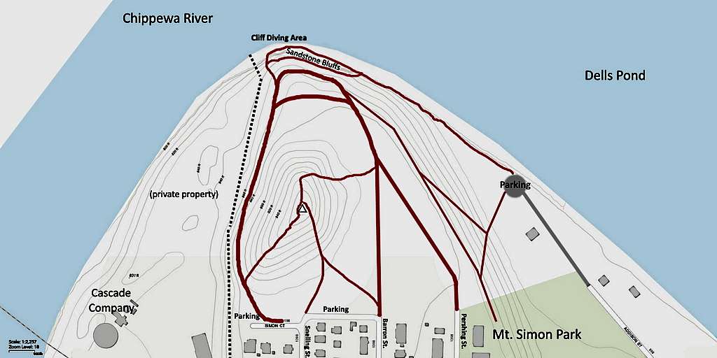 Mt. Simon Trails Map
However, if you prefer to hike near the river’s edge, know that the banks are rather steep and the footing is not always so good. Plus, the river is deep! You will likely encounter deep mud (often covered in leaves or snow) in one particular area, that is maintained by tiny springs from the rock outcroppings above. It’s never fun to unexpectedly sink your foot into ankle-deep mud! Because of the variety of trails and combinations, your trip to the summit can be quick, or it could be longer, whatever route you choose to suit your interests.
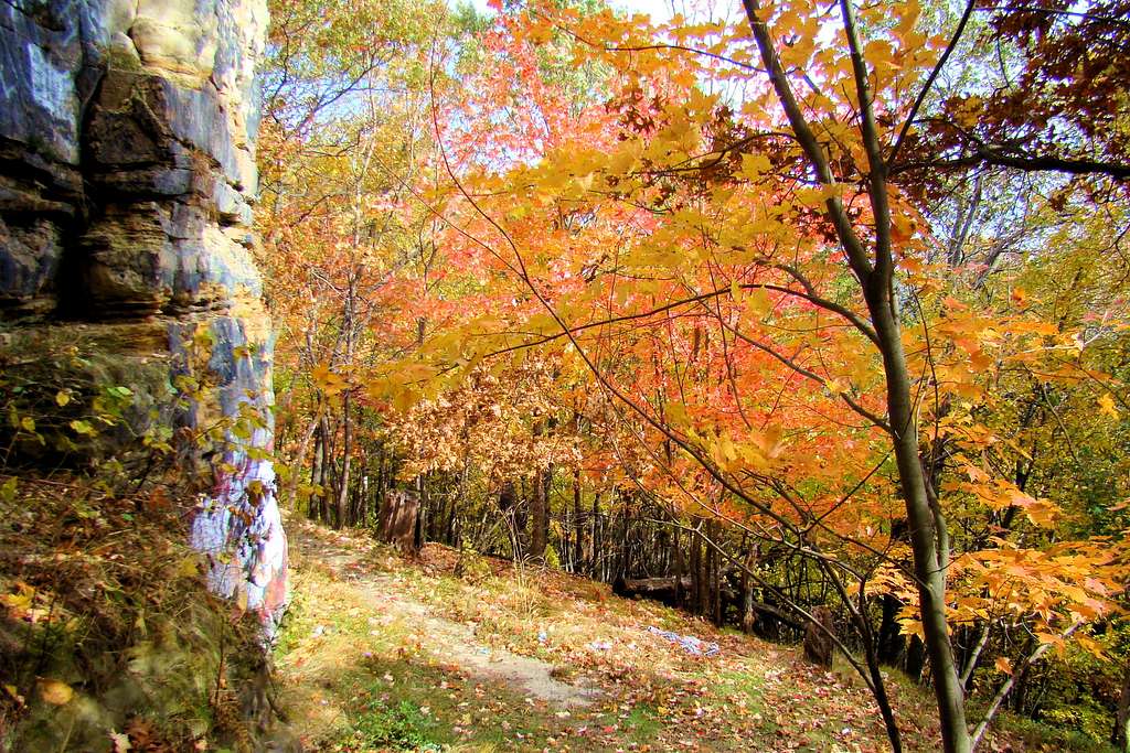
While Mt. Simon hiking and climbing will never rival great alpine adventures, it does provide a great place to hike, explore, climb, photograph or enjoy other forms of recreation. With all the hardwood trees, Mt. Simon is especially beautiful in the autumn. The University of Wisconsin - Eau Claire offers a free map download at the link below:
Downloadable Mt. Simon Trails Map from UWEC
Rock Climbing
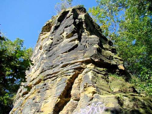 Mt. Simon Summit Block
While there are not many locations for rock climbing in this part of Wisconsin, there are seven toprope routes on the east side of the 30-foot high summit block of Mt. Simon. Mountain Project provides this link for information on these routes:
Mount Simon Climbing Routes on Mountain Project
 A Topbolt on Mt. Simon Summit Block
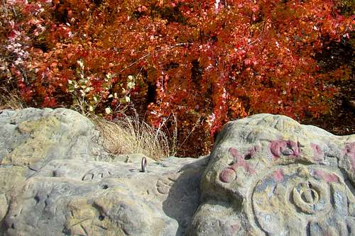
Unfortunately, some visitors to Mt. Simon have found it necessary to spray paint names and messages on the easy-to-reach lower surfaces of the summit block. Names have been carved into the rock also, further marring the otherwise beautiful rock formations.
Red Tape
City Park Rules state that Mt. Simon Park is open 4 AM to 11 PM every day. No alcoholic beverages are allowed. No fires are allowed, except with fire grates at the park next to the peak (and that means the campfire pit you will see near the summit is actually illegal).
When to Climb
 Late Autumn at the Mt. Simon Cliff Diving Area
Mt. Simon Park is open all year long. Being located within the city limits of Eau Claire, there is no hunting in the city, so that should not be a concern. This part of Wisconsin can receive deep snow in the winter, making hiking and climbing at those times rather difficult. The makeshift and narrow trail above the river’s edge on the north side can pose footing problems in snowy, icy and wet conditions, plus the water below is about 30 feet deep, and can often be very cold. Please be careful if this is the route of your choice.
For the latest weather forecast and conditions, click here:
Mt. Simon – Eau Claire Weather Forecast & Conditions
Camping
There are a variety of camping & lodging options in the Eau Claire area. For up-to-date information, click on any of the links below:
Lake Wissota State Park (26 miles north)
Chippewa Moraine State Recreation Area (38 miles north)
Visit Eau Claire Campground Listings
 Most Climbing Routes Start Here