
-
 3902 Hits
-
 81.84% Score
-
 14 Votes
|
|
Mountain/Rock |
|---|---|
|
|
44.54318°N / 9.49111°E |
|
|
Liguria |
|
|
Hiking, Mountaineering, Sport Climbing |
|
|
Spring, Summer, Fall, Winter |
|
|
5902 ft / 1799 m |
|
|
Overview
Monte Maggiorasca
Monte Maggiorasca 1804 m is located in the mountain group of the same name, the largest in the Ligurian Apennines, also including the summits of Monte Nero, Monte Bue, Rocca del Prete and others. This mountainous area is located between the provinces of Genova, Parma and Piacenza, but the main peak, the Maggiorasca, which is the highest peak in the whole Ligurian Apennines, is located in the province of Genova.
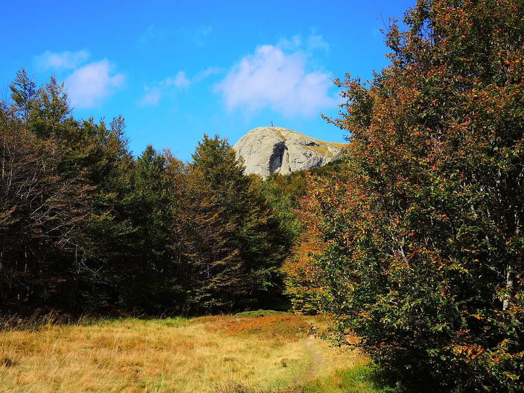
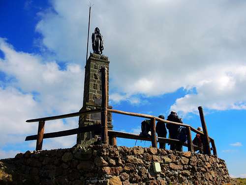
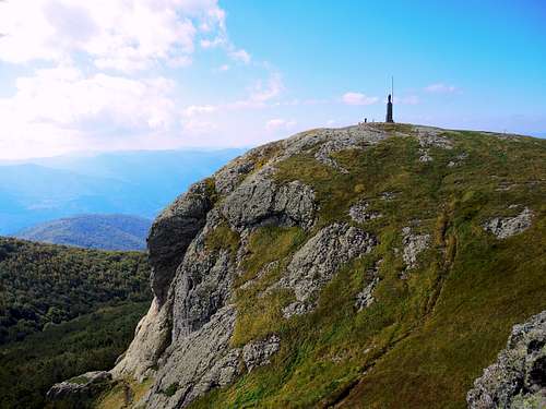
It is a massive mountain with a tabular shape, located on the Val d'Aveto-Val Ceno displuvial. The wide summit consists of two summits, on the highest one there are some radio-television equipment, while on the slightly lower Southern peak (1799 m), which is the traditional frequented summit, there is a large bronze statue of the Madonna of Guadalupe. The mountain is very popular and often climbed both by the Ligurians and the Piacenza and Parma people and has three different access routes, all without climbing difficulties, as well as a Via Ferrata.
Getting There
The road approaches are different, depend on the route chosen to climb the mountain.
The most popular Normal route is the one on the West side (Liguria), starting from Santo Stefano d'Aveto or Rocca d'Aveto, reachable from Chiavari and from the Val Nure. The shortest route starts from Passo del Tomarlo, reachable from all three sides (Genova, Parma and Piacenza). A third normal route starts from Passo Zovallo.
Normal Route from Passo del Tomarlo
Monte Maggiorasca S flank Normal route
Difficulty: E
Difference in level: 320 m. from Passo del Tomarlo
It's the shortest route between the Normal ones and the one with the lowest difference in level. Very interesting in reason of the fine context in which it takes place
Route description
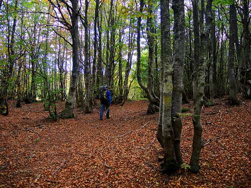
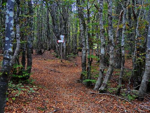
It starts from the Passo del Tomarlo 1482 m, a largely road saddle, located between the summits of the Croce Martincana and Monte Tomarlo. It is the highest road pass in Liguria, crossed by the ex-state road SS654 (now downgraded to a provincial road), which connects Santo Stefano d'Àveto with the Val Nure and the Val Ceno. From the pass take the steep path upstream of the road with indications "Monte Maggiorasca". Once you enter a small wood, the path becomes gentler, then continues through small woods and clearings in the direction of the Croce Martincana. Once in the beech forest, the path turns right and restarts to climb very steep, reaching then a wooded shelf from where it descends briefly and reaches a small clearing where it meets a path marked with a yellow X at the altitude of 1655 m. Take this path and follow it to a second crossroads. Here ignore the path marked with two solid yellow circles which climbs to the left to reach the Croce Martincana and take the path marked with the yellow X which continues almost flat in the woods, quickly reaching another crossroads. On the left, the path CAI 194a heads towards the Rocca del Prete. Turn right on a path that goes almost flat, going around Monte Picchetto to the east and crosses a clearing.
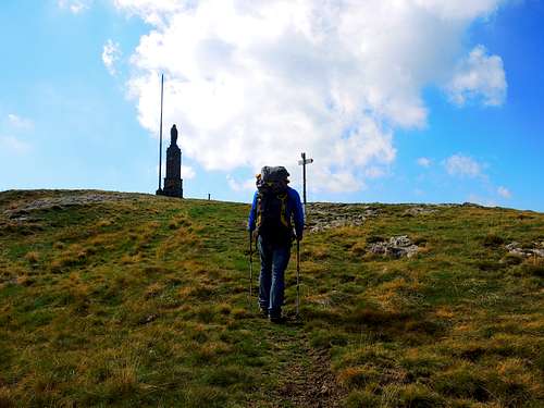
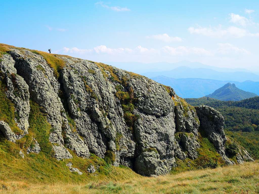
You enter the wood again until you reach yet another crossroads, where you climb to the right along a steep path through the thick beech trees which at the end comes out of the woods and turns right, skirting the rocky wall of the southern peak of Monte Maggiorasca at the base, where it is situated the Falesia del Maggiorasca. The path enters to the right in a grassy gully closed between rocky cliffs and climbs it up to the wide saddle between the two peaks of the mountain. Going to the left you can reach the statue of the Madonna of Guadalupe placed on the south-west top the conventional summit 1792 m, while on the right a track leads to the highest summit 1804 m, where there are some TV antennas.
Descent: reversing the same itinerary
Rock climbing - Falesia del Maggiorasca
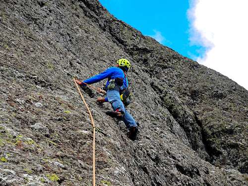
On the South side of Monte Maggiorasca, along the Normal route from Passo del Tomarlo, there is a rocky wall located just below the second summit of the mountain, the Falesia del Maggiorasca. The rock is a kind of "ofiolite" of pretty good quality. The wall - of limited height - houses about twenty equipped single pitches and some double pitches.
Red Tape
No fees no permits required. Monte Penna is located inside the Parco Naturale Regionale dell'Aveto, a protected area of considerable natural and landscape interest. This park shows a high level of environmental preservation, so let's respect the common rules for the preservation of the environment.
When to Climb
All year round. There are various activities that can be carried out on the mountain, from hiking to climbing to Via ferrata and winter ascents.
Hiking grades of difficulty
T - Turistico (Tourist): Itineraries on wide, clear and well worn paths, sometimes on mule tracks or gravel roads. The routes are never exposed, don't give any orientation problems and don't exceed 2500 meters of altitude. Suitable also for children
E - Escursionisti (Hikers): Itineraries on marked trails, even narrow and with possible steep and impervious sections. They are never exposed and don't give any orientation problems. They can tread different kinds of ground, such as forests, gravel, meadows, pastures, easy rocks, etc.). They form the majority of the trails that wind up in the mountains and require a certain habit to walk; you need equipment suitable for the altitude and resistant footwear with soles suitable for rough terrain
EE - Escursionisti Esperti (Experienced Hikers): Itineraries for hikers with experience and good knowledge of the mountain. Some of these paths may have exposed sections, however brief, which require firm foot and no dizziness. They require the ability to adapt to particular terrain, such as steep grassy slopes or stretches of rocks with difficulties that can reach the 1st degree of the UIAA scale. They can also reach high altitudes (3000 m or more). Sometimes they may include unmarked sections, requiring a good sense of orientation. Snow slopes are possible, however which can be overcome without specific mountaineering gear (rope, harness, crampons, ice-axe)
EEA - Escursionisti Esperti con Attrezzatura (Experienced Hikers with equipment - The same as EE, in addition these routes require the use of via ferrata equipment (lanyards, harness, carabiners, heat sink, helmet). This kind of itineraries range from the trails with short easy and not much exposed sections, previously equipped with fixed ropes and iron pegs, to the true and more difficult Via Ferratas climbing on rocky walls or on aerial ridges and ledges, previously equipped with long stretches of iron ropes, iron steps, ladders without which proceeding would constitute a real climbing. It is necessary to know how to use the technical equipment and have a certain habit of exposure and mountaineering terrains.
Accomodation
Different possibilities of accomodation in the area.
Meteo
Meteo ARPA Emilia-Romagna
Meteo ARPAL Liguria
Guidebooks and maps

NEW - "Arrampicaparma" III updated edition - Alberto Rampini, Silvia Mazzani - IDEA MONTAGNA 2019
- "Appennino Ligure e Tosco-Emiliano" - M. Salvo, D. Canossini - Collana Guide Monti d'Italia TCI-CAI, 2003
- "Vette e sentieri in Val d'Aveto e valli circostanti" - Fabrizio Capecchi, Andrea Parodi - Andrea Parodi Editore