
-
 8304 Hits
-
 83.69% Score
-
 17 Votes
|
|
Mountain/Rock |
|---|---|
|
|
43.94099°N / 90.31682°W |
|
|
Monroe |
|
|
Hiking |
|
|
1130 ft / 344 m |
|
|
Overview
Travelers on Interstate 90/94 in Monroe County, Wisconsin are often amazed at the abrupt sandstone buttes, or bluffs, concentrated in an area ten miles south of the town of Tomah.
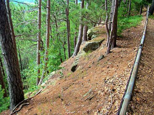
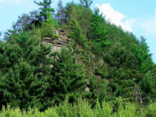 North Ridge of Mill Bluff
These scenic bluffs rise anywhere from 80 to 200 feet above the otherwise flat terrain of the area. All but one of these sandstone formations are off-limits to rock climbing. Mill Bluff, with about 185 feet of prominence, is that one exception. The rock formations on Mill Bluff are almost completely obscured by lush vegetation, softening its appearance. The summer forest green coverage of the area provides a beautiful contrast to the yellow Upper Cambrian sandstone of the bluffs in the park, while autumn colors create another look later in the year.
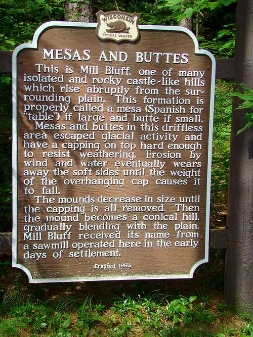 Mesa and Butte Sign at Mill Bluff
Mill Bluff and a small area around it was set aside as a state park in 1936 to preserve the fragile rock, though capped by more weather resistant sandstone, was still weathering away as well as being damaged by frequent visitors. The park has expanded several times and is now 1,337 acres large, with ten bluffs included. Some of the bluffs are rounded, while others are rock pinnacles and buttes. All rock climbing at the park has been prohibited, and though you may find a post on the internet with a route to climb one of the summits, know that those who are caught will face a large fine.
Names of the bluffs include Camel’s Bluff (two separate outcroppings that resemble a camel’s hump), Round Bluff, Ragged Rock, Bee Bluff, Wildcat Bluff, Sugar Bowl Bluff, one unnamed bluff, Long Bluff, Bear Bluff and the park’s namesake Mill Bluff. Almost all the major bluffs’ elevations are within 20 feet of one another. Named rock pinnacles include Cleopatra’s Needle and Devil’s Monument. A few of the bluffs have Native American petroglyphs, similar to those found in Roche-a-Cri State Park.
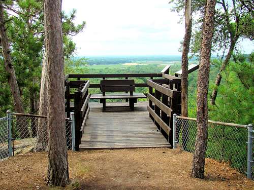 Mill Bluff Summit Deck
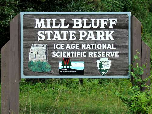
In 1971, the glacial features of Mill Bluff State Park were protected when it was added as a unit of the Ice Age National Scientific Reserve, which is one of nine units. The level of protection for the bluffs was increased in 2002 when all became part of the Mill Bluff State Natural Area.
Mill Bluff got its name from a saw mill operated nearby many years ago. A 223- step stairway was built to the summit by WPA workers during the Great Depression, making the summit still accessible, while protecting the bluff’s rock. The flat area of the summit is also fenced in for further protection, and there is an observation deck over a rock outcropping at the north end that provides excellent photo ops for visitors.
Mill Bluff State Park is open throughout the year, but the park office and campground are only open from May to September. You can access their website by clicking here: Mill Bluff State Park
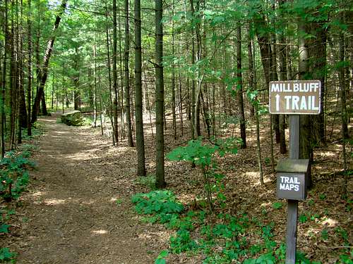 Mill Bluff Trailhead
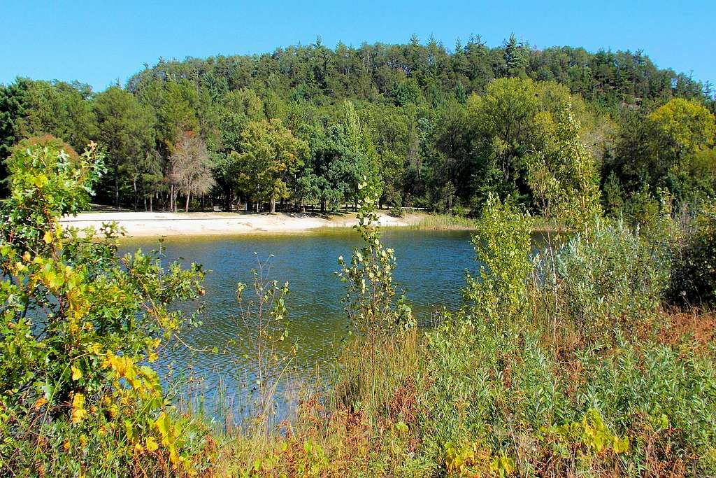
The state park has 21 campsites, a small swimming lake with 250-foot white sand beach, two picnic areas, a route to the summit of Mill Bluff and a hiking trail around Camel’s Bluff. The water in the lake comes from underground springs. Places are provided for changing. There are no lifeguards, so swim at your own risk.
The park is mostly forested with red pine, eastern white pine, jack pine, white oak and some maples, which provide great summer canopy and excellent fall colors in the autumn.
To download a park map, click on this link: Mill Bluff State Park Map
Getting There
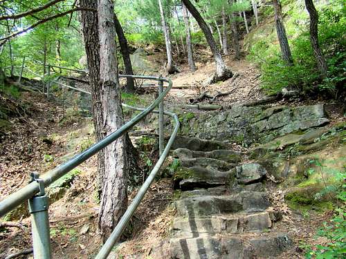 Mill Bluff Trail Upper Stairway
If you are traveling from the north on Interstate 90/94, turn off on exit 48 and go west to Highway 12 and then travel south to Funnel Road. Mill Bluff and the park headquarters are a few hundred yards north.
For those traveling from the south on Interstate 90/94, turn off on exit 55 and go left on Road C to Highway 12. Follow Highway 12 north to Funnel Road and then turn right and go to the park entrance.
If you also wish to go to the Camel’s Bluff Trail loop, drive or hike across the Interstate 90/94 overpass on Funnel Road to reach the parking lot. This is less than one mile.
Route Options
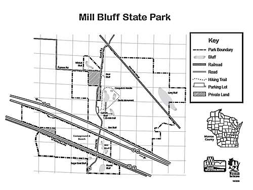 Mill Bluff State Park Map, courtesy Wisconsin DNR
Because this is a short ascent up an unranked summit, some might choose to ignore Mill Bluff. However, between the hike and climb to Mill Bluff’s summit, plus the 1.25-mile Camel’s Bluff trail loop, this is a good and scenic hiking stop if you are traveling the I-94 corridor through this area. The park’s .4-mile nature trail goes to the base of Mill Bluff from the parking lot at the headquarters. The nature trail ends at the 223 stone steps stairway to the summit. This is a pretty simple trail that is well-kept and well-marked. The stairway will likely get your heart rate up a bit, but you will be treated to some great views at the summit.
If you are interested in more hiking and photo ops, less than a mile north on Funnel Road you will find the parking lot for the Camel’s Bluff loop trail. The trail loop passes between the two sections of Camel’s Bluff and winds near the base of 30-foot Devils Monument and also takes you near the 40-foot high Cleopatra’s Needle, located back in the trees. This trail is mostly level and passes through a beautiful forest.
Mill Bluff Trails Map Download
Red Tape
 Ice Age National Scientific Reserve Location
Because of the fragile nature of the rock, no climbing is allowed. There are big penalties for violations of this rule.
Please be observant of hunting seasons and regulations.
Pets must be on a leash at all times.
The little lake is for swimming only. Fishing is not allowed.
While campfires are allowed, campers must be aware of the Wisconsin State Park Firewood Rules.
Mill Bluff State Park is open for hiking and recreation from 6 AM to 11 PM.
When to Climb
 Summit Area Fence
Hunting is permitted here, though, so practice caution when traveling through this densely wooded area on foot, and be sure to wear bright, reflective clothing if you plan to explore off the beaten path.
To avoid winter storms and summer hail and lightning, please check the latest area forecast:
Mill Bluff Area Weather Forecast & Conditions
Camping
The park is open for day use year-round. For camping or shelter reservations, call Mill Bluff (608) 427-6692 from May through September, or during the off-season call the administrative office of nearby Wildcat Mountain State Park at (608) 337-4775. The park at Mill Bluff has pit toilets and six electrical hook-ups. Drinking water is provided by hand pumps, so there are no showers.
Wisconsin State Park Camping Rules
 Mill Bluff SP Beach & Campground