
-
 2698 Hits
-
 87.31% Score
-
 24 Votes
|
|
Mountain/Rock |
|---|---|
|
|
46.44360°N / 10.60126°E |
|
|
Lombardia |
|
|
Mountaineering, Mixed, Skiing |
|
|
Spring, Summer |
|
|
11657 ft / 3553 m |
|
|
Overview
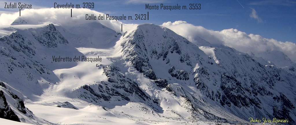
Monte Pasquale 3553 m
Monte Pasquale 3553 m is an ice covered mountain belonging to the Ortles-Cevedale Group, located west of the Cevedale and dominating the Val Cedèc. Very popular mountaineering and ski mountaineering destination, Pasquale is a secondary peak of the Ortles-Cevedale group, but equally highly satisfying. It is separated from the Cevedale by the Colle del Pasquale 3423 m and in reason of its central position it's possible to enjoy an excellent panorama of the group from the summit. The beautiful NW wall in the shape of a snow shovel dominates the Rifugio Pizzini and offers a renowned ice route, even if in recent years, like other ice walls in the Alps, the ice cover is decreasing. The NE side that has in common with the Cevedale is covered by the Vedretta di Cedèc.
Monte Pasquale is also an open-air museum of the WWI. In fact there are still several testimonies of those events, as on other peaks where it passed the front line during the war. The glacial cover gradually retreating brings them back to light. A little S of the summit, above a large rocky terrace, there are remains of barracks, defensive stalking, ammunition crates, metal shields with slits, an iron stove, a brick oven and even the small bundles of wood used for turn on the fire.
Getting There
Road access
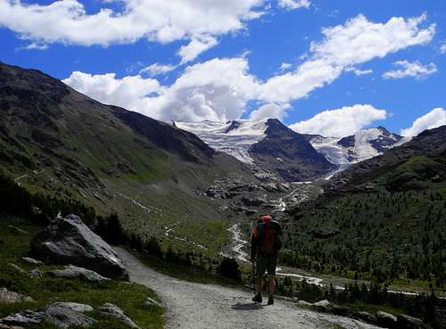
The starting point to approach the mountain is the village of Santa Caterina Valfurva m. 1734, situated 12,5 km. to Bormio, an important destination. From here youneed to drive to the Rifugio Albergo dei Forni. Santa Caterina can be approached from Milano following the Valtellina or from Alto-Adige through the Stelvio pass.
- From Autobrennero exit Bolzano and follow the road to Merano, then enter the Venosta Valley and follow it to the fork in Spondigna. Turn to left, following the road to Passo Stelvio (2758 meters, open only in the summer period). From here descent to Bormio (3 hours and half from Bozen, Stelvio pass requires 44 bends to go up and 15 to go down).
- From Milano follow the state road "Valsassina" n. 36 to Lecco and then to Colico, here take the "Valtellina" road to Morbegno, Sondrio, Tirano and then to Bormio.
Road to Rifugio-Albergo Forni
From Santa Caterina Valfurva take the steep road which after about 8 reaches the large parking area located near the Rifugio Forni 2178 m. There are some rules about the private traffic on this road:
- pay a toll in La Fonte car park in S. Caterina Valfurva -Via Forni at the info-point with automatic ticket-machine.
- snow tires and chains on board are mandatory until 30.05.2019
From the parking area take the road which after two steep bends enters the Valle di Cedèc and in about an hour and a half leads to the Rifugio Pizzini.
Approach to Rifugio Pizzini
From the Refuge Hotel Forni 2178 m take the unsurfaced road which after a few bends enters the Val Cedec. A simple itinerary along the hillside leads to the Rifugio Pizzini-Frattola in about 1 and a half hour.
Approach to Rifugio Branca
From the Refuge Hotel Forni 2178 m take the unsurfaced road following the signposts to the Rifugio Pizzini-Fràttola and the Rifugio Branca. After passing the Cedec stream and the Malga dei Forni, we ignore the signposts to the Rifugio Pizzini and follow those for the Rifugio Branca, taking the track on the right which after a stretch of ascent ends at the Rifugio Branca 2493 m.
SW ridge - Normal route from Rifugio Branca
Monte Pasquale Normal route from Rifugio Branca
Difficulty: EE/F
Difference in level: 1060 m from the hut
Starting point: Rifugio Branca m. 2493
Exposure: SW
It is the easiest way to climb the Pasquale. The withdrawal of the glaciers and the snow cover made this itinerary a simple hiking, even if it is advisable to bring at least the crampons in case the final stretch between the fore-summit and the summit is frozen.
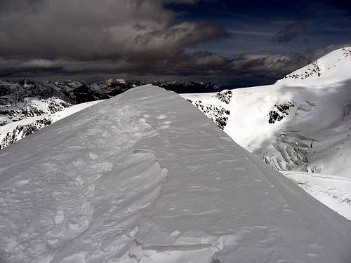
From the Rifugio Branca follow the path starting behind the building entering the Val Rosole. Head to the obvious moraine and walk on its wire to its end. Continue until you reach the Lower Lake of Rosole and skirt it on the left in the direction of another moraine near the Pasquale and on whose summit two little cairns are clearly visible. The track (cairns) starts on their left and reaches the ridge of Monte Pasquale near another cairn. The SW ridge is initially wide and not very steep, then the steepness increases and the ridge becomes a little narrower. The steeper section culminates around the 3400 m with the achievement of a WWI shelter.
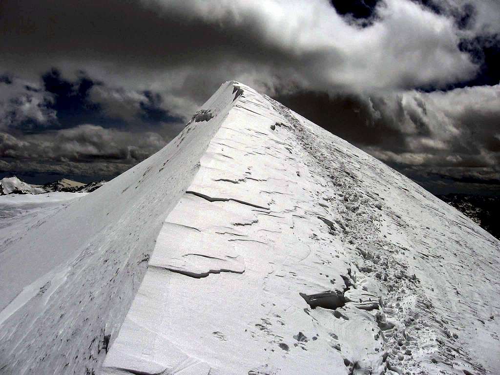
We continue on the ridge wide again to the fore-summit situated before the summit by a few tens of meters. In this last section there is often snow or ice and crampons may be needed, even if the crest is practically horizontal anyway. The summit top is characterized by a wooden cross and artifacts dating back to the WWI.
Descent: reversing the route
East ridge - Normal Route from Rifugio Pizzini

Monte Pasquale Normal route from Rifugio Pizzini
Difficulty: Alpine PD+
Starting point: Rifugio Pizzini-Frattola m. 2700
Exposure: East
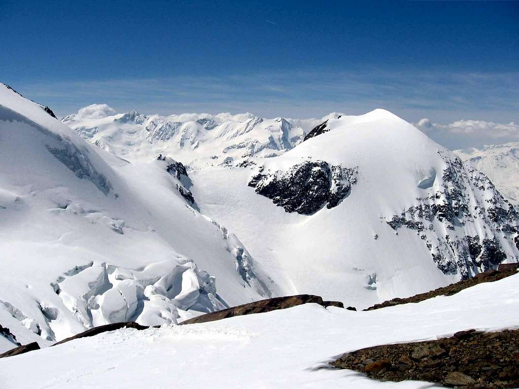
This itinerary is a more interesting alternative from a mountaineering point of view than the Via Normale from Rifugio Branca, especially at the beginning of the season, and winds along the Vedretta di Cedec, a rather crevassed glacier, especially in late season.
From the Capanna Pizzini follow the path that leads to the Refuge Casati. Arriving near the departure of the cableway to the Refuge Casati at about 2800 m, turn definitely right and reach the beginning of the Cedec Glacier. Pointing to the N-NE wall of the Pasquale one reaches the base of a steep slope (40°) which ends at the Colle del Pasquale 3423 m.
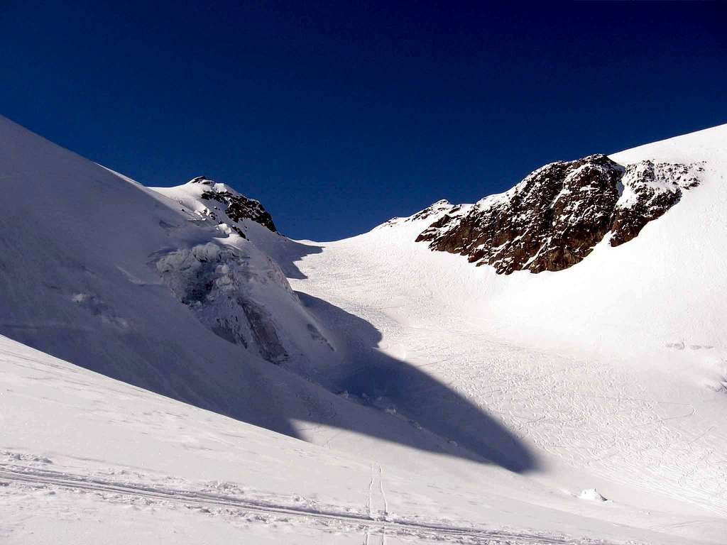
Depending on the conditions of the glacier, it is also possible not to reach the Colle, but to deviate to the right just before the col, climb up a steep slope (snow at the beginning of the season, (45°) and directly gain the final ridge. In any case, then you must follow the East ridge to the summit plateau of Monte Pasquale.
Descent: reversing the same itinerary. Another possibility is the descent along the easy SW ridge to the Rifugio Branca
Red Tape
Monte Pasquale and the whole Ortles-Cevedale Group are situated inside Parco Nazionale dello Stelvio, one of the hystorical national parks in Italy, belonging to the provinces of Trento, Bolzano and Sondrio. Free camping is not allowed and fires are strictly forbidden. The whole fauna and flora are protected.
When to Climb
Mountaineering: usually the best period goes from the end of May to the middle of September.
Ski-Mountaineering: from March to May
Huts
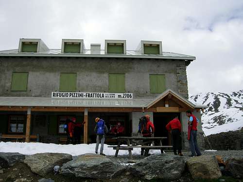
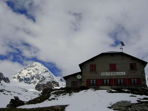
- Rifugio Pizzini-Frattola 2700 m
The Refuge Pizzini-Frattola is located in the large basin at the head of Val Cedèc in a majestic amphitheater, closed by Gran Zebrù to the North and Cevedale to the East. Owned by Club Alpino Italiano Sez. Milano, it was built in 1887 and destroyed during the First World War.
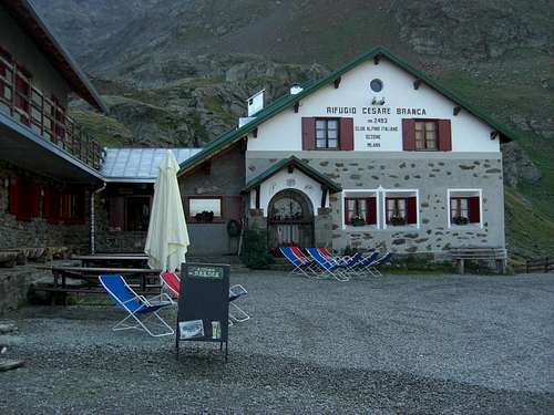
- Rifugio Branca 2493 m - Club Alpino Italiano C.A.I Sez. di Milano
In the middle of Parco Nazionale dello Stelvio at 2493 mt is situated the Rifugio Branca, guarded by Alberti/Confortola family, rising in front of the huge Forni Glacier and dominated by Punta S.Matteo (3678 m.), Pizzo Tresero, (3594 m.), Vioz (3645 m.), Palòn de la Mare (3708 m.) and Cevedale (3769 m.).
Meteo
Guidebooks and maps

“Ortles Cevedale – Parco nazionale dello Stelvio” by Gino Buscaini – Collana Guide dei Monti d'Italia CAI-TCI (Club Alpino Italiano-Touring Club Italiano)
Map “Ortles-Cevedale” foglio 72 - Kompass 1:50.000