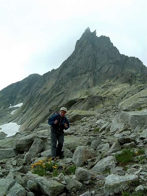
Winterstock Turm I is a granite tower belonging to the Urner Alps. The Urner Alps - or Uri Alps - are located in the Uri district, Central Switzerland, amongst the three most popular cols in Switzerland: Sustenpass to the North, Furkapass to the South and Grimselpass to the West. This group is famous in reason of its compact and fine granite, that can stand comparison with the Mont Blanc one.
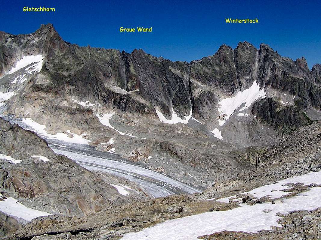
Graue Wand- Winterstock
Winterstock Turm I is situated between the most famous Graue Wand (to the left) and Lochberg (to the right) and it's only one amongst the numberless climbing possibilities in this magnificent area.
Getting There
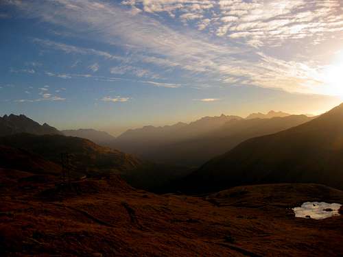
Furkhapass autumn sunrise
Road Access
The nearest town inthe Furka Pass Area is Andermatt, a little town lying at St. Gotthard Tunnel Northern exit. Andermatt can be suitably approached:
- From the Wallis via Sion, Brig, Gletsch and Furkapass - From Luzern via Altdorf - From Bern via Interlaken , Meiringen, Grimselpass, Gletsch and Furkapass - From Milan (Italy) via Chiasso, Lugano, Bellinzona and the St. Gottard Tunnel - From Chamonix (France) via Martigny, Brig and Furkapass
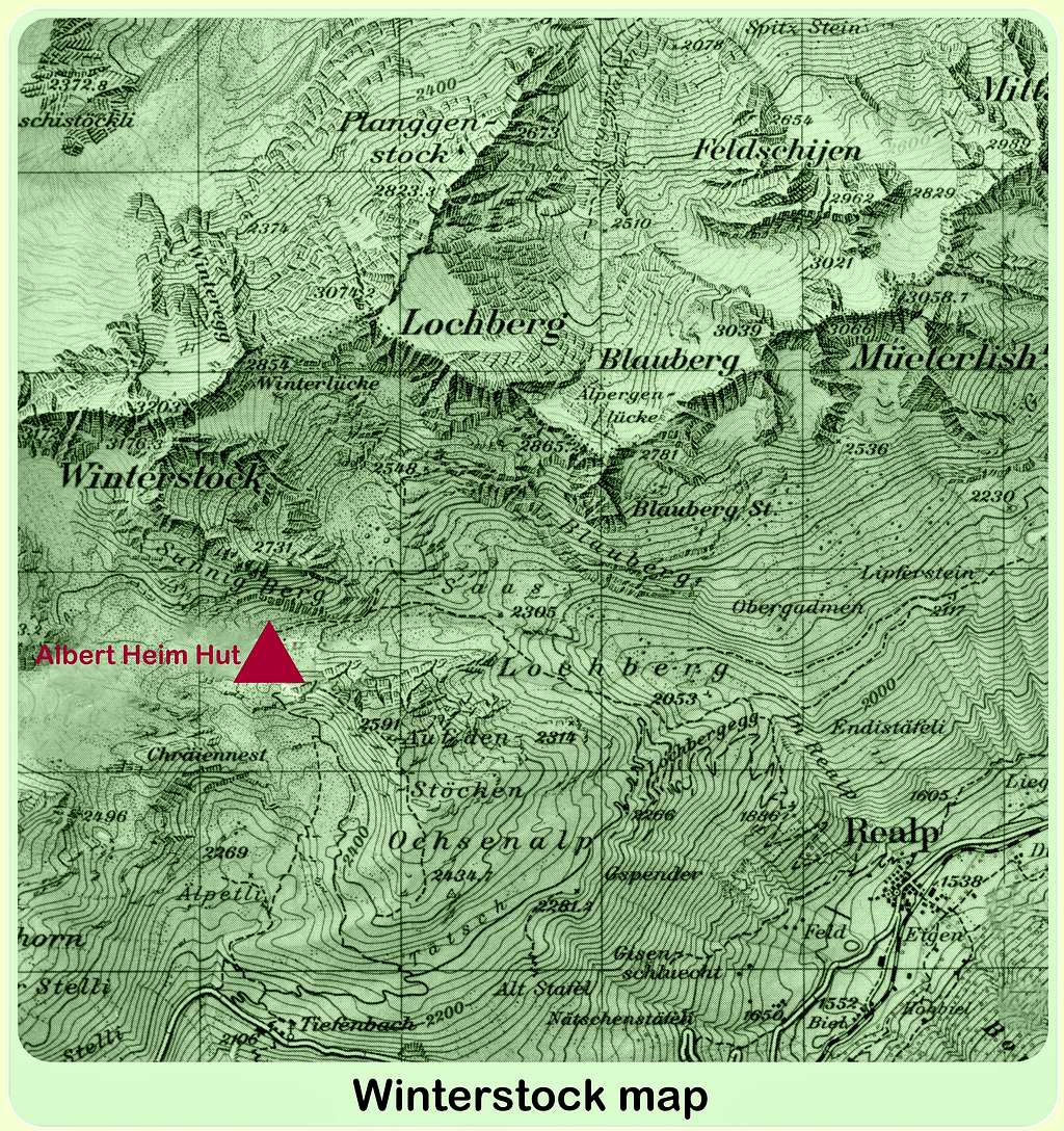
The starting point to climb Winterstock Turm I is the Furkapass road, connecting Andermatt on the Eastern side of the pass and Gletsch, on the Western side. From Andermatt take the Furkapass road; before reaching the pass the road gets to the Tiefenbach Hotel m. 2110, situated along the road on the east side of Furkapass. It’s possible to park here or alternatively follow an unsurfaced military toll-road (7 CHF to be payed before taking the road), starting on the right a few hundred meters past the hotel. The road cuts the walking approach time of about 20 minutes and rises with some hairpins to the Tatsch parking m. 2270.
Walk approach
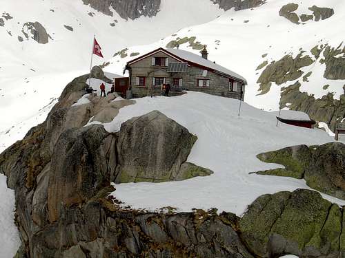
From the Tatsch parking a good marked trail leads to Albert Heim Hutte (1 hour). From the refuge take the path that descends behind it, losing altitude and heading South East into the shallow valley behind the refuge, continuing slightly downhill. At the first crossroad (huge painted highway style sign) go left, crossing a few streams and arriving at a pond. Now go up along traces of path and snowfields towards Winterstock and finally cross to the left to reach the basal slabs, usually surrounded by a snowfield.
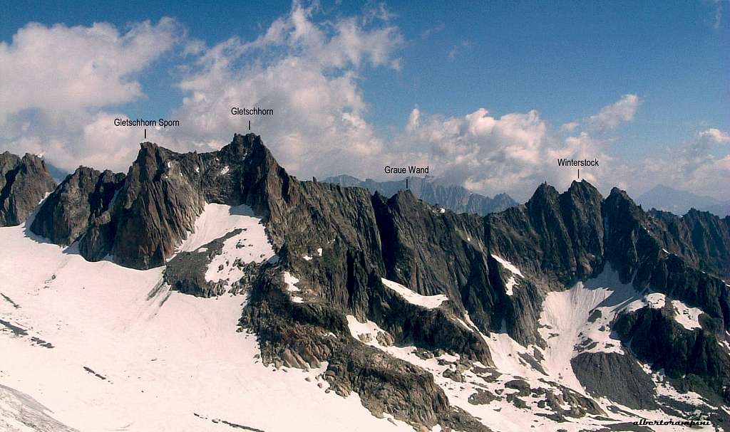
Gletschhorn - Winterstock ridge labelled
Main routes
Difficulty: 6a (5c + compulsory). Development: 8 lengths for about 300 meters of development. Equipment: route entirely bolted Exposure: SE Type of rock: granite. Recommended period: summer. Ascent time: 4/5 hours. First ascent: Jürg von Känel, Ernst Müller, 1991. Bibliographical references: Jürg von Känel, Plaisir Ost, Edition Filidor, 1999
Fine route on excellent rock in a rewarding alpine environment. After the questionable doubling of the bolts compared to the situation of the first climbers, the fast protections are now useless.
Report
L1 - The route starts in the middle of a smooth slab (bolt visible) in correspondence of a patch of snow, whichWinterstock Turm Ivaries according to the seasons, usually conspicuous in early summer (pay attention to the space between snow and rock). Climb the compact slab with irregular holds, 5c+. L2 - From the belay traverse to the left, climb the step formed by the edge of a dihedral and stay on the left of the dihedral. Up to a roof, then some fine blades. 5c L3 - Directly on slab and vertical walls, then an interesting slab, 6a L4 - Gain a fine wall on the right, then a blade-crack and easier ground, 6a L5 - Definitely slanting left, then straight on easier rocks up to a ledge, 5c L6 - Climb the slab above the stop, then to the left on a blade. Dihedral and and athletic exit to the belay on the left, 5c L7 - Take the large crack on the left of the belay and get out of it with strenuous climb. Take a hard blade with two bolts, from which you exit to the left. Still left at the ledge closed by a small overhang on which there is the belay, 6a.
L8 - To the right of the stop overcoming the overhang. Take the ramp to the left up to the wall at the end of which the belay is visible, one meter below the top. 5b
Descent: abseiling along the ascent route
Red Tape
No particulary restriction in climbing and hiking. An entrance fee is due to get the Tatsch parking, where free camping is not allowed.
Parents refers to a larger category under which an object falls. For example, theAconcagua mountain page has the 'Aconcagua Group' and the 'Seven Summits' asparents and is a parent itself to many routes, photos, and Trip Reports.

 2723 Hits
 81.18% Score
 13 Votes