

-
 3496 Hits
-
 77.48% Score
-
 8 Votes
|
|
Mountain/Rock |
|---|---|
|
|
34.41850°N / 47.24340°E |
|
|
Mountaineering |
|
|
11024 ft / 3360 m |
|
|
Parau Mountain
The 3360 m (11024 ft) Mt. Parau rises to the northeast of the city of Kermanshah in the Zagros Mountains of western Iran. It is the highest peak in the Kermanshah Province and is number 22 on the list of the 31 provincial high points of Iran.
A trail starts at an elevation of 1500 m (4900 ft) and goes to the summit of Mt. Parau. A couple of mountain shelters can be found along the way.

West face of Mt. Parau. Photo by Nader Montazeryani
South face of Mt. Parau
Winter Photos by Nader Montazeryani
 |
 |
 |
 |
Ultra-Prominent Peak
Ultra-Prominence refers to those peaks that have a prominence of more than 1500 meters (4921 ft). There are 1515 such peaks in the world. Iran occupies 1.11% of the world’s land surface area but contains 3.6% of the world’s ultra-prominent peaks (55 such peaks). With a prominence of 1833 m (6014 ft), Mt. Parau is Iran’s 19th most prominent peak.
Caves
Entrance to Parau Cave sits on a flat area below the summit of Mt. Parau at an elevation of 3080 m (10105 ft). In Iran, this cave is known as the “Everest of all caves” due to its high elevation. The cave is 751 m (2464 ft) deep.
In 2015, the nearby Jujar Cave was explored to a depth of 1097 m (3600 ft) making it the deepest cave in Iran.
Jujar Cave
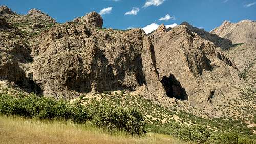
Bisotun Wall
The 1100 m (3600 ft) tall Bisotun Wall sits a few kilometers to the east of Mt. Parau. It is the greatest rock climbing destination in Iran and has hosted a number of international competitions.
All photos by Nader Montazryani
 |
 |
 |
 |
 |
 |
 |
 |
 |
 |
Historical Sites
Parau area mountains rise near the ancient roads that connected the cities of Babylon and Ctesiphon to the Iranian Plateau (Ctesiphon was a city on the banks of Tigris River 35 miles south of modern day Bagdad that for 800 years, during the Parthian (247 BC-224 AD) and Sassanid dynasties (224-651 AD), served as the capitol of the Persian Empire). The mountains house countless archeological sites dating back to pre-history. Chief among these are Mt. Bisotun Inscription by Darius the Great of the Achaemenid Persian Empire (550-330 BC) and Taghe Bostan carvings of the Sassanid Persian Empire.
Bisotun Wall and Khosro & Shirin Love Story
Khosro & Shirin is one of the greatest love stories in Persian Literature. Many versions of it have been told by various poets. The most romantic version has been written by the great Persian poet Nezami Ganjavi (1141-1209 AD) who lived in what is now the Republic of Azerbaijan. The story is about love between the Sassanid Emperor Khosro II who ruled from 590 to 628 AD and the Armenian Princes Shirin. A commoner named Farhad had also fallen in love with Shirin. To get Farhad out of his way, Khosro tells Farhad if he could flatten Mt. Bisotun, he could have Shirin. The big walls of Mt. Bisotun are said to have been created by the chiselings of Farhad.
Nezami’s poem has 6150 rhymed verses and took 16 years to complete.
Excerpts of Khosro & Shirin music by the Iranian-Armenian composer Loris Tjeknavorian with poetry by Nezami Ganjavi.
Getting There
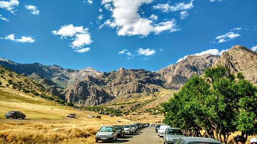
From the center of the city of Kermanshah, drive 13 Km east on Route 48 toward the city of Hamedan to reach a place called Chalabeh. Turn north onto a dirt road (Route 48 is a divided highway. Coming from Kermanshah, you must go a few kilometers further east to a designated U-Turn and then head back west to reach the access point to the dirt road). Drive the road less than 3 Km to a parking area.
Route
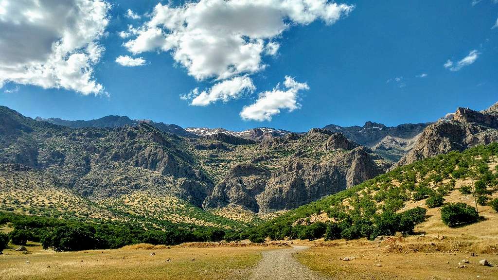
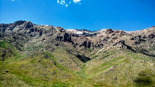
Mt. Parau from the parking area. Elevation ot the parking area is just below 1500 m.
Head north hiking up a valley. On your right side, you will see a spur trail that goes to a narrows called “Tange Taaf” where there is a seasonal waterfall. View of the narrows from far away
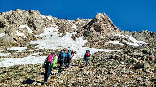
The main trail begins to climb the steep slopes.
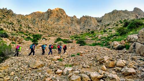
You will then reach a high point where Mt. Parau will come to view again.
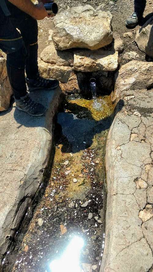
A little downhill will get you to a flat area at 2150 m where there is a natural spring called Do Zari.
|
|
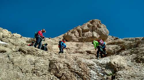
Farther up, you will find a huge boulder named Kharsang.

Photo by Nader Montazeryani
Heading northwest from the Do Zari Plain, the trail begins to climb again.
 |
 |
At 2650 m, you will reach a cave turned into an emergency shelter.

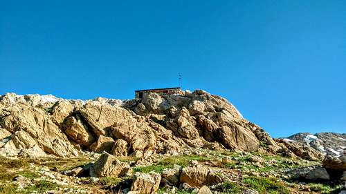
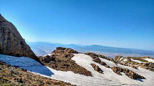
The main shelter is reached at an elevation of 3080 m on a small plain below the summit.
|
|
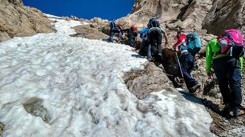
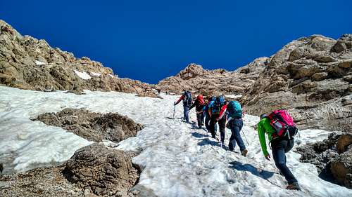
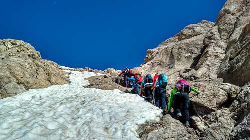
The final path to the summit is steep.
|
|
|
|
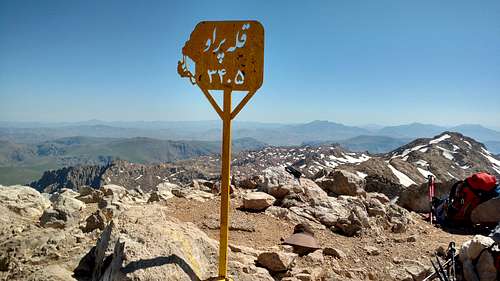
Just below the summit.
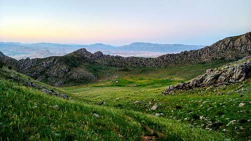
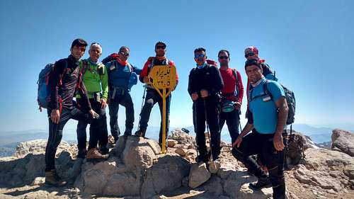
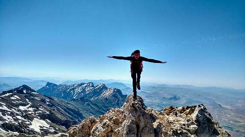
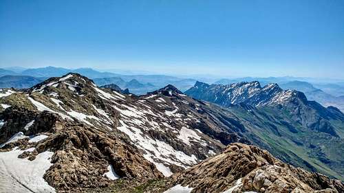
Views from the summit.
|
|
|
|
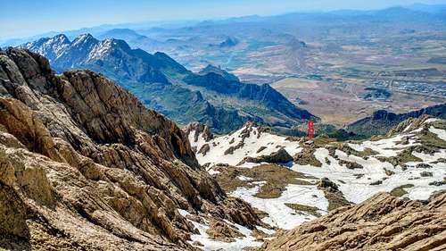
Looking back at the main shelter and the plain around it from the summit.
Red Tape
This is a protected area. Hiking requires no permits or fees.