
-
 6532 Hits
-
 78.27% Score
-
 9 Votes
|
|
Mountain/Rock |
|---|---|
|
|
43.16001°N / 109.65899°W |
|
|
Hiking, Mountaineering, Scrambling, Skiing |
|
|
Spring, Summer, Fall |
|
|
13185 ft / 4019 m |
|
|
Overview
Twin Peaks are a pair of peaks in the core Wind River Range, and part of 10 of the 35 Wyoming 13ers (see the list here) that encircle Titcomb Basin. It is generally regarded that East Twin Peak is higher with an elevation of 13185 feet, however when standing on its summit, West Twin which is located just 0.18 mile away looks about the same. Each peak has a closed 13160 foot contour at its summit on the USGS quad, however East twin's 13160 foot closed contour covers a larger area. That doesn't definitively say it's actually higher though. If you stand on West Twin, you can pretty clearly take a line of sight by placing your eyeball at the highest point of the summit block on West Twin, and look over the top of East Twin and line it up with a point on the Sphinx further behind, which is 73 feet higher using the elevations listed on Lists of John. If you can confidently say the point on The Sphinx this line of sight intersects is more than say 75 feet lower than the summit of Sphinx, than West Twin would be higher. I performed this test and took a photo of it below.
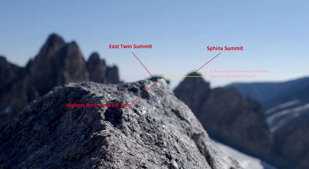
In my opinion the test was inconclusive, since the photo is blurry, there is no guarantee I held the camera exactly level perpendicular to gravity, and it isn't definitive if that vertical distance marked with the pink line is more or less than 75 feet. It would be worth it for someone to take some equipment up there to settle this once and for all.
So what it boils down to is just climb them both. From the sadde between them, East Twin is a class 2 ridge walk, and West Twin is only slightly harder with a move or two of class 3. Getting to this saddle is much more difficult, as described below.
Getting There
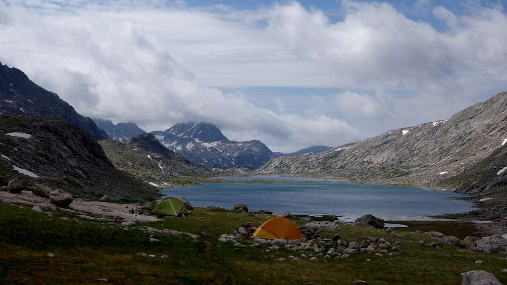
Use the Elkhart Park Trailhead accessed from Pinedale on the west side of the range and hike the Pole Creek Trail to Island Lake, passing by Photographers Point and Seneca Lake along the way. Just after passing over a small divide at 10,660 feet Island Lake will come into view. Descend to it and continue to the junction with the Titcomb and Indian Basin trails. Take the Titcomb Basin Trail heading north/leftward and hike past Lower and Upper Titcomb Lakes as the trail follows along their east shores. Base camp can be set up about 0.5 mile past the upper lake where many rock shelters have been built by Gannett Peak climbers and other backpackers.
Route to Saddle
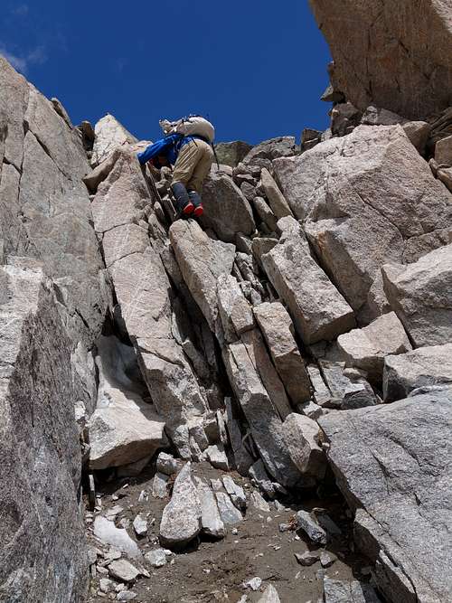
There are two ways you can get to the saddle between East and West Twin; either from the north or the south, and both ways have completely different but equally lengthy routes, although the southern way is going to be the shorter of the two. From the south, approach via Titcomb Basin as per described above, and continue up the valley towards Knapsack Col. A few hundred feel before reaching this col, turn north and ascend the small Twins Glacier (more of a permanent snowfield). Continue up the steepending snow and aim for the highest, northernmost point of snow which typically terminates 50 feet below the saddle in summertime. The snow gets to be 45 degrees at the upper portion where it narrows into a thin band. I was very happy to be here when the snow had softened a little, and crampons were needed. You can exit off the snow to the left and climb loose class 3 scree covered rock to the base of the final 20 foot class 4 chimney. This isn't actually trivial, and is by far the crux of the route. There are also large blocks in this chimney that you have to yank on that don't appear super solid so excercise caution here. Once at the saddle, either peak is easily reached.
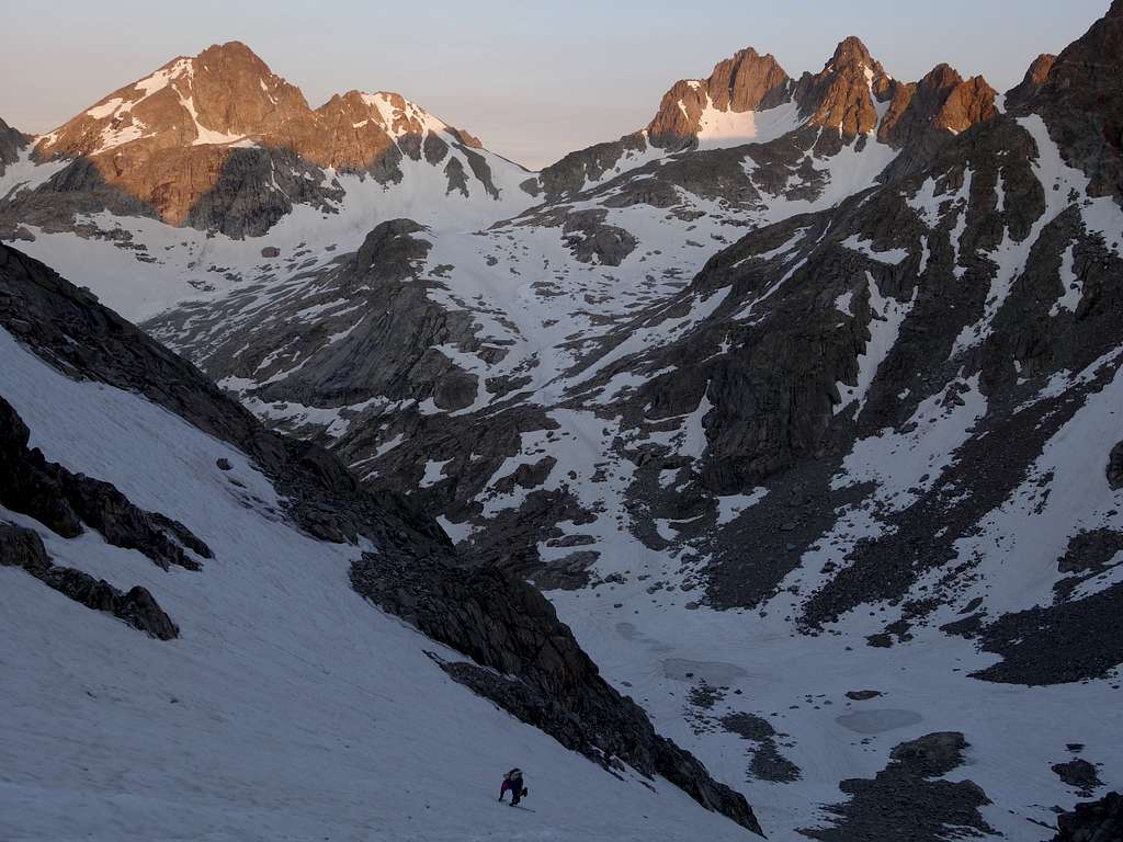
From the north, the technical difficulty and the snow steepness are both considerably easier, however the overall length, and distance backpacking off trail with potentially heavy packs increases. The Mammoth Glacier extends from the saddle down to the north a long way, and is one of the biggest glaciers in the Winds remaining. It is an easy snow ascent to the saddle up from the toe of this glacier, with a maximum of about a 35 degree snow steepness only on the uppermost 400 feet or so. You can reach the toe of the Mammoth Glacier in a number of ways outlined below.
1. You can come up Wells Creek and past Scott Lake via Green River Lakes Trail
2. If you've taken the trails to Peak Lake, you can boulder hop up to the low saddle just west of Split Mountain and descend onto the upper Mammoth Glacier from there.
3. You can cross the divide from the east off to the north of the Twin Peaks in a number of places, including Glacier Pass, which is the low saddle between Gannett and Pinnacle Ridge (class 2 scree and the most direct from the Dinwoody), or over Bastion and Rampart Peaks and down the west flank of Rampart to Desolation Col (class 2+ talus and scree).
Any of these routes are goiung to be overall more time consuming than coming from Titcomb. If you come up via a route further north and find yourself at the icy toe of the Mammoth Glacier, you can ascend the ice/moraine boundary zone up the right (west) side of the toe, and get onto the glacier higher close in the 11700 foot range to avoid any bare ice.
Red Tape/Camping
No red tape. Great Camping can be had 0.5 mile above upper Titcomb Lake, or near the junction of the Indian/Titcomb Basin Trails.
When to Climb
Best time for summer conditions will be July - Early September. Ski touring would be advisable before June. The initial hike towards Seneca Lakes dries out a little earlier, but tons of snow typically persists in Titcomb Basin past July 4th, but will normally dry out reasonably well shortly after mid July.
Map
This map shows the route up East Twin with a green line from a typical camp in Titcomb Basin approaching the saddle from the south. Combining with The Sphinx is also displayed.
External Links
My Trip Report of The Twin Peaks, and all the other 13ers in the Wind Rivers